Nearby
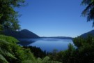
Lake Kaniere - Otira
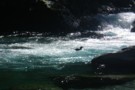
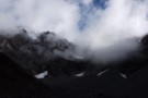
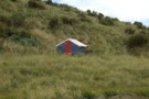
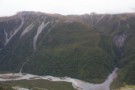
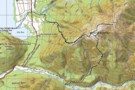
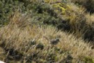
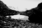
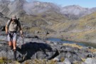
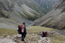
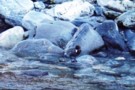
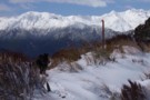
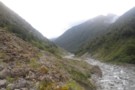
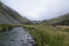
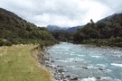
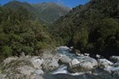
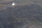
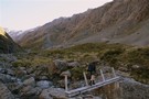
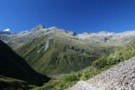
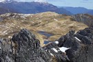
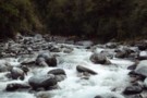
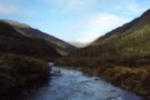
Blue Duck at the Tyndall / Styx confluence
Photograph
•
Distance: less than 100m away
Blue Duck at the Tyndall / Styx confluence
More ▶︎
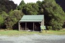
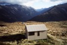
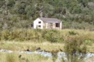
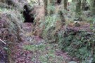
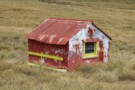
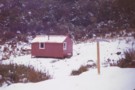
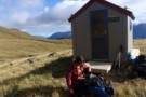
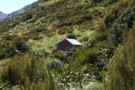
Kelly Shelter (Removed)
Hut
•
Removed!
•
Distance: 205m away
Kelly shelter is a roadside shelter on the Arthur's Pass road, at the base of Kelly's Creek and the track ...
More ▶︎
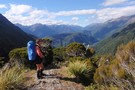
Hunts Creek Track
Track
•
2 days. Medium. Return via same track.
•
Distance: 205m away
Rough travel to a small, tidy hut. Better walked as part of a circuit.
More ▶︎
Picton to Aspiring
GPX file
•
Distance: 263m away
An aborted alpine traverse. Picton to West Cape, but aborted at Aspiring due to real world emergencies back home. Posted ...
More ▶︎
Kahikatea Walk, Lake Kaniere
Track
•
Easy. Loop track.
•
Distance: 274m away
Short loop through mossy forest.
More ▶︎
Goat Creek track to Mt Barron
Track
•
0 – 1 day. Hard. Loop track with a road section.
•
Distance: 396m away
Overgrown and line is destroyed by recent slips.
More ▶︎

Route Guide: Otira to Mt Cook Village (pt 2)
Track
•
12 – 21 days. Hard. One way.
•
Distance: 515m away
One possible route down the main divide from Otira on the Arthur's Pass road to Mt Cook Village.
Otira Hotel ...
More ▶︎

Route Guide: Otira to Mt Cook Village (pt 1)
Track
•
12 – 21 days. Hard. One way.
•
Distance: 515m away
One possible route down the main divide from Otira on the Arthur's Pass road to Mt Cook Village.
Otira Hotel to ...
More ▶︎
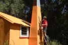
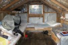
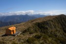
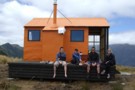
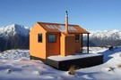
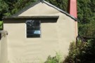
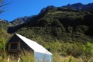
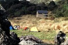
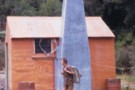
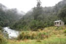
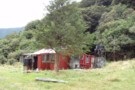
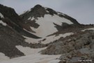
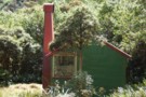
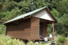
Mid Styx Hut painting March 2014
Photograph
•
Distance: 533m away
Volunteers have prepared & painted the hut exterior. This is just the second paint job this 1960 built hut has ...
More ▶︎
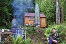
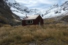
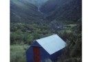
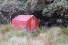
Mid Styx hut Feb 2009
Photograph
•
Distance: 547m away
This photo of Mid Styx hut was taken during a "Permolat" working bee when a group of volunteers worked on ...
More ▶︎
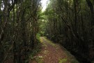
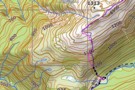
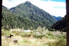
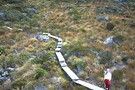
Track to Mid Styx Hut
Track
•
Easy. Loop track.
•
Distance: 547m away
Recently recut 40 minute track to this front country hut renovated by volunteers from the Permolat on-line community.
More ▶︎
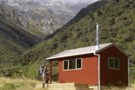
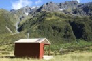
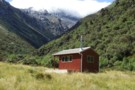
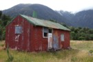
Mid Styx Hut
Article
•
Distance: 547m away
Our trip in to check out this hut restored by the Permolat Community
More ▶︎
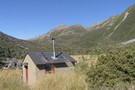
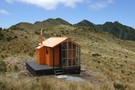
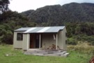
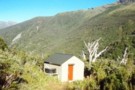
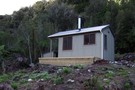
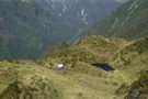
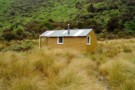
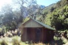
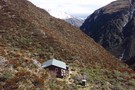
Mid Styx Hut
Hut
•
Basic Hut/Bivvy (NA). Capacity: 4.
•
Distance: 547m away
4 person ex-NZFS hut with open fireplace on north facing terrace high above the Styx River. Renovated extensively and maintained ...
More ▶︎
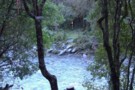
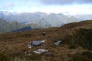
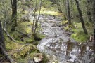
Short cut to Mid Styx hut
Photograph
•
Distance: 547m away
This photo shows the turnoff to Mid Styx hut as described below.
Easiest access to Mid Styx hut is the Styx ...
More ▶︎
Cockayne Nature Walk
Track
•
Easy. Loop track.
•
Distance: 678m away
A short loop in forest near Kelly's Creek, Otira.
More ▶︎
Cockayne Nature Walk
GPX file
•
Distance: 678m away
Short walk in rich forest near Kellys Creek, Arthur's Pass National Park.
More ▶︎
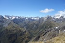
Kelly Range - Hunts Saddle Circuit
Track
•
2 – 3 days. Medium/hard. Loop track.
•
Distance: 1.5km away
A challenging circuit route traversing the Kelly Range and returning along Kelly's Creek. The direction described is the easiest option.
More ▶︎
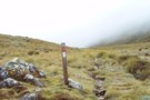
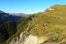
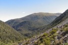
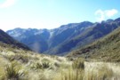
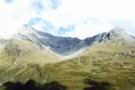
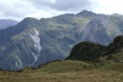
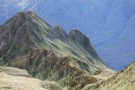
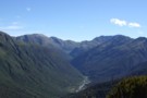
Kellys Saddle
Photograph
•
Distance: 1.5km away
Kellys Saddle - a tussock saddle between the Otira and Taipo near Carroll Hut
More ▶︎

Arthur's Pass National Park
Place
•
National Park. 1145.00km2.
•
Distance: 1.5km away
This alpine park straddles the Main Divide of the Southern Alps, with dry beech forests in the east and damp ...
More ▶︎
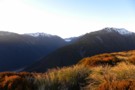
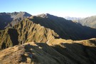
Catching the dawn on the Kelly range
Photograph
•
Distance: 1.6km away
The morning light on the Kelly range before it reaches the valley with Arthurs Pass
More ▶︎
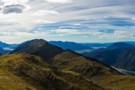
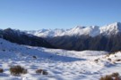
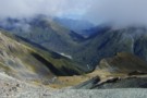
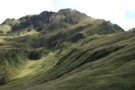
Kellys Range & beyond from Kellys Hill July 2011
Photograph
•
Distance: 1.6km away
This pic looking SW from Kellys Hill was taken before this weeks heavy snowfalls. The dip in the foreground is ...
More ▶︎
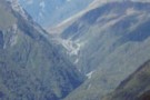
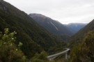
Arthur's Pass
Photograph
•
Distance: 1.6km away
Arthiur's pass and the viaduct viewed from the Kelly Creek to Carroll's Hut track.
More ▶︎
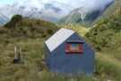
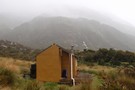
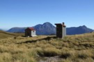
Carroll Hut
Photograph
•
Distance: 1.6km away
This newly renovated hut sits on a pretty tussock plateau on the Kelly Range.
More ▶︎
Carroll Hut
Hut
•
Standard Hut (DOC). Capacity: 10.
•
Distance: 1.6km away
A small, tidy hut just above the treeline on the Kelly Range. Recently renovated with new cladding and new windows. ...
More ▶︎
Kelly Range
Track
•
1 – 2 days. Medium. Return by the same track.
•
Distance: 1.6km away
A brief climb up to Carroll Hut on the tops at the northern edge of Arthur's Pass National Park. Magnificent ...
More ▶︎
Carroll Memorial Hut
Photograph
•
Distance: 1.6km away
Situated on Kelly Saddle, Carroll Hut has stunning views across to Arthur's Pass.
More ▶︎
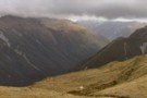
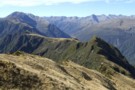
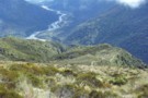
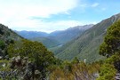
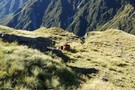
Kelly Range views over Kelly Ck
Photograph
•
Distance: 1.7km away
Moving southward above Carroll hut on the Kelly Range.
Descending the range to Hunts saddle and returning by Kellys Creek resulted ...
More ▶︎
Kellys Hill
Photograph
•
Distance: 1.7km away
1400m above, looking NW from Kellys Hill, APNP.
More ▶︎
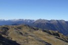
Mt Pfeifer etc from Kellys Hill July 2011
Photograph
•
Distance: 1.7km away
This photo was taken from near the broadcasting repeaters on top of Kellys Hill which is the hill immediately north ...
More ▶︎
Mt Brown Hut
Track
•
1 – 2 days. Medium. Loop track with a road section.
•
Distance: 1.7km away
A circuit in the foothills behind Hokitika. Excellent views and a nice little hut.
More ▶︎
Tracks to the "New" Mt Brown hut
GPX file
•
Distance: 1.7km away
Here is a gpx file. It shows the new huts location & the routes to the hut from the Geologists ...
More ▶︎
Mount Barron Route
GPX file
•
Distance: 2.0km away
Old trail leading up the the tussock tops of Mount Barron. A good benched track leads up to a rocky ...
More ▶︎
Mount Barron Route
Track
•
Medium/hard. One way.
•
Distance: 2.1km away
Old access track onto the Mount Barron tussock tops.
More ▶︎
View from Hans Bay Lake Kaniere Aug 2015
Photograph
•
Distance: 2.2km away
I took this picture from beside the lake a few minutes before parking at the Mt Tuhua track carpark and ...
More ▶︎
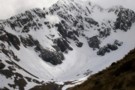
Newton Range biv Jan 2008
Photograph
•
Distance: 2.3km away
This biv is perched near the crest of the Newton Range. This range seperates the Arahura River to the north ...
More ▶︎
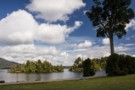
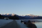
Hans Bay, Lake Kaniere
Photograph
•
Distance: 2.3km away
Hans Island is just a short swim from the shoreline.
More ▶︎
Newton Range biv
Hut
•
Basic Hut/Bivvy (DOC). Capacity: 2.
•
Distance: 2.3km away
This NZFS biv built in 1962 is perched near the crest of the Newton Range. This range seperates the Arahura ...
More ▶︎
Mt Brown hut & Newton Range April 2013
Photograph
•
Distance: 2.3km away
This photo shows how the popular Mt Brown hut sits in relation to the Newton Range.
As well as tramps to ...
More ▶︎
Looking eastward along the Newton Range April 2012
Photograph
•
Distance: 2.3km away
This picture was taken from a spot on the range a bit over an hour west of the bivvy. The ...
More ▶︎
Hans Bay Campsite
Campsite
•
Basic Campsite (DOC). 40 spaces.
•
Distance: 2.4km away
Large campsite next to Lake Kaniere. Very popular with families over the summer.
Dogs are not permitted.
More ▶︎
Barrack Creek Route
Photograph
•
Distance: 2.4km away
Goat Hill and Barrack Creek from Mount Barron. The route follows the spur to the true right of Barrack Creek.
More ▶︎
Harman Pass - Taipo River - Kelly Saddle
Track
•
3 – 5 days. Medium/hard. One way.
•
Distance: 2.5km away
A long journey through the west of Arthur's Pass National Park.
More ▶︎
Mount Barron tops
Photograph
•
Distance: 2.5km away
The end of the marked track up Mount Barron.
More ▶︎
Toaroha/Zit Saddle/Kokatahi/Lathrop Saddle/Styx River Route
Track
•
3 – 5 days. Medium/hard. Loop track with a road section.
•
Distance: 2.6km away
Loop track across 2 Westland saddles, taking in some remote huts
More ▶︎
Browning Range Biv - almost ...
Photograph
•
Distance: 2.6km away
Browning Range Biv - almost there ...
More ▶︎
Browning Range Bivouac
Photograph
•
Distance: 2.6km away
Browning Range Bivouac, on the bush-line in the Browning Range - the hut overlooks the Styx Valley and Grassy Flat, ...
More ▶︎
Grassy Flats
Photograph
•
Distance: 2.6km away
Grassy Flats, in the upper Styx Valley (Westland). Taken fron Browning Range Biv, 600m above.
More ▶︎
Browning Range Bivouac
Hut
•
Basic Hut/Bivvy (DOC). Capacity: 2.
•
Distance: 2.6km away
'If you're just about buggered, you're just about at Browning Biv'. The sign below the biv says it all: it's ...
More ▶︎
Southern descent of Mt.Browns Tops
Photograph
•
Distance: 2.8km away
Moving through a boggy section of the Mt.Browns Tops route just before dropping over the edge into the creek.
That's ...
More ▶︎
Leaving Mt.Browns Tops
Photograph
•
Distance: 2.8km away
A good stretch of the legs. Everyone else we saw on this walk and there were a few, was staying ...
More ▶︎
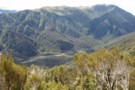
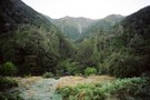
Looking up the Styx from near the New Mt Brown hut
Photograph
•
Distance: 2.8km away
This pic taken yesterday was snapped from the tussock section below the hut whilst heading for the start of the ...
More ▶︎
glennj & Elle dog on summit of Mt Brown April 2011
Photograph
•
Distance: 2.8km away
Summit of Mt Brown. It is the Browning Range in the background.
Yesterday was such good weather I decided to head ...
More ▶︎
Lake Kaniere etc from top of Mt Brown April 2011
Photograph
•
Distance: 2.8km away
This pic shows Elle dog on Mt Brown with views out to the coast behind. The Lake is Kaniere and ...
More ▶︎
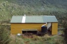
Mount Brown Hut
Photograph
•
Distance: 2.9km away
Perched on a cliff overlooking Lake Kaniere.
More ▶︎
The Mt Brown ridge construction site May 2010
Photograph
•
Distance: 3.0km away
Looking SW from Mt Brown ridge over top of the early stages of construction of the "new" hut.
The "old" Lower ...
More ▶︎
View out to coast from Mt Brown hut
Photograph
•
Distance: 3.0km away
This view is taken just a few steps from Mt Brown hut and looks back toward the track start and ...
More ▶︎
Lunch time at Mt Brown hut Dec 2010
Photograph
•
Distance: 3.0km away
The four younger members of the group of five of us that walked up to check out the new hut.
The ...
More ▶︎
Mt Brown hut & beyond Dec 2010
Photograph
•
Distance: 3.0km away
This hut replaces, but on a different site, the old Mt Brown hut which was removed by DOC about five ...
More ▶︎
Mt Brown Hut
Hut
•
Basic Hut/Bivvy (Mt Brown Community Hut Project). Capacity: 4.
•
Distance: 3.0km away
This hut replaces the old Mt Brown hut which was removed by DOC in 2006. The hut is in a ...
More ▶︎
Mt Brown summit & circuit routes March 2011
Photograph
•
Distance: 3.0km away
This map shows the actual track/routes overlayed in solid black lines on a Topo 50 map. The "old" Mt Brown ...
More ▶︎
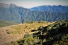
View up Styx valley from Mt Brown hut June 2012
Photograph
•
Distance: 3.0km away
This photo looks up the Styx valley and was taken from outside Mt Brown hut. If you look closely you ...
More ▶︎
Mt Brown hut June 2012
Photograph
•
Distance: 3.0km away
Here is a winter time pic of the hut.
More ▶︎
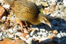
(Pihoihoi) - Pipit
Photograph
•
Distance: 3.1km away
Moaris used to mimick the pipits movements and use a tactic called Manukawhaki (decoy bird). They would pretend to retreat ...
More ▶︎
Grassy Flats Hut
Photograph
•
Distance: 3.1km away
Grassy Flats Hut in the upper Styx Valley, Westland. The hut lies on the easy, benched Arahura-Styx track, and is ...
More ▶︎
Grassy Flat Hut
Hut
•
Standard Hut (DOC). Capacity: 12.
•
Distance: 3.1km away
Grassy Flat Hut (sleeps 12 on 2 platforms, matresses, water, stove) is a modern tramping hut with a large covered ...
More ▶︎
Descent to the Taipo Valley
Photograph
•
Distance: 3.4km away
Descent to the Taipo Valley from the Kelly Range, above Dillons Homestead / Hut
More ▶︎
Lathrop Saddle
Photograph
•
Distance: 3.5km away
Lathrop Saddle - a hanging valley cutting through the Browning Range between the Styx and Crawford valleys. A marked track ...
More ▶︎
Browning Range
Photograph
•
Distance: 3.5km away
From the Browning Bivvy on the bushline above the Styx River we climbed in the dark to reach the top ...
More ▶︎
Below Kelly-Hunt Saddle
Photograph
•
Distance: 3.5km away
The Kelly below the Kelly-Hunt Saddle
More ▶︎
Dillons Hut (new)
Photograph
•
Distance: 3.6km away
Dillons Hut (new), Taipo Valley, Westland
More ▶︎
Crossing Lathrop Saddle
Photograph
•
Distance: 3.8km away
Crossing Lathrop Saddle from the Crawford towards Browning Biv
More ▶︎
Old Water Race below Lower Arahura hut
Photograph
•
Distance: 4.0km away
Here is a photo of a remnant section of the water race that runs roughly parallel with the current track ...
More ▶︎
Kaniere Water Race Track
Photograph
•
Distance: 4.0km away
Kaniere Water Race Track from Lake Kaniere towarss rhe Kaniere township
More ▶︎
Lathrop Saddle feet dangle
Photograph
•
Distance: 4.1km away
Sitting on the edge of Lathrop. Spot the biv. Descent far right on the tussock spur. Dangling feet highly recommended.
More ▶︎
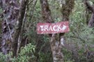
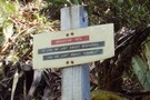
Another old track sign July 2012
Photograph
•
Distance: 4.2km away
Ian G's. picture of an old National Park sign still marking a track in the Urewera got me thinking. I ...
More ▶︎
View of Mt Lathrop etc. and further east
Photograph
•
Distance: 4.5km away
This photo looks east along the Browning Range. Lathrop Saddle crosses this scene in front of the prominent Mt Lathrop ...
More ▶︎
Looking SW from Mt Lathrop March 2017
Photograph
•
Distance: 4.5km away
This is the view looking out over the Crawford and Kokatahi Rivers in a south westerly direction. The Bracken snowfield ...
More ▶︎
Hunts Creek
Photograph
•
Distance: 4.5km away
Barron Ridge is at left, and Hunts Ridge at right. Hunt Saddle is at bottom right and Kelly's Creek at ...
More ▶︎
Descent from Kelly Tops to Hunts Saddle and Return!
Photograph
•
Distance: 4.6km away
Masochistic mission involving at times 40 degrees gradients where the techniques of hanging off scrub and sliding to the next ...
More ▶︎
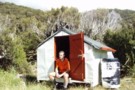
Boo Boo hut & woodshed March 2009
Photograph
•
Distance: 4.7km away
TL of the Kokatahi valley. High on a ridge well above the river gorges.
More ▶︎
Boo Boo Hut
Hut
•
Basic Hut/Bivvy (DOC). Capacity: 4.
•
Distance: 4.7km away
Located on the Kokatahi River track just south of where a branch leads up onto the Toaroha Range.
More ▶︎
Waimakariri River-Rolleston River
Track
•
2 – 3 days. Hard. One way.
•
Distance: 4.7km away
Alpine tramp over Waimakariri Col.
More ▶︎
Other Part of trail to Carrington Hut
Photograph
•
Distance: 4.7km away
the trail after a nice rain
More ▶︎
The Trail Klondyke Corner to Carrington Hu
Photograph
•
Distance: 4.7km away
view of the grassy trail before the riverbed becomes the trail.
The hut is still far here but it is behind ...
More ▶︎
Track Descent
Photograph
•
Distance: 4.7km away
The map shows the track crossing two small tributaries before heading sharply down to meet the main river. You may ...
More ▶︎
The Track Starts
Photograph
•
Distance: 4.7km away
After three or four scree/shrub combinations, where the gorge below opens out a little, keep an eye out for the ...
More ▶︎
Grass my Arse
Photograph
•
Distance: 4.7km away
Sections of alpine "herbs" break up the scree slopes high above the Rolleston River. There is no track through these ...
More ▶︎
Pick Your Path
Photograph
•
Distance: 4.7km away
Try to stay reasonably high above the river on the true left for the easiest route down and to avoid ...
More ▶︎
Top of Rolleston Valley
Photograph
•
Distance: 4.7km away
There are sporadic cairns down into the Rolleston Valley, but they can be difficult to pick out against the scree. ...
More ▶︎
At the top
Photograph
•
Distance: 4.7km away
If intending to cross over into the Rolleston from the Waimak, DON'T go over the actual Waimak Col (you'll see ...
More ▶︎
Route Planning
Photograph
•
Distance: 4.7km away
Checking the map for a route over the head of the Waimakariri Valley into the Rolleston Valley. Be aware in ...
More ▶︎
Insulator grown into Rimu tree near Dough Town August 2012
Photograph
•
Distance: 4.8km away
I snapped this picture of an old telegraph insulator at least 3m up a rimu tree. It is beside the ...
More ▶︎
Dough Town Track July 2012
Photograph
•
Distance: 4.8km away
Bits of an old miners track that linked Humphreys Gully to Dough Town & then carried on to Milltown still ...
More ▶︎
Kelly Range from Hunts Creek Track
Photograph
•
Distance: 5.1km away
The route from the tops of the Kelly Range to Hunts Saddle drops through thick scrub to a small bog ...
More ▶︎
Mingha River-Deception River
Track
•
2 days. Medium. One way.
•
Distance: 5.1km away
Goat Pass Track. Alpine track over a pass between two river valleys.
More ▶︎
View East from Top Crawford biv Dec 2010
Photograph
•
Distance: 5.1km away
This pic was taken from the biv & shows the basin immediately East of the biv. Thought the ribbonwoods looked ...
More ▶︎
Crawford Biv looking up Lathrop saddle
Photograph
•
Distance: 5.1km away
Lathrop saddle is off to the right, the spur to it is center above biv.
More ▶︎
Top Crawford Bivouac
Photograph
•
Distance: 5.2km away
Top Crawford Bivouac, Crawford Valley, Westland
More ▶︎
Mount Learmont
Photograph
•
Distance: 5.2km away
Mount Learmont and the upper Crawford Valley, Westland
More ▶︎
Top Crawford Bivouac (Removed)
Hut
•
Removed!
•
Distance: 5.2km away
The Top Crawford Bivouac (2 bunks, no matresses, stream water 100m distant, no fire) is a typical alpine Biv, with ...
More ▶︎
Blue Ducks
Photograph
•
Distance: 5.2km away
Blue Ducks on Crawford Creek, Westland. Between Top Crawford Hut and Top Crawford Bivouac
More ▶︎
Hunts Hut
Photograph
•
Distance: 5.2km away
A small but tidy hut located at the edge of a tussock clearing near Hunts Creek.
More ▶︎
Hunts Creek Hut
Hut
•
Standard Hut (DOC). Capacity: 4.
•
Distance: 5.2km away
A small hut handsomely located at the edge of a tussock clearing on Hunts Creek, west of Otira.
Hunts Creek takes ...
More ▶︎
Hunts Creek Hut
Photograph
•
Distance: 5.2km away
5-7 hours slog up Kellys Creek from the Otira highway, this little abode is welcome site after mud-jumping across Hunts ...
More ▶︎
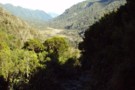
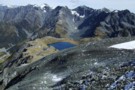
Upper Styx valley
Photograph
•
Distance: 5.3km away
Upper Styx valley and Grassy Flats, from the track over Styx Saddle.
More ▶︎
Three Passes
Track
•
4 – 5 days. Medium/hard. One way.
•
Distance: 5.3km away
A classic trip from Arthur's Pass across Browning, Whitehorn and Harman Passes, emerging near Lake Kaniere on the West Coast.
More ▶︎
Top Crawford Hut
Photograph
•
Distance: 5.3km away
Near old Top Crawford Biv site, this 4 bunk forest service hut was refurbished and relocated in February 2011. It ...
More ▶︎
Rear view of "New" Top Crawford hut
Photograph
•
Distance: 5.4km away
Here is a rear view of the hut. The perspective is looking NNW past the hut and over the two ...
More ▶︎
"New" Top Crawford hut Feb 2012
Photograph
•
Distance: 5.4km away
This photo is of the "new" Top Crawford hut which is an hour walk up the valley from the location ...
More ▶︎
Top Crawford Hut (New)
Hut
•
Standard Hut (DOC). Capacity: 4.
•
Distance: 5.4km away
This entry is for the "new" Top Crawford hut which is an hour walk up the valley from the location ...
More ▶︎
Browning Pass etc from Mt Browning Nov 2017
Photograph
•
Distance: 5.4km away
Looking toward Browning Pass etc from high on Mt Browning.
I climbed up from the Styx Saddle and enjoyed great ...
More ▶︎
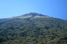
Mt Tuhua Sept 2010
Photograph
•
Distance: 5.4km away
Yesterday morning I took advantage of the first nice day for a while to head up Mt Tuhua which is ...
More ▶︎
Top Crawford Hut
Photograph
•
Distance: 5.5km away
Top Crawford Hut, Crawford Creek, Westland.
More ▶︎
Top Crawford Hut (Removed)
Hut
•
Removed!
•
Distance: 5.5km away
Top Crawford Hut (4-bunks, matresses, tank water, no fire) is a typical forestry-style hut. It's located on a small terrace ...
More ▶︎
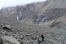
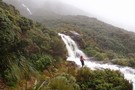
Styx Saddle
Photograph
•
Distance: 5.6km away
Styx Saddle - between the Styx and Arahura valleys in Westland. The Campbell Range forms a backdrop beyond the upper ...
More ▶︎
"New" Lower Arahura hut June 2010
Photograph
•
Distance: 5.8km away
A replacement DOC 6 bunk hut for the old NZFS 4 bunk hut that used to sit 30m to the ...
More ▶︎
Lower Arahura hut
Hut
•
Standard Hut (DOC). Capacity: 6.
•
Distance: 5.8km away
A new DOC 6 bunk hut that replaces the old 4 bunk NZFS hut. The new hut is 30m east ...
More ▶︎
"Old" Lower Arahura hut (removed)
Photograph
•
Distance: 5.8km away
This photo shows the "old" Lower Arahura hut as it was in January 1976 when it had recently received a ...
More ▶︎
Lower Arahura Hut
Photograph
•
Distance: 5.8km away
A nice new 6 bunk hut in the Arahura valley.
More ▶︎
View from un-named Campbell Range saddle
Photograph
•
Distance: 5.8km away
This April 2013 photo was taken from the un-named Campbell Range Saddle at 1600m that is on the direct route ...
More ▶︎
Harper Pass - Kiwi Saddle
Track
•
5 – 7 days. Medium. One way.
•
Distance: 5.9km away
A classic crossing of the Main Divide, following the deep valleys of the Hope Fault from the Arthur's Pass road ...
More ▶︎
Otehake Hot Springs
Track
•
2 days. Easy/medium. Return via same track.
•
Distance: 6.0km away
A popular weekend route to good hot pools.
More ▶︎
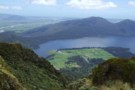
Lake Kaniere
Photograph
•
Distance: 6.0km away
Lake Kanierec from lookout below Mt Upright, Lake Kaniere track
More ▶︎
Track amongst gold workings Taipo River
Photograph
•
Distance: 6.2km away
This photo shows a section of the Seven Mile Creek to Kelly Range tops track that passes amongst old alluvial ...
More ▶︎
Upper Hunts Creek
Photograph
•
Distance: 6.4km away
Upper Hunts Creek - valley head above the hut. Te pass to Dry Creek in the Taipo is up scree ...
More ▶︎

Taipo River
Photograph
•
Distance: 6.4km away
Lower Taipo river valley from the Kelly Range above Dillons Hut
More ▶︎
Taipo River above Dillons Hut
Photograph
•
Distance: 6.4km away
Taipo River above Dillons Hut, Westland
More ▶︎
Dillons Hut
Hut
•
Standard Hut (DOC). Capacity: 10.
•
Distance: 6.4km away
The New Dillons Hut (sleeps 10, stove, tank water) lies in the middle reaches of the Taipo valley, 10 minutes ...
More ▶︎
West Coast Streams
Photograph
•
Distance: 6.5km away
En-route from Harman Hut to Grassy Flat Hut. Be mindful that during heavy rain in the New Zealand bush, small ...
More ▶︎
Map of Toaroha Valley to Pinnacle Biv via Adventure Ridge routes
Photograph
•
Distance: 6.5km away
This map is to illustrate the route info provided under the Comments section of the Pinnacle biv hut page.
The ...
More ▶︎
Setting of Pinnacle biv (aka Crinkle Top biv) March 2012
Photograph
•
Distance: 6.5km away
This pic shows the replacement biv which was moved to this site in 2011. It is the same design & ...
More ▶︎
Pinnacle biv (aka Crinkle Top biv)
Hut
•
Basic Hut/Bivvy (DOC). Capacity: 2.
•
Distance: 6.5km away
An old late 1950's NZFS cullers biv situated up in the tussock near the top of Mt Crinkle Top. This ...
More ▶︎
Genoa Peak March 2009
Photograph
•
Distance: 6.5km away
This pic is of the eastern side of Genoa Peak and was taken from just above Pinnacle biv on the ...
More ▶︎
Pinnacle biv (aka Crinkle Top biv) March 2009
Photograph
•
Distance: 6.5km away
A survivor from the deer culling days before helicopters! This biv gave shooters access to hundreds of hectares of tussock ...
More ▶︎
Mount Barron
Photograph
•
Distance: 6.6km away
Mount Barron from the Death's Corner lookout. The route follows the far edge of the obvious slip. The steep bluffs ...
More ▶︎
Rangi-Taipo Traverse from Taipo Access 4WD track
Article
•
Distance: 6.6km away
10 hour untracked traverse though unpleasant nearly impenetrable vegetation culminating in glorious ascent to Rangi-Taipo and descent via overgrown but ...
More ▶︎
Paratu Stream - Waharoa Saddle
Article
•
Distance: 6.6km away
The easiest route to Mt Pfeifer via an attractive bouldered stream and a magical saddle with flybys of kaka and ...
More ▶︎
Harman hut August 1975
Photograph
•
Distance: 6.6km away
This pic was taken after having come down from Browning Pass. Shortly after I snapped the pic it started snowing ...
More ▶︎
Harman Hut
Hut
•
Standard Hut (DOC). Capacity: 6.
•
Distance: 6.6km away
Standard DOC hut at the confluence of the Harman & Arahura rivers. This hut is on the popular "3 passes" ...
More ▶︎

Dillon's Hut (historic)
Photograph
•
Distance: 6.7km away
Dillon's Hut (historic), in the Taipo Valley
More ▶︎
Dillons Hut (historic)
Photograph
•
Distance: 6.7km away
Dillons Hut (historic), in the Taipo Valley
More ▶︎
Dillon's Homestead (historic)
Hut
•
Standard Hut (DOC). Capacity: 5.
•
Distance: 6.7km away
Dillon's Homestead(historic) (5 beds, fireplace, tank & stream water, fiirewood available) is a well built, well restored hut in the ...
More ▶︎
Harman Hut
Photograph
•
Distance: 6.8km away
Harman Hut on a typical West Coast summer day. Pretty basic hut that comes with its own family of weka!
More ▶︎
Crawford Creek
Photograph
•
Distance: 6.9km away
Crawford Creek, Westland. Between Top Crawford Hut and Crawford Junction Hut.
More ▶︎
View of McArthur Crags from the Newton Range Jan 2008
Photograph
•
Distance: 7.0km away
This picture was taken from just north of the Newton Range biv. I took it to show the band of ...
More ▶︎
Mt Philistine
Track
•
1 day. Medium/hard. Return via same track.
•
Distance: 7.1km away
Moderate to hard daytrip in Arthurs Pass.
More ▶︎
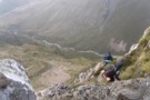
Philistine Bluffs
Photograph
•
Distance: 7.1km away
Decending the bluffs - not a forgiving place to loose your footing- there have been deaths here.
More ▶︎
Philistine Bluffs
Photograph
•
Distance: 7.1km away
Decending the bluffs - not a forgiving place to loose your footing- there have been deaths here.
More ▶︎
Philistine / Warnock's Bluffs
Photograph
•
Distance: 7.1km away
The normal route up Philistine from the road ascends through this line of bluffs. When there is no snow, the ...
More ▶︎
Jade Prospectors hut at Olderog/Jade Ck confluence Feb 2009
Photograph
•
Distance: 7.2km away
This hut is known by the names of both the creeks it is at the confluence of. We used to ...
More ▶︎
Seven Mile hut Jan 2008
Photograph
•
Distance: 7.3km away
Well it is a surprise that this hut is still there. A while back I read that DOC had removed ...
More ▶︎
7 Mile Hut
Hut
•
Basic Hut/Bivvy (PVT). Capacity: 2.
•
Distance: 7.3km away
This hut is on private land and both have been bought by someone who has improved access to 7 Mile ...
More ▶︎
Upper Deception Hut
Hut
•
Basic Hut/Bivvy (DOC). Capacity: 6.
•
Distance: 7.5km away
Six bunk hut adjacent the popular Mingha-Deception route. It was built by the NZFS in 1962.
[A four bunker Lower Deception ...
More ▶︎
Upper Deception hut Feb 2009
Photograph
•
Distance: 7.5km away
A sound old NZFS hut in need of a bit of TLC. The scrub badly needed cutting back last time ...
More ▶︎
Route down off McArthur Crags to Lower Olderog biv Jan 2010
Photograph
•
Distance: 7.6km away
This pic shows the SE leading spur off the top of Mt McArthur that leads down to Lower Olderog biv. ...
More ▶︎
Lower Olderog biv (aka Jade biv) Feb 2009
Photograph
•
Distance: 7.6km away
This biv is located on a bench well above the creek bed in the headwaters of Jade Creek. It is ...
More ▶︎
Lower Olderog biv (aka Jade biv)
Hut
•
Basic Hut/Bivvy (DOC). Capacity: 2.
•
Distance: 7.6km away
This NZFS biv dating from 1957 is located on a bench well above the creek bed in the headwaters of ...
More ▶︎
Blue Duck Bivvy Setting Feb 2016
Photograph
•
Distance: 7.7km away
Blue Duck Bivvy is a derelict B-49 style NZ Forest Service hunters bivvy that was built in the late 1950's ...
More ▶︎
Blue Duck Bivvy
Hut
•
Basic Hut/Bivvy (DOC).
•
Distance: 7.7km away
A derelict B-49 NZ Forest Service hunters bivvy that was built in the late 1950's and is still on site. ...
More ▶︎
Otira Valley
Track
•
Easy. Return via same track.
•
Distance: 7.7km away
A short, pretty walk into an alpine environment. A variety of alpine flowers in summer.
More ▶︎
Crawford Junction
Photograph
•
Distance: 7.7km away
Crawford Junction, the confluence of Crawford Creek and Kokatahi River in Westland. Photo taken from the doorway of Crawford Junction ...
More ▶︎
Crawford Junction Hut
Photograph
•
Distance: 7.7km away
Crawford Junction Hut, at the confluence of Crawford Creek and Kokatahi River in Westland
More ▶︎
Crawford Junction hut Feb 2012
Photograph
•
Distance: 7.7km away
This hut sits near the edge of a low terrace on the TL of the Crawford River and overlooks the ...
More ▶︎
Crawford Junction Hut
Hut
•
Basic Hut/Bivvy (DOC). Capacity: 6.
•
Distance: 7.7km away
Crawford Junction Hut (6 bunks, matresses, tank water, stove) is by far the nicest hut in the valley. It's of ...
More ▶︎
Mt Philistine Traverse
Track
•
1 day. Hard. One way.
•
Distance: 7.7km away
A classic mountain traverse in Arthurs Pass National Park, includes climbing steep scree, bluffs, rock and snow. An ice axe ...
More ▶︎
Lake Misery Track
GPX file
•
Distance: 7.8km away
Short connector track that crosses the Main Divide of the Southern Alps.
More ▶︎
Lake Misery Track
Photograph
•
Distance: 7.9km away
Small rockpile on the Lake Misery Track.
More ▶︎
"Old" Pfeifer biv (Removed) Dec 2007
Photograph
•
Distance: 8.3km away
The old biv a few months before it was replaced.
More ▶︎
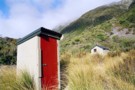
Pfeifer biv & toilet April 2012
Photograph
•
Distance: 8.3km away
A new biv from early 2008 replacing an old biv that was about 20m to the south. (The sign on ...
More ▶︎
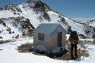
Pfeifer biv
Hut
•
Basic Hut/Bivvy (DOC). Capacity: 2.
•
Distance: 8.3km away
A new biv from early 2008 replacing an old biv that was about 20m to the south. (The sign on ...
More ▶︎
Pfeiffer Biv
Photograph
•
Distance: 8.3km away
cosy,dinky even,modern 2 bunker with longdrop nearby.
More ▶︎
birds-eye view
Photograph
•
Distance: 8.4km away
Looking from Waharoa Saddle down Pfeifer Stream & to Lake Kaurapataka
More ▶︎

Descent from Pfeifer Biv into Pfeifer Creek via scree
Photograph
•
Distance: 8.4km away
Unmarked route exiting basin where biv lies, maintaining altitude to cross a spur after 20 minutes then travelling northeast along ...
More ▶︎
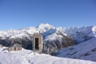
Page Memorial Shelter
Photograph
•
Distance: 8.5km away
Day shelter in Temple Basin, Arthurs Pass.
Page Memorial Shelter is little day-hut built for skiers in Temple Basin, set apart ...
More ▶︎
Toaroaha Saddle-Frew Saddle Circuit
Track
•
4 – 6 days. Medium. One way.
•
Distance: 8.6km away
A great tramp in a remote location, crosses two alpine saddles, ice-axes and crampons needed in winter. More information on ...
More ▶︎
Dobson Nature Walk
Track
•
Easy. One way.
•
Distance: 8.6km away
A short walk on the Main Divide of the Southern Alps, offering alpine flora and panoramic views.
More ▶︎
Tarns on the tops above Camp Creek hut Sept 2010
Photograph
•
Distance: 8.7km away
These tarns are a short walk SW along the range from where the tops track emerges. Most people head along ...
More ▶︎
Walks Around Arthur's Pass
Article
•
Distance: 8.7km away
A variety of both easy and more challenging walks are available around Arthur's Pass village and the nearby pass.
More ▶︎
Dobson Nature Walk
GPX file
•
Distance: 8.7km away
Stroll through an alpine herbfield scattered with massive boulders, Arthur's Pass National Park.
More ▶︎
Looking down the Arahura River from near Campbell biv Feb 2009
Photograph
•
Distance: 8.7km away
This pic shows the Arahura River as far as the "big bend" where it goes out of sight then it ...
More ▶︎
Campbell biv Feb 2009
Photograph
•
Distance: 8.7km away
A 1950's vintage cullers biv located on a west facing spur of the Campbell Range. From the biv there are ...
More ▶︎
Campbell biv
Hut
•
Basic Hut/Bivvy (DOC). Capacity: 2.
•
Distance: 8.7km away
A 1950's vintage cullers biv located on a west facing spur of the Campbell Range. From the biv there are ...
More ▶︎
Temple Basin Ski Field
Photograph
•
Distance: 8.7km away
Taken a little past the ski huts, November 2012
More ▶︎
Temple Basin
Track
•
Easy/medium. Return via same track.
•
Distance: 8.7km away
A steepish climb through alpine meadows to the Temple Basin skifield
More ▶︎
Mts Te Kinga & Alexander August 2011
Photograph
•
Distance: 8.9km away
This photo looks along the Te Kinga tops from the low peak near the trig to the top of Te ...
More ▶︎
Mt Alexander
Photograph
•
Distance: 9.0km away
Looking down on the confluence of the Otira and Taramakau rivers from Summit of Mt Alexander
More ▶︎
Mt Alexander
Photograph
•
Distance: 9.0km away
Looking back at point 1786 ,Mt Tekinga, Lake Brunner, Kangaroo Lake, Lady Lake and Swan lake
More ▶︎
Mount Alexander
Track
•
2 days. Medium. Return by the same track.
•
Distance: 9.0km away
A long climb to the summit of Mount Alexander (1958m) on the Kaimata Range. This range lies directly north of ...
More ▶︎
Head of the Rolleston River, just below Pt2000
Photograph
•
Distance: 9.0km away
Taken while traversing slopes high in the Rolleston river. Shows the snow slope used to access the first col north ...
More ▶︎
Dunns Creek
Photograph
•
Distance: 9.1km away
The lower Dunns Creek ascending from the Taipo to Dunns Creek Hut
More ▶︎
Kelly Tops, Dry Creek, Taipo Circuit
Article
•
Distance: 9.1km away
A 3 day circuit from 7 Mile Creek to the Kelly Tops, down to Hunts Saddle and then over Hunts ...
More ▶︎
Posing on Mt Pfeifer
Photograph
•
Distance: 9.1km away
This pic looks westward from Mt Pfeifer during autumn conditions prior to the May snowfalls.
Mt Pfeifer is an easy ...
More ▶︎
traverse of Mt Pfeifer
Photograph
•
Distance: 9.2km away
Traverse of ridge south-east of the summit in clag. Getting around the boulder was tricky and a bit exposed.
More ▶︎
Dry Creek
Photograph
•
Distance: 9.2km away
Dry Creek - descending into the Taipo from it's 1700m saddle off Hunts Creek
More ▶︎
Mt Kerr
Photograph
•
Distance: 9.2km away
Exploring the exposed tops above the Arahura RIver just before a front rolls in. Reached by an old NZFS track ...
More ▶︎
Looking toward Mt Alexander from above Camp Creek hut Sept 2010
Photograph
•
Distance: 9.3km away
This picture was taken not far from where the tops track crests the ridge. Mt Alexander (1958m) is the back ...
More ▶︎
Bealey Chasm and Valley
Track
•
Easy/medium.
•
Distance: 9.6km away
A excellent short walk in the autumn or spring with wonderful views of rolleston glacier
More ▶︎
Mt Rolleston - Otira Face
Photograph
•
Distance: 9.7km away
The best known peak in Arthurs Pass national park. The Otira Face as seen here from Mt Philistine is often ...
More ▶︎
Goat Pass Hut
Hut
•
Standard Hut (DOC). Capacity: 20.
•
Distance: 9.7km away
Large hut on the popular Mingha-Deception route
More ▶︎
Lake Mavis
Track
•
2 days. Medium. Return via same track.
•
Distance: 9.8km away
A side trip off the popular Mingha-Deception route in Arthur's Pass.
More ▶︎
Mount Cassidy
Track
•
1 day. Medium/hard. Return via same track.
•
Distance: 9.8km away
A short but challenging climb from Arthur's Pass Village.
More ▶︎
Tops SW of Lake Browning April 2013
Photograph
•
Distance: 9.8km away
I'm sharing this photo of the area near Browning Pass. I guess it must be one of my favoured areas ...
More ▶︎
Mudflats Hut
Photograph
•
Distance: 9.9km away
Mudflats Hut, in the Arahura Valley, Westland.
More ▶︎
Arahura Valley
Photograph
•
Distance: 9.9km away
The Arahura Valley from the Mudflats swingbridge.
More ▶︎
Mudflats Hut
Hut
•
Standard Hut (DOC). Capacity: 6.
•
Distance: 9.9km away
Mudflats Hut (6 bunks, matresses, tank water, stove, firewood available) lies in the mid-reaches of the Arahura Valley in Westland. ...
More ▶︎
Kokatahi River
Photograph
•
Distance: 9.9km away
Kokatahi River, between Crawford Junction Hut and Top Kokatahi Hut.
More ▶︎