Otira Valley
- 1 hr 30 min – 4 hr return via same track
- Easy
A short, pretty walk into an alpine environment. A variety of alpine flowers in summer.
|
Walking time
|
1 hr 30 min – 4 hr |
|---|---|
|
Distance
|
5.0km |
|
Type
|
Return via same track
|
|
Grade
|
Easy
Easy benched track as far as the bridge. Medium poled route with alpine skills required beyond the bridge. Grades explained
|
|
Bookings
|
No bookings — open access
No — open access
|
|
Starts
|
Otira Valley car park north of Arthur's Pass summit, SH73. |
|---|---|
|
Maps
|
NZTopo50-BV20
|
|
Altitude
|
880m
–
1,260m
Altitude change 380m
|
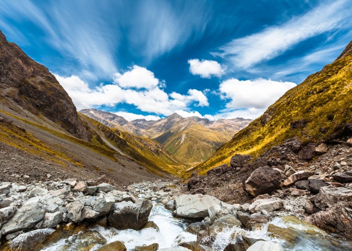
From the car park, the smooth benched track leads under power pylons and into the picturesque valley. The Dobson Nature Walk leads off to the left, and the Otira Track continues its sidle up the valley, bending gently to the left. After 45 minutes, the track drops to the valley floor and a foot bridge over the river.
The track ends at the bridge, becoming a lightly poled route up the valley on the true left. There are several alpine hazards to be aware of from here. Avalanche paths cross the route, with the greatest risk of avalance being after heavy snow or rain. There is also a danger of rock fall. Alpine experience is necessary.
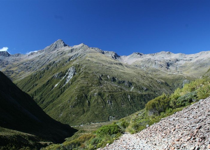
The route leads over scree along the river, climbing into the top basin in 30 minutes. Alpine species here include Gentiana, Ranunculus lyallii (buttercup), Leucogenes (edelweiss), Anisotome, Celmisia, Leptinella, Dolichoglottis. Patches of permanent snow lie here where they collect from the bluffs beneath Mounts Philistine and Rolleston.