
Village walks

Punchbowl Road at the northern edge of the village leads to a car park and bridge over the Bealey River. The Arthur's Pass Walking Track and the Punchbowl Falls Tracks both set off from here. The Arthur's Pass Village Historic Walk visits a number of sites around the village -- pick up a brochure from the visitor centre. The short Millennium Walk starts behind the visitor centre and visits a waterfall.
Walking times:
- Devils Punchbowl Falls: 1 hour return
- Arthur's Pass Walking Track: 1.5 hours each way
- Arthur's Pass Village Historic Walk: 1 hour
- Millennium Walk: 10 minutes
Pass walks
From the village, access the pass along the Arthur's Pass Walking Track.
South of the pass, the Bealey Valley Track leads through forest and into a subalpine environment, finally coming to a false glacier where snow has piled on the valley floor. On the eastern side of the road, the Temple Basin Track leads up to the skifield, with commanding views across the valley to Mount Rolleston. On the pass, the Dobson Nature Walk meanders easily through herbfields that feature the New Zealand giant buttercup in spring.
From the nature walk, the Lake Misery Track heads north over wetland to connect up with the Otira Valley Track. The Otira River drains the northern side of the pass, and a track leads to its headwaters in a high alpine valley beneath imposing cliffs.
Walking times:
- Bealey Valley Track: 3 hours return
- Temple Basin Track: 3 hours return
- Dobson Nature Walk: 30 minutes loop
- Lake Misery Track: 20 minutes each way
- Otira Valley Track: 2 hours return
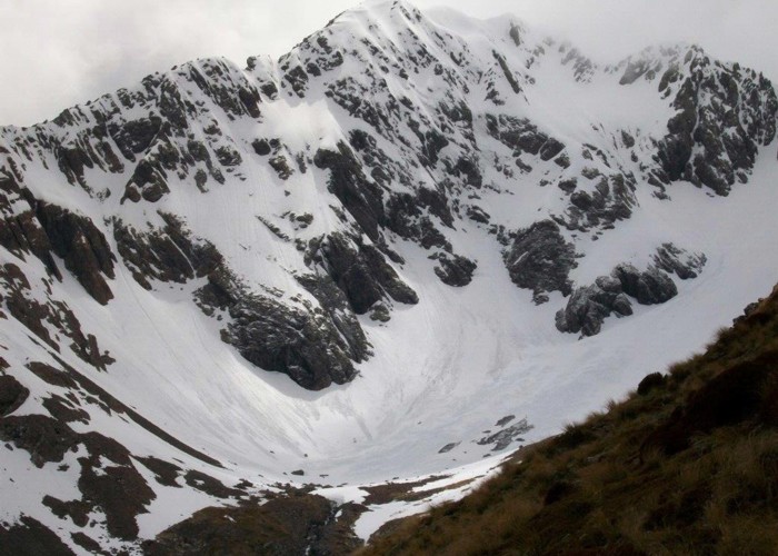
Challenging tracks
From the village, a number of day-walk tracks lead steeply up the mountain sides to alpine environments. These tracks are hazardous and require appropriate equipment and preparation. Check in at the visitor centre for current conditions.

The most popular route is a loop onto Avalanche Peak (1833m), along Scott's Track just north of the village and the steeper Avalanche Peak Track in the centre of the village. A short walk along Scott's Track offers excellent views of the Punchbowl Falls opposite, while a journey to the bushline reveals good views of the village and surrounds.
The Mount Bealey Track starts near Rough Creek, south of the village. With planning, it is possible to complete a long circuit between Mount Bealey (1836m) and Avalanche Peak.
Con's Track sets off discreetly from the flats on the eastern side of the Bealey River bridge. The track climbs swiftly next to the Punchbowl Falls to raw alpine rock that is crumbly and unstable. The route leads to Mount Cassidy (1850m) and Blimit (1921m). Mountaineering helmets are advised in even the best conditions.
The Mount Aicken Track leads off the Punchbowl Falls Track a little further on. This climbs to Mount Aicken (1863m) on a relatively even grade.
The Coral Track sets off north of the village near McGrath Creek. It climbs the Rome Ridge and is used by mountaineers heading for Mount Rolleston (2275m).
From the Temple Basin Skifield, a walk up to Temple Col (1774m) is straightforward, and is about an hour from the skifield huts.