
The stream is reached from the Morrison footbridge and the flood track that takes you to the Taramakau. When you reach Paratu Stream, cross to the true right and travel on cattle flats to the corner where the stream bed narrows. The water is still polluted by cattle feces for some time after this. Travel in the stream bed is obvious but there are 2 possible bypasses. The first short bypass is on the true left and is a small initially bouldery flood channel which becomes an easily navigable verdant section. The second longer flood channel is on the true right and is hopefully marked with a cairn. Gorse is threatening to block this route so it will need some trimming to prevent this soon.
Soon after the flood channel there is a junction of Paratu Stream. This takes about an hour's steady travel to reach from the road. At this junction the tributary on the true right is marked with a cairn. The initial travel is in an enclosed, slimey in heavier flows stream for a short distance. In low flows, this stream percolates nearly completely underground and often there are no pools available for another hour. The stream opens up to fragrant mountain holly etc. at the edges and is easy travel for another hour to the cut track.
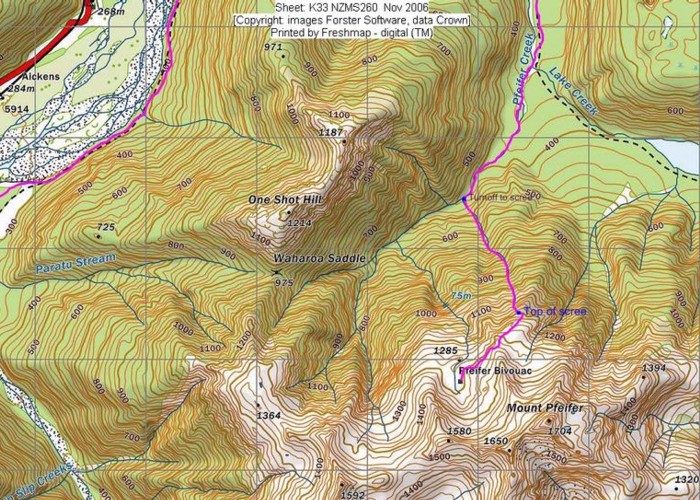
This last section to the saddle takes about 20 minutes. It is via a cut track that Frank and I created several years ago. We do regular maintenance to keep it in good order especially so when there's heavy snow the side branches will not drop down and obstruct the track. This is an especially beautiful section with birdlife, and fortunately a tiny stream appearing after 5 minutes.
Waharoa Saddle is open with shingle on its western side. There is a flat spot for a 2 person tent and other flat spots for single bivvying. On the northern side are copious trails formed by kiwis and possibly kakapo in former years. Boughs of dead mountain cedars and track trimmings provide modest amounts of firewood for an aromatic small fire to keep you cosy. Kiwis never fail to enthrall as dusk comes with their male/female duets and tuis and kaka fly over the saddle on their circuits. Last visit we also watched an aerial dogfight where a falcon was seeing off a kaka from its territory. The previous visit a kiwi ran over our tent and left several feathers.
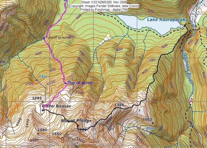
A well cut track continues from here to the Pfeifer tops to visit Pfeifer Hut or the summit. It begins in mountain cedar and carries on through scrub to the tussock tops and tarns. You can see the summit of Mt Pfeifer and the two basins that are travelled through to get to the biv. There is also a descent route from the biv into Pfeiffer Stream via a reasonable scree making a nice circuit. This descent route requires good location awareness skills or failing that, a GPS. I'll attempt to put a gpx file on the site as well as a jpg of the routes described!