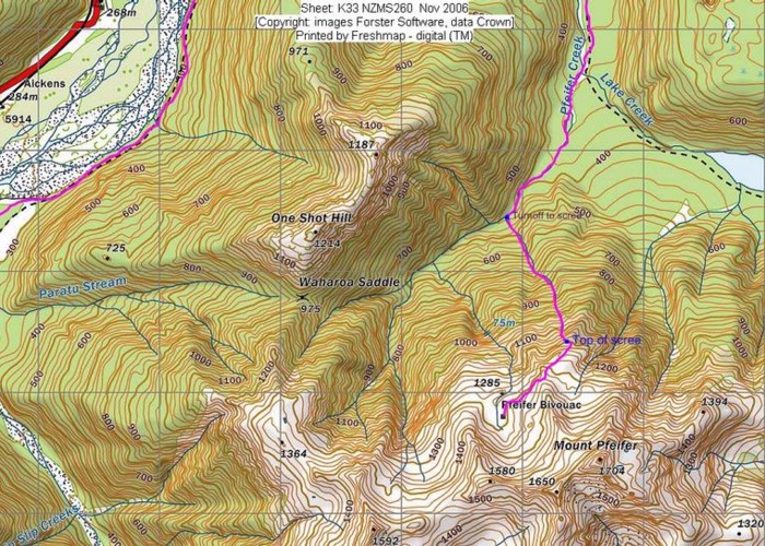
Descent from Pfeifer Biv into Pfeifer Creek via scree

Unmarked route exiting basin where biv lies, maintaining altitude to cross a spur after 20 minutes then travelling northeast along a narrow descending fault scarp to the bushline half an hour from the hut. After a final descent of 50m dropping down through scrub, you will see a large cairn (E2401361, N5822424)marking the point where you enter the top of a small open scrubby gully that joins a wide trail of scree formed of fist-sized rocks. This scree descends nearly all the way to Pfeifer Creek and takes about an hour. The last section is slower via greasy forest and a slippery small stream taking another half hour. The GPS coordinates for the exit point into Pfeifer Creek are E2400869, N5823457.
