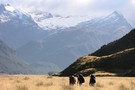
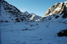
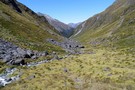
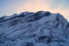
Nearby
Haast to The Divide
Boyd Creek to The Divide via Kiwi Burn and the Mavora Walkway
Article
•
Distance: less than 100m away
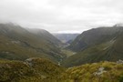
A New Year's trip through the Snowdon Forest and on to The Divide. Heavily affected by weather, I had to ...
More ▶︎
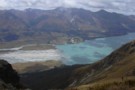
Matukituki to Paradise by roads less travelled
GPX file
•
Distance: less than 100m away
A rough, tough crossing from Raspberry Flat (Aspiring Road, Wanaka) to the Earnslaw Burn (Glenorchy-Paradise road) via Shotover Saddle, Lochnagar, ...
More ▶︎
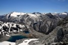
Picton to Aspiring
GPX file
•
Distance: less than 100m away
An aborted alpine traverse. Picton to West Cape, but aborted at Aspiring due to real world emergencies back home. Posted ...
More ▶︎
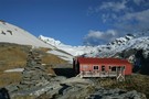
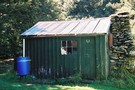
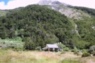
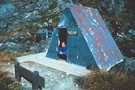
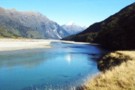
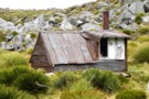
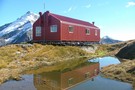
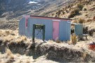
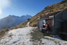
Kerin Forks Hut
Hut
•
Serviced Hut (DOC). Capacity: 10.
•
Distance: less than 100m away
Kerin Forks Hut (10 bunks, wood-burning stove, firewood avail., tank water) is a spacious, comfortable hut at the back of ...
More ▶︎
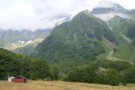
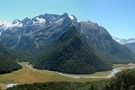
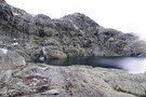
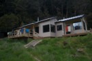
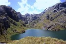
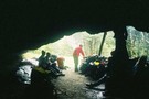
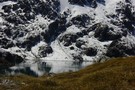
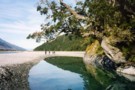
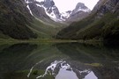
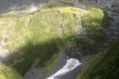
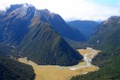
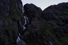
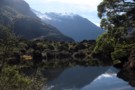
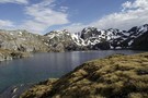
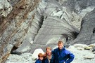
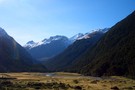
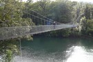
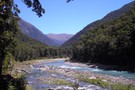
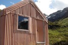
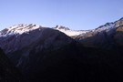
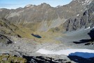
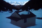
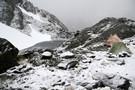
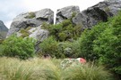
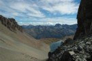
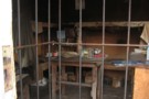
Dart Hut
Photograph
•
Distance: less than 100m away
Dart hut, taken from the swing bridge crossing the Snowy stream, just as you approach the hut
More ▶︎
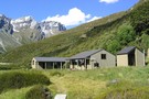
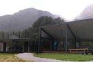
Routeburn Flats Hut
Hut
•
Great Walks Hut (DOC). Capacity: 20.Bookings required.
•
Distance: less than 100m away
A large hut on the Routeburn Track, often bypassed for the Routeburn Falls Hut which is 1 hour further along ...
More ▶︎

Rockburn - Lake Nerine - North Routeburn
Track
•
3 – 5 days. Medium. Loop track.
•
Distance: less than 100m away
A slightly shorter option to the 5 passes trip but of similar if not more difficulty. Can be done in ...
More ▶︎
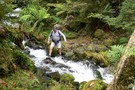
French Ridge
Track
•
2 – 4 days. Medium. Return via same track.
•
Distance: less than 100m away
A steep climb to the snowline in the West Matukituki.
More ▶︎
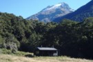
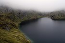
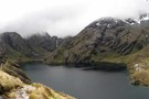
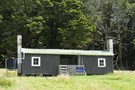
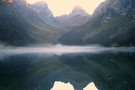
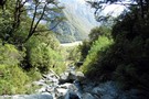
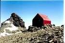
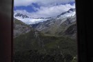
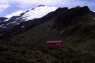
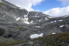
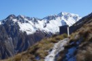
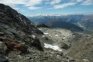
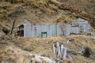
Shelter Rock Hut
Photograph
•
Distance: less than 100m away
Shelter Rock Hut in its surrounding mountains
More ▶︎
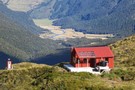
Shelter Rock Hut
Hut
•
Serviced Hut (DOC). Capacity: 22.
•
Distance: less than 100m away
In the Rees Valley. One of the huts on the Rees-Dart Track
More ▶︎
Daley's Flat Hut
Hut
•
Serviced Hut (DOC). Capacity: 20.
•
Distance: less than 100m away
This is the oldest hut on the Rees Dart route but is a welcome stop over on the long trip ...
More ▶︎
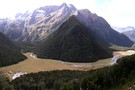
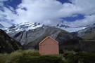
Daley's Flat Hut
Photograph
•
Distance: less than 100m away
Half way up the Dart Valley. This hut is on the Rees Dart track
More ▶︎
Daley's Flat Hut
Photograph
•
Distance: less than 100m away
Looking south west down the Dart River. Heavy rain overnight saw the Dart river rise to the top of it's ...
More ▶︎
Aspiring - Rees
GPX file
•
Distance: less than 100m away
Starting at Raspberry Flat, this track passes Mt Aspiring Hut in the West Matukituki Valley and then climbs steeply to ...
More ▶︎
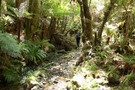
Lake Sylvan
Track
•
Easy. Loop track.
•
Distance: less than 100m away
A short forest walk to a tranquil lake.
More ▶︎
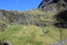
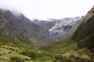
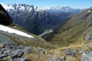
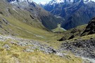
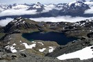
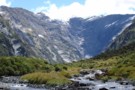
Gillespie Stream and the Siberia from Gillespie Pass
Photograph
•
Distance: less than 100m away
Looking South West from the pass, the Gillespie Stream snakes its way down towards the Siberia Valley. The valley across ...
More ▶︎
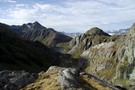
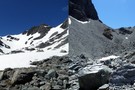
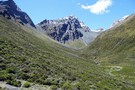
The Gillespie Saddle
Photograph
•
Distance: less than 100m away
Taken from the hightest point of the Gillespie Pass track on point 1629 looking over the saddle towards point 1726. ...
More ▶︎
Rees-Dart Track
Track
•
3 – 4 days. Medium/hard. Loop track.
•
Distance: less than 100m away
Alpine circuit along two river valleys at the head of Lake Wakatipu.
More ▶︎
Routeburn Falls Hut
Hut
•
Great Walks Hut (DOC). Capacity: 48.Bookings required.
•
Distance: less than 100m away
A modern hut on the Routeburn track. It is at bushline on the edge of the cirque that leads up ...
More ▶︎
Not The Routeburn
GPX file
•
Distance: less than 100m away
A six-passes, seven catchments trip through the Humboldt Mountains from Glenorchy to The Divide.
Note that for access from Double Barrel ...
More ▶︎
Where do rivers come from?
Photograph
•
Distance: less than 100m away
Wilkin North Branch toward upper lakes
More ▶︎
Track to North Branch lakes
Photograph
•
Distance: less than 100m away
Shortly before reaching the Disappearing Tarn
More ▶︎
Wilkin Valley Track
Track
•
2 – 5 days. Easy/medium. Return by the same track.
•
Distance: less than 100m away
This stunning track is commonly tramped in conjunction with the Gillespie Pass Circuit or with the Rabbit Pass/East Matukituki traverse, ...
More ▶︎
Routeburn Falls hut
Photograph
•
Distance: less than 100m away
Routeburn Falls hut - great views (April 2009)
More ▶︎
25-Mile Hut
Photograph
•
Distance: less than 100m away
This is a derelict Hut on the Rees Dart track. It is in an ideal location on a terrace above ...
More ▶︎
25 Mile Hut
Hut
•
Removed!
•
Distance: less than 100m away
*EDIT* From DOCs website:
28 April 2016: Rees Valley - 25 Mile Hut removed
The derelict 25 Mile Hut in the Rees ...
More ▶︎
Routeburn Track
Track
•
2 – 4 days. Easy/medium. One way.
•
Distance: less than 100m away
An internationally renowned and popular alpine crossing between Fiordland and Lake Wakatipu.
More ▶︎
Parorama from Harris Saddle
Photograph
•
Distance: less than 100m away
several photographs put together to create a panoramic view
More ▶︎
Rabbit Pass - Wilkin to East Matukituki
Track
•
1 day. Hard. One way.
•
Distance: less than 100m away
A fair weather route linking the upper Wilkin valley to the head of the East Matukituki. Two dangerous climbs are ...
More ▶︎
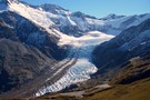
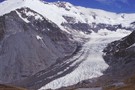
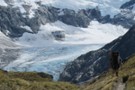
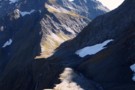
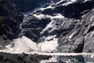
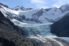
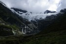
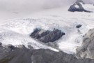
Dart Glacier
Photograph
•
Distance: less than 100m away
Located right beside the Cascade Saddle, a climb to the saddle allows you a view of the intier length of ...
More ▶︎
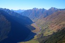
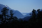
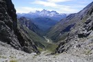
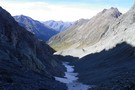
The Siberia Valley
Photograph
•
Distance: less than 100m away
This is looking downvalley from just below the Siberia hut. The Siberia airstrip is located right of frame across the ...
More ▶︎
Five Passes via Lake Nerine and North Col
Article
•
Distance: less than 100m away
A classic tramp north of the Routeburn. Rather than exit via the Rockburn, we extended the trip through Lake Nerine ...
More ▶︎
Rees - Dart
GPX file
•
Distance: less than 100m away
Starting at Muddy Creek, this track heads up the Rees River to the head of the valley with a short ...
More ▶︎
Rockburn Hut
Photograph
•
Distance: less than 100m away
DOC advises that the Rockburn Hut is closed "due to adverse weather conditions"
.... and a fairly solid tree !
More ▶︎
Gillespie Pass
Photograph
•
Distance: less than 100m away
Looking down at the Young side of the Pass.
More ▶︎
Gillespie Pass Circuit
Track
•
3 – 4 days. Medium. Loop track.
•
Distance: less than 100m away
This is a 3-4 day track that is located near Makarora at the head of Lake Wanaka. Being a loop ...
More ▶︎
Key Summit
Track
•
Easy. Return via same track.
•
Distance: less than 100m away
Short, easy walk at the start of the Routeburn Track to a low summit. Panoramic views of the Greenstone, Hollyford, ...
More ▶︎
rees valley
Track
•
3 days. Medium. Return via same track.
•
Distance: less than 100m away
pleasant walk up the rees valley. the track gets a bit swampy at the start and then a few avalance ...
More ▶︎
Five Passes
Track
•
6 – 7 days. Medium/hard. Loop track.
•
Distance: less than 100m away
A classic trip starting and finishing at the Routeburn road.
The five passes are; Sugarloaf pass, Park pass, Cow saddle, Fiery ...
More ▶︎
Waterfall Flat from above
Photograph
•
Distance: less than 100m away
Scungy weather continues to obscure the views, topped by a raging wind....
More ▶︎
Waterfall Face, Wilkin River
Photograph
•
Distance: less than 100m away
Misty rain obscures the infamous Waterfall Face
More ▶︎
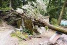
Broken bridge
Photograph
•
Distance: less than 100m away
The bridge at the start of the Routeburn Track, damaged by a slip, August 2008.
More ▶︎
The Serpentine Range and the Three Passes
Article
•
Distance: 102m away
A six day trip around the Three Passes, including a traverse of the Serpentine Range instead of the North Route ...
More ▶︎
Lake Wilson and the Valley of the Trolls
Track
•
2 – 3 days. Medium. Return by the same track.
•
Distance: 104m away
An overnight or multiday scenic diversion from the Routeburn Great Walk. The Valley of the Trolls is easily accessed from ...
More ▶︎
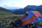
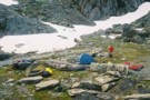
Cascade Saddle Camp
Photograph
•
Distance: 111m away
Nice campsite where the Cascade Saddle track crosses the top of Cascade Creek, with Mt Aspiring visible over the ridge. ...
More ▶︎
Siberia Hut
Hut
•
Serviced Hut (DOC). Capacity: 20.
•
Distance: 115m away
Popular hut in the Siberia Valley. Part of the Gillespie Pass circuit.
More ▶︎
Siberia Hut
Photograph
•
Distance: 115m away
This is a popular hut on the Gillespie Pass circuit from the Young to the Wilkin.
More ▶︎
New Siberia Hut
Photograph
•
Distance: 115m away
The new hut was built and completed by the end of November 2011. It's a lovely little hut and after ...
More ▶︎
Wilkins - Young (Gillespie Pass) Circuit
Track
•
3 – 4 days. Medium. One way.
•
Distance: 115m away
Crossing the Makarora river on foot to the Young valley. Ascending to Young Hut in the first day. 2nd Day ...
More ▶︎
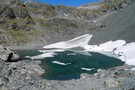
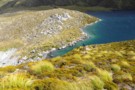
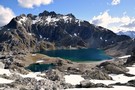
Crucible Lake
Photograph
•
Distance: 117m away
Taken from the Western end of the morrain, gives a good idea as to why the lake is named. Often ...
More ▶︎
North Wilkin from Top Forks Hut
Photograph
•
Distance: 117m away
Wilkin River north branch, from the verandah at Top Forks Hut
More ▶︎
Top Forks Hut (Wilkin)
Hut
•
Standard Hut (DOC). Capacity: 16.
•
Distance: 117m away
There are two huts at Top Forks (total 16 bunks, stove / fireplace, firewood available, tank water). The smaller is ...
More ▶︎
Looking up the Rockburn
Photograph
•
Distance: 121m away
From Sugarloaf pass, this is the view of the Rockburn that greets you after you cross
More ▶︎
Rockburn Hut
Hut
•
Basic Hut/Bivvy (DOC). Capacity: 4.
•
Distance: 136m away
Rockburn Hut or McIntyres Hut. Near the confluence of Rock Burn and Dart River. A very rough and uninviting hut. ...
More ▶︎
Rees Saddle from near Cleft Peak
Photograph
•
Distance: 143m away
Rees Saddle from near Cleft Peak; Snowy Creek to the right, & the Rees to the left.
More ▶︎
Rees Saddle
Photograph
•
Distance: 143m away
This picture was take at the top of the rees saddle looking down towards the rees vally in december 2006
More ▶︎
Upper Wilkin South Branch
Photograph
•
Distance: 148m away
Taken from above the Waterfall Face looking South West towards Pickelhaube. Pearson Saddle is the low grassy bit beneath Pickelhaube ...
More ▶︎
Waterfall Flat from ontop of the Waterfall Face
Photograph
•
Distance: 148m away
Having made it to the top you are gifted views such as this.
More ▶︎
Lake Mackenzie Campsite
Campsite
•
Great Walks Campsite (DOC). 9 spaces.
•
Distance: 156m away
Small campsite on the Routeburn Track located near the hut.
More ▶︎
Lake Mackenzie Hut
Hut
•
Great Walks Hut (DOC). Capacity: 50.Bookings required.
•
Distance: 156m away
A Great Walks Hut on the Routeburn Track. During the summer season, bookings are required, with a maximum two-night stay. ...
More ▶︎
Camp on Sugarloaf Pass
Photograph
•
Distance: 157m away
A good way to start a trip going into the Rockburn is to leave Glenorchy late in the day and ...
More ▶︎
Earland Falls
Photograph
•
Distance: 158m away
A 174m watterfall that the Routeburn track passes right underneath.
More ▶︎
Lake Harris, Routeburn Track.
Photograph
•
Distance: 162m away
From Lake Harris and Harris Saddle, the Left Branch of the Route Burn leads up to the Lake Wilson (at ...
More ▶︎
Lake Harris
Photograph
•
Distance: 162m away
January 2009, Although it doesn't look like, we had awesome weather :)
More ▶︎
Routeburn Falls
Photograph
•
Distance: 165m away
Located near the Falls hut these impressive falls are passed on the way to Harris Saddle.
More ▶︎
Birthplace of Rivers
Photograph
•
Distance: 176m away
From such humble beginnings does the South branch of the Wilkin start.
More ▶︎
Cattle Flat Biv
Photograph
•
Distance: 190m away
Plenty of room for everyone to get out of the rain and enjoy a brew
More ▶︎
Cattle Flat Bivy Rock
Hut
•
Natural shelter (NA).
•
Distance: 190m away
A huge shelter rock in the Dart half way between Dart & Daleys Huts. It is back in the bush ...
More ▶︎
Rabbit Pass
Photograph
•
Distance: 191m away
A view of Rabbit Pass from just below the drop off point. In the distant is the route from Waterfall ...
More ▶︎
My wife crossing the schist slab below the Pylon
Photograph
•
Distance: 194m away
Being relatively new to this we found croosing the schist slab below the Pylon fairly tricky. The "track" was a ...
More ▶︎
Cascade Saddle
Track
•
1 – 2 days. Hard. One way.
•
Distance: 194m away
Alpine crossing linking the valleys of the West Matukituki and the Dart Rivers.
More ▶︎
Frozen South Island Edelweiss
Photograph
•
Distance: 195m away
Leucogenes grandiceps (thanks john dutchie) on Cascade Saddle, above the Dart Glacier (April 2009)
More ▶︎
Dart Valley from Cascade Saddle
Photograph
•
Distance: 195m away
This is inspiring country (April 2009)
More ▶︎
The Blue Pools
Photograph
•
Distance: 199m away
A bridge over the Blue river just a 10 minute nature walk from the Haast highway allows viewing of the ...
More ▶︎
Top Forks Hut (Wilkin)
Photograph
•
Distance: 199m away
Top Forks Hut, in the Wilkin Valley. The last hut north of the infamous rabbit pass.
More ▶︎
Rabbit Pass from under Lois Peak
Photograph
•
Distance: 209m away
Looking West along the cliff top towards Rabbit Pass, Pickelhaube and the Beauty Ridge above, the East Matukituki waterfall below.
More ▶︎
DOC campsite at Young Forks
Photograph
•
Distance: 210m away
Located 2 minutes from the swingbridge up the Young North branch and about 2 hours from Young hut, this is ...
More ▶︎

Cascade hut
Photograph
•
Distance: 213m away
Cascade hut in the West Matukituki valley, about 10km from the carpart, only about 1.5km short of Aspiring hut.
More ▶︎
Cascade hut
Photograph
•
Distance: 213m away
Cascade hut in the West Matukituki valley, about 10km from the carpart, only about 1.5km short of Aspiring hut.
More ▶︎
Cascade hut
Photograph
•
Distance: 213m away
Cascade hut in the West Matukituki valley, about 10km from the carpart, only about 1.5km short of Aspiring hut.
More ▶︎
Lake MacKenzie
Photograph
•
Distance: 220m away
The lake just below the DoC hut, looking towards Emily Pass.
More ▶︎
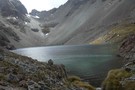
Crucible Lake 2
Photograph
•
Distance: 232m away
Crucible Lake located under Mt Alba often contains iceburgs but none were present this April.
More ▶︎
Walking on Air
Photograph
•
Distance: 236m away
Joseph (10 years old at the time) leaping across the stream on the way up to Crucible Lake, which is ...
More ▶︎
Lake Crucible (trampers on moraine near outlet)
Photograph
•
Distance: 236m away
Wilkin Mar 05
More ▶︎
Along way up
Photograph
•
Distance: 242m away
The track to Gillespie Pass climbs nearly verically towards the pass. This is looking back down into the Young Valley ...
More ▶︎
East Matukituki Cliff Route
Photograph
•
Distance: 243m away
Not a good picture of the route, but the best I have! The descent down starts in the sunny bit ...
More ▶︎
Cascade Saddle Route from Aspiring Hut
Photograph
•
Distance: 246m away
The route does not actually cross the saddle, but follows the rugged spur in the top centre of this photograph, ...
More ▶︎
Mount Aspiring
Photograph
•
Distance: 246m away
Peering over the shoulder of Rob Roy Peak, late afternoon, Aspiring Hut.
More ▶︎
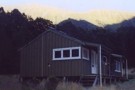
Aspiring Hut
Photograph
•
Distance: 246m away
This 1949 hut is constructed from local schist.
More ▶︎
Aspiring Hut
Hut
•
Serviced Alpine Hut (NZAC). Capacity: 38.
•
Distance: 246m away
This historic hut in the West Matukituki Valley was constructed of local schist, and opened at Easter 1949. Situated immediately ...
More ▶︎
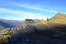
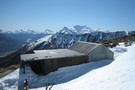
Harris Saddle Shelter
Hut
•
Shelter (DOC).
•
Distance: 251m away
Enclosed day shelter perched on Harris Saddle, on the Routeburn Track. Overnight use prohibited. A side trip from here leads ...
More ▶︎
Closeup of the Wilkin Waterfall Route
Photograph
•
Distance: 255m away
Hard to get a good angle of this! The route initially goes up the middle of the 2nd to the ...
More ▶︎
The Wilkin Waterfall Face
Photograph
•
Distance: 255m away
The route to Rabbit Pass climbs up the cliff to the right of the falls.
More ▶︎
Avalanche at Crucible Lake
Photograph
•
Distance: 270m away
A crackling boom was followed by rumbling and a small 20-30 second avalanche of ice and snow came crashing down ...
More ▶︎

Tramp from the Haast to the Blue
Article
•
Distance: 270m away
Tramping the Burke, Howe, Okuru and the Blue rivers via the Douglas and Maori saddles.
More ▶︎
Maori Saddle
Photograph
•
Distance: 270m away
Crossing of the Main Divide from the Okuru River to the Blue River. 1245m. This photo taken from Douglas Saddle. ...
More ▶︎

Cascade Saddle
Photograph
•
Distance: 275m away
Looking down at the Saddle from above Heads Leap. A 500 metre cliff drops off to the Cascade creek floor ...
More ▶︎
Lake Harris Western Shore
Photograph
•
Distance: 280m away
The western end of Lake Harris looking towards the entrance to the Valley of the Trolls. The route to the ...
More ▶︎
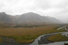
Lower Matukituki
Photograph
•
Distance: 287m away
Taken from the Cascade Saddle route a short distance below the Pylon looking downvalley towards the carpark at Raspberry Flat. ...
More ▶︎
Glengyle Peak
Photograph
•
Distance: 287m away
Taken from below the Pylon on the Cascade Saddle route looking across the West matukituki towards Glengyle. If you look ...
More ▶︎
West Matukituki valley
Photograph
•
Distance: 287m away
Taken from the Cascade Saddle route not far below the Pylon, looking up valley towards Mt Aspiring which towers above ...
More ▶︎
Old Routeburn Falls Hut 1989
Photograph
•
Distance: 329m away
The old Routeburn Falls Hut I stayed at in 2 November 1989 and 23 January 1990. Picture from November 1989. ...
More ▶︎
Harris Saddle, Routeburn
Photograph
•
Distance: 335m away
Harris Saddle, Routeburn, Sept 2006
More ▶︎
Kerin Forks
Photograph
•
Distance: 359m away
Taken from the True Right side of the Wilkin River and looking up at the Siberia/Wilkin confluence. Kerin Forks hut ...
More ▶︎
Routeburn Flats
Campsite
•
Great Walks Campsite (DOC). 15 spaces.
•
Distance: 361m away
Grassy camping next to Routeburn Flats Hut.
More ▶︎
Howden Hut
Hut
•
Great Walks Hut (DOC). Capacity: 28.
•
Distance: 371m away
Hut on the Routeburn Track, destroyed by a landslide in February 2020.
More ▶︎
East Branch Matukituki visible through the rain
Photograph
•
Distance: 378m away
Demon descent in the conditions
More ▶︎
The East Matukituki from Rabbit Pass - a video
Video
•
Distance: 391m away
Shot on my point and shoot digital camera, hopefully gives some idea of the amazing view from this spot!
More ▶︎
The East Matukituki from Rabbit Pass
Photograph
•
Distance: 391m away
From just past the pass looking South over the valley from some 600 metres above the valley floor.
More ▶︎
Descent of the Matukituki Cliff
Photograph
•
Distance: 399m away
Taken from the top of the cliff the route zigzags steeply down on the left of frame for about 20m ...
More ▶︎
New Dredge Lake
Photograph
•
Distance: 404m away
The new lake at Dredge Flat on the Dart River.
More ▶︎
Icebergs in Crucible Lake
Photograph
•
Distance: 406m away
Taken January 24 2010, Crucible was full of bergs and avalanch debris this day.
More ▶︎
Harris Saddle Old Emergency Shelter
Photograph
•
Distance: 418m away
This old Emergency Shelter on Harris Saddle (1277m) is now replaced by something larger/better. This picture is from 2 November ...
More ▶︎
Routeburn Shelter
Photograph
•
Distance: 419m away
another rainy day at the start of the Routeburn (April 2009)
More ▶︎
Routeburn Shelter
Hut
•
Shelter (DOC).
•
Distance: 419m away
Enclosed shelter at the Wakatipu end of the Routeburn Track. Overnight use prohibited.
More ▶︎
The Valley of the Trolls
Photograph
•
Distance: 436m away
Looking into the rain swept valley. The route in climbs over the rocks on the True Right of the Route ...
More ▶︎
Rabbit Pass is up there
Photograph
•
Distance: 447m away
View from the East Branch Matukituki River of the descent from Rabbit Pass
More ▶︎
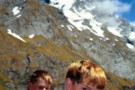
The boys, Gillespie Pass, Jan 2001
Photograph
•
Distance: 447m away
Aged 11 and 14, the lads proved remarkably resilient on the Wilkin/Young tramp, braving sandflies a the "Young Forks lunch ...
More ▶︎
Lake Howden
Photograph
•
Distance: 456m away
Summer at Lake Howden is a magic time. The wind is warm, days are hot and sunny, and the fellow ...
More ▶︎
The Young River/Makarora River Confluence
Photograph
•
Distance: 461m away
This is looking West up the Young Valley. The Gillespie Pass Circuit starts here at the other side of the ...
More ▶︎
Tramping in the Wilkin Waterfall valley
Photograph
•
Distance: 471m away
Approaching the dreaded 200m Wilkin Waterfall face, we're dwarfed by the 400m waterfall tumbling off the North slopes of Mt ...
More ▶︎
North Route Burn Rock bivvy
Rock bivouac
•
Distance: 496m away
2 person biv rumoured to be 500m from the Routeburn Track in the North Branch of the Route Burn on ...
More ▶︎
North Routeburn Rock bivvy
Photograph
•
Distance: 496m away
I've guessed the location from a description but don't take my word for it.
More ▶︎
The Head of the Young Valley
Photograph
•
Distance: 525m away
The Head of the valley shortly before leaving the valley floor to begin the climb to Gillespie Pass up the ...
More ▶︎
Lake Harris from Conical Hill
Photograph
•
Distance: 532m away
If you are walking the Routeburn Track, don't miss the opportunity to climb Conical Hill from the Harris Saddle shelter. ...
More ▶︎
from Cascade Saddle
Photograph
•
Distance: 538m away
looking to the SE from Cascade Saddle, across Heads Leap to Cascade Falls
More ▶︎
beansburn track
Track
•
3 – 5 days. Medium. Return via same track.
•
Distance: 540m away
a route that follows the beansburn valley. lake unknown can be reached from here.
times:
beansburn mouth-rock bivvy no 1 1-1.5 ...
More ▶︎
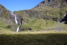
Waterfall Flat
Photograph
•
Distance: 554m away
Looking over the South branch of the Wilkin towards the Wilkin Waterfall Face and Mt Taurus.
More ▶︎
Damaged bridge between Routeburn Falls and Routeburn Flats Huts
Photograph
•
Distance: 566m away
Photograph courtesy of DOC, I think. Around 30 April. Repairs not expected for about 3 months. This creek is easily ...
More ▶︎
Routeburn Tops
Photograph
•
Distance: 566m away
The Route Burn meanders through this basin beneach Harris Saddle.
More ▶︎
Young and Makarora Rivers
Photograph
•
Distance: 577m away
Confluence of the Young and Makarora Rivers near Haast Pass
More ▶︎
Snow Bridge Gorge
Photograph
•
Distance: 587m away
One of a couple of snow bridges that remain year round in here.
More ▶︎
Hollyford Valley
Photograph
•
Distance: 600m away
The Hollyford Valley floor sits just above sea level, while the Routeburn Track creeps along the Serpentine Range at around ...
More ▶︎
Rabbit Pass from Pearson Saddle
Photograph
•
Distance: 615m away
Looking from a great spot for lunch on the saddle towards the pass.
More ▶︎
View from Pearson Saddle
Photograph
•
Distance: 615m away
Looking West into the Pearson River valley with a distant glimpse of the Waiatoto valley.
More ▶︎
Mount Aspiring National Park
Place
•
National Park. 3555.18km2.
•
Distance: 620m away
The third-largest national park, although most of its space is under-utilised. The Routeburn is the second busiest trail in New ...
More ▶︎
Emily Peak Reflections
Photograph
•
Distance: 624m away
Serenity can be found early morning at places like Lake Mackenzie.
More ▶︎
Misty Morning Reflections at Lake MacKenzie
Photograph
•
Distance: 663m away
Taken from near the campisite at the top of lake on a cool crisp March morning, fog swirls over reflections ...
More ▶︎
Aspiring Flat and Sisyphus Peak
Track
•
3 days. Medium. Return via same track.
•
Distance: 680m away
A one and two-half day tramp up the East Matukituki to overnight in Aspiring Flats, with a day trip up ...
More ▶︎
Looking south from Sysiphus Peak
Photograph
•
Distance: 680m away
The Matukituki East Branch winds its way down to meet the West Branch, where we started this walk yesterday. It's ...
More ▶︎
Snowbridge Gorge
Photograph
•
Distance: 687m away
Permanent snow remains in the gorge that the South branch of the Wilkin river flows.
More ▶︎
Wilkin River flats
Photograph
•
Distance: 691m away
Wilkin River flats, below Kevin Forks Hut.
More ▶︎
Lake Sylvan
Photograph
•
Distance: 718m away
A calm forested lake in the Dart Valley near Glenorchy.
More ▶︎
Emily Creek
Photograph
•
Distance: 722m away
In Emily Creek looking down towards the bridge. Once you you get past the initial large boulders it's a typical ...
More ▶︎
Routeburn
Photograph
•
Distance: 758m away
Taken from a slip below the Routeburn Falls hut (April 2009)
More ▶︎
The sun is always brighter on the other side
Photograph
•
Distance: 852m away
That's the last we'll see of the sun tonight. The Rees valley continues to be flooded with rays.
Rees Saddle from ...
More ▶︎
Overnight beside Snowy Ck. - Mt.Aspiring NP NZ
Photograph
•
Distance: 865m away
Looking upstream on Snowy Ck. after crossing Rees saddle. Around the corner is a broad spur giving access to a ...
More ▶︎
Valley of the Trolls from rock bivy
Photograph
•
Distance: 880m away
Despite the abundance of boulders in the Valley of the Trolls, there is vertually no natural shelter here. One place ...
More ▶︎
Lake Mackenzie and the Ailsa Range
Photograph
•
Distance: 931m away
Mackenzie Hut is near the lake edge, with the guided walks hut further back.
More ▶︎
Valley of the Trolls Rock bivvy
Rock bivouac
•
Distance: 961m away
Rock bivvy formed by an overhanging cliff. Probably enough room for about a dozen people but the northern end is ...
More ▶︎
Valley of the Trolls Rock bivvy
Photograph
•
Distance: 962m away
Rock bivvy underneath an overhanging cliff about half way up the Valley of the Trolls and about 40m above the ...
More ▶︎
Routeburn Flats
Photograph
•
Distance: 1.0km away
An interesting hours excursion from Routeburn Falls hut takes you up the hill to the South of the hut giving ...
More ▶︎
Lake Whakatipu from Sugarloaf
Photograph
•
Distance: 1.1km away
On the five passes route. Lake Whakatipu from just above Sugarloaf pass. taken Jan 2010
More ▶︎
Dart River
Photograph
•
Distance: 1.1km away
looking down the Dart - about to head into the forest
Feb 2013
More ▶︎
The Divide Shelter
Hut
•
Shelter (DOC).
•
Distance: 1.1km away
Open shelter at the Milford end of the Routeburn Track. Overnight use prohibited.
More ▶︎
Valley of the Trolls, January 16, 2012
Photograph
•
Distance: 1.2km away
Result of 24 hours snow fall on Jan 14 & 15. What about summer! Looking back towards the Routeburn Track.
More ▶︎

Great Walks Information
Article
•
Distance: 1.2km away
The DOC Great Walks are a set of premium tramping tracks throughout New Zealand.
More ▶︎
Emily Basin
Photograph
•
Distance: 1.3km away
High above the Routeburn at the top of Emily Creek, about 1.5 hours climb from Emily Creek bridge. Fraser Col ...
More ▶︎
Greenstone Saddle Camping Area
Campsite
•
Informal campsite (DOC).
•
Distance: 1.3km away
Large informal campsite at Greenstone Saddle, near the top of the Greenstone Track.
More ▶︎

Young Hut
Hut
•
Serviced Hut (DOC). Capacity: 20.
•
Distance: 1.3km away
A newly built hut (2006) with stainless steel benches. A inside sink with tap from rain tank. 2 rooms, one ...
More ▶︎
Routeburn Flats
Photograph
•
Distance: 1.3km away
The view over Routeburn Flats is the quintessential photo of the Routeburn Track
More ▶︎
The track is booked out? Try TrekWatch.net
Article
•
Distance: 1.3km away
SMS texts directly to your cellphone when a place becomes available. Free of charge!
More ▶︎
The Route up to Lake Wilson
Photograph
•
Distance: 1.4km away
It begins here at the foot of the waterfall at the head of the Valley of the Trolls and climbs ...
More ▶︎
Crucible Valley
Photograph
•
Distance: 1.4km away
Having cleared the bushline this view is offered of the head of the valley. The morrain forms Crucible Lake.
More ▶︎
Morning at the Greenstone Saddle Camping Area.
Photograph
•
Distance: 1.4km away
Morning at the Greenstone Saddle Camping Area. McKellar Saddle, cloaked in cloud and dusted with snow, is left of centre.
More ▶︎
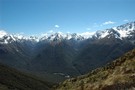
The Darran Mountains
Photograph
•
Distance: 1.5km away
Taken from the Routeburn North of The Orchard, almost the whole length of the Hollyford valley is visible with Lake ...
More ▶︎
Rees Vally
Photograph
•
Distance: 1.6km away
A photo taken looking towards the rees saddle, taken inbetween rees saddle and shelter rock hut
More ▶︎
A camp with a view over the East Matukituki
Photograph
•
Distance: 1.6km away
Kathryn returns from Dragonfly Peak to her camp on the ridge to South AlbertBurn saddle from the East Matukituki.
More ▶︎
The Disappearing Tarn and Apollo Peak Reflections
Photograph
•
Distance: 1.7km away
The first mini lake encountered is the small Disappearing tarn.
More ▶︎
Scott Saddle route (Dart to Caples)
Track
•
1 – 2 days. Medium. One way.
•
Distance: 1.7km away
This route crosses the easiest pass from the Dart to Caples Valleys, via Scott Creek, Scott Saddle and Kay Creek ...
More ▶︎
Emily Pass South View
Photograph
•
Distance: 1.7km away
What a difference a month makes.
Left photo mid December 2014. Right photo mid January 2015.
More ▶︎
Emily Pass View
Photograph
•
Distance: 1.7km away
The view north from Emily Pass.
December 2014
More ▶︎
Route up to Emily Pass
Photograph
•
Distance: 1.8km away
This is looking west at the northern route up to Emily Pass, and is the opposite direction from this photo: ...
More ▶︎
Fraser Col to Emily Pass Sidle.
Photograph
•
Distance: 1.8km away
This photo is looking east at Fraser Col from the true right top of the gut of the initial climb ...
More ▶︎
Harris Saddle and Valley of the Trolls from Lake Wilson outlet
Photograph
•
Distance: 1.8km away
At the top of the climb to Lake Wilson this great view is to be had when looking south. Ocean ...
More ▶︎
Greenstone Track
Track
•
2 – 3 days. Easy. One way.
•
Distance: 1.8km away
A famous, easy track along red tussock river flats.
More ▶︎
Lake Wilson from the outlet
Photograph
•
Distance: 1.8km away
The first view of Lake Wilson you are greeted with upon reaching the lake. Theres good camping here. 5th Jan ...
More ▶︎
Rees Vally
Photograph
•
Distance: 1.9km away
This is a picture taken on the rees/dart track and is on day 2 of our tramp in between shelter ...
More ▶︎
Sisyphus Peak from Wilmot Saddle
Photograph
•
Distance: 1.9km away
Still 200m to go.
Sisyphus Peak (1859m) from Wilmot Saddle (1682m).
More ▶︎
Rainbow Stream
Photograph
•
Distance: 1.9km away
Probably at about 1000m here, 500m above Aspiring Flats visible below.
We faffed around somewhere near here and lost a couple ...
More ▶︎
Rees valley
Photograph
•
Distance: 1.9km away
Looking up the Rees valley from near 25-mile spur (April 2009)
More ▶︎
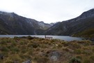
Lake Diana Reflections
Photograph
•
Distance: 2.0km away
The lower slopes of Mt Betsy Jane and Mt Pollux reflected in Lake Diana.
More ▶︎
Southern (waterfall) route up Erebus
Photograph
•
Distance: 2.0km away
A photgraph from near the bottom of the climb up the southern route to Erebus (I had just climbed down ...
More ▶︎
The Orchard
Photograph
•
Distance: 2.0km away
Open space edged by ribbonwood near Lake Mackenzie.
More ▶︎
Lake Diana Reflections 2
Photograph
•
Distance: 2.1km away
The Snow Bridge Gorge gap between Mt Twilight and Mt Betsy Jane reflected in Lake Diana.
More ▶︎
Lake Dianna
Photograph
•
Distance: 2.1km away
The 1st of the three main lakes of the North branch of the Wilkin it is perhaps the least stunning ...
More ▶︎
The Newland Stream
Photograph
•
Distance: 2.1km away
Taken from the true left side of the Wilkin after a dangerous fording of the flooded Newland stream. Moirs guide ...
More ▶︎
Lake Wilson Panorama
Photograph
•
Distance: 2.1km away
Lake Wilson with Mt Erebus and Mt Xenicus above. 5th Jan 2013
More ▶︎
Routes up Mt Erebus
Photograph
•
Distance: 2.1km away
There are at least 3 possible routes to climb Erebus from Lake Wilson. The red and blue routes go up ...
More ▶︎
Lake Lucidus Morain Walls and the Upper Wilkin Valley
Photograph
•
Distance: 2.2km away
Mts Juno and Vesta tower over the massive morain which conceals Lake Lucidus.
More ▶︎
Emily Basin from Fraser Col
Photograph
•
Distance: 2.2km away
Looking north from Fraser Col across Emily Basin.
January 2015.
More ▶︎
Fraser Creek
Track
•
1 – 2 days. Easy/medium. One way.
•
Distance: 2.2km away
One of several valleys that cut into the southern Humboldt Mountains. It passes through many kilometres of beech forest, river ...
More ▶︎
Emily Pass 1400m Basin
Photograph
•
Distance: 2.2km away
What a difference a month makes.
Left photo mid December 2014. Right photo mid January 2015.
More ▶︎
Fraser Valley from Fraser Col
Photograph
•
Distance: 2.2km away
The view down the Fraser from just below the Col.
January 2015.
More ▶︎
Ruth Flat Bivy
Photograph
•
Distance: 2.2km away
Found at the North End of Ruth Flat this bivy provides easy accomodation for those not wanting to carry on ...
More ▶︎
Frosty Morning in the East Matukituki
Photograph
•
Distance: 2.2km away
Taken from near the rock biv at the top of Ruth Flats looking North towards Rabbit Pass in the clouds.
More ▶︎
Lake Marian
Track
•
Easy/medium. Return via same track.
•
Distance: 2.3km away
Short walk from the Hollyford Road up to a hanging valley and lake in the Darran Mountains.
More ▶︎
A visit to South AlbertBurn saddle
Photograph
•
Distance: 2.3km away
Michael crosses the snow slopes above Hester Pinney Creek. The sun has only just risen over the saddle and the ...
More ▶︎
Route from Pine Creek to Matukituki Valley via Shotover Saddle
GPX file
•
Distance: 2.3km away
(Partial) route from Pine Creek to Matukituki via Shotover Saddle. The cattle track passage in this file is probably very ...
More ▶︎
North Ruth Flat Rock Bivvy
Rock bivouac
•
Distance: 2.4km away
Good rock bivvy formed by an overhanging rock cliff located north of Ruth Flat in the East Matukituki. On topo ...
More ▶︎
Family on Dart Glacier, 2001
Photograph
•
Distance: 2.4km away
Helen and the boys (then 14 and 11) on Dart Glacier (Rees/Dart tramp).
More ▶︎
Rock of Ages Bivouac
Rock bivouac
•
Distance: 2.4km away
An overhang above the Kitchener River and Aspiring Flats, near the Matukituki East Branch. Room to sleep 10, although exposed ...
More ▶︎
Approaching the South AlbertBurn saddle and the sun
Photograph
•
Distance: 2.4km away
An early start made it easier to cross the slopes above Hester Pinney Ck. We were pleased to make it ...
More ▶︎
Double-Barrel - Fraser Pass
Photograph
•
Distance: 2.5km away
A steep, loose but otherwise straight forward pass out of the Double Barrel into the Fraser
More ▶︎
Shovel Flat in the West Matukituki
Photograph
•
Distance: 2.5km away
A beutiful spot with heaps of great camping sites, French Ridge is the major ridge descending to the valley floor ...
More ▶︎
Marian Creek
Photograph
•
Distance: 2.6km away
Taken from the viewing gantry, an easy 10 minute walk from the carpark, Marian creek tumbles down the hillside on ...
More ▶︎
Lake Wilson from near Mt Erebus
Photograph
•
Distance: 2.6km away
I didnt summit Erebus due to exhaustion and the snow conditions but from 1860m the view is almost as fine! ...
More ▶︎
Head of the Fraser Valley
Photograph
•
Distance: 2.6km away
This photo is taken from the site marked on the topo map where a rock bivy is supposed to exist. ...
More ▶︎
Double Barrel from pass with the Fraser
Photograph
•
Distance: 2.6km away
Double Barrel Creek from the pass into the Fraser. Mt Earnslaw looking bare & bleak without snow cover in the ...
More ▶︎
Lennox Creek, South Branch
Photograph
•
Distance: 2.6km away
Upper crossing of Lennox Creek (south branch). Not a place to be with unstable snow above.
The next viable crossing is ...
More ▶︎
Rock of Ages bivvy - Mt.Aspiring Flats
Photograph
•
Distance: 2.7km away
A short distance from the East Matukituki, through which flows Kitchener stream is Aspiring Flats. Coveniently located is a rock ...
More ▶︎
Earnslaw Hut - Mt.Earnslaw - Mt.Aspiring NP
Photograph
•
Distance: 2.7km away
At appx 980m set in beech forest above the Rees valley. This historic hut is on a short 50m side ...
More ▶︎
Lake Mackenzie
Photograph
•
Distance: 2.7km away
Lake MacKenzie from the basin below Emily Col. Good campspots and a so-so rock biv marked by a cairn.
More ▶︎
Earnslaw Hut
Photograph
•
Distance: 2.7km away
Rough four-bunk historic hut below Kea Basin on the ascent to Mt Earnslaw
More ▶︎
Emily Pass 1200m Basin
Photograph
•
Distance: 2.7km away
There's great camping to be had in the large grassy basin at just over 1200m on the south side of ...
More ▶︎
Earnslaw Hut
Hut
•
Basic Hut/Bivvy (DOC). Capacity: 4.
•
Distance: 2.7km away
Earnslaw hut. Located near Kea Basin on the slopes of Mt Earnslaw, above the Rees valley.
More ▶︎
Looking inside Earnslaw Hut - Mt.Aspiring NP
Photograph
•
Distance: 2.7km away
An old hut with a distinctive rustic look. I believe many people would prefer to occupy the rock bivvy at ...
More ▶︎
View from Lake Alabaster
Photograph
•
Distance: 2.7km away
mountain shot from Lake Alabaster
More ▶︎
Hollyford Track
Track
•
4 days. Medium. One way.
•
Distance: 2.7km away
The Hollyford Track is a classic lowland Fiordland route from the Hollyford Road out to the coast at Martins Bay.
More ▶︎
THE START OF THE DEMON TRAIL
Photograph
•
Distance: 2.7km away
Over this bridge the trail starts to live up to its name
More ▶︎
Stormy skies over Lake Wilson
Photograph
•
Distance: 2.8km away
It blew but didn't come to much
More ▶︎
Dragonfly slopes
Photograph
•
Distance: 2.8km away
From a short distance above South AlbertBurn saddle. Whare-Kea Lodge can be seen below in the saddle. Note: The saddle ...
More ▶︎
Kea Basin Bivvy - Mt.Earnslaw
Photograph
•
Distance: 2.9km away
This is one of the best bivvy rocks i've seen. Situated at appx 1060m on the north flank of Mt.Earnslaw. ...
More ▶︎
Lake Lucidus from Atop the Morain Wall
Photograph
•
Distance: 2.9km away
After reaching Lake Lucidus its well worth fording the outlet stream and scrambling up the South morain for a stunning ...
More ▶︎
Camping at Lake Wilson
Photograph
•
Distance: 2.9km away
When the snows gone, the head of the lake is a spectacular place to pitch your tent. January 2017
More ▶︎
Lake Lucidus
Photograph
•
Distance: 3.0km away
Located beneath Mt Caster and Apollo Peak, Lucidus is a great example of a lateral morain lake.
More ▶︎
Lake Unknown
Photograph
•
Distance: 3.1km away
Lake Unknown lies high between the Beans Burn & the Rockburn. The Dart Valley is visible behind about 750 meters ...
More ▶︎
West Matukituki valley
Photograph
•
Distance: 3.1km away
Looking up the West Matukituki valley
More ▶︎
Falls Creek
Track
•
1 – 2 days. Medium. Return by the same track.
•
Distance: 3.2km away
Day or overnight trip to a choice of two rock bivvies off the Milford Road.
More ▶︎
Fraser Creek flats
Photograph
•
Distance: 3.2km away
Fraser Creek passes through several grass flats which get more and more pleasant the closer to the head of the ...
More ▶︎
Mt Tutoko and the Darrans from Lake Wilson
Photograph
•
Distance: 3.2km away
While on a circuit of Lake Wilson, Peak 1680 is a hard scramble on the northwestern corner of the lake. ...
More ▶︎
Fraser Creek Waterfall
Photograph
•
Distance: 3.3km away
Unnamed waterfall crashing out of a hanging valley about half way up the Fraser. Its well worth the 15-20 minute ...
More ▶︎
Wilkin River
Track
•
3 days. Medium. Return via same track.
•
Distance: 3.3km away
A 3 day tramp from Kerin Forks hut to the Wonderland Valley. Following the Wilkin River upstream. We took a ...
More ▶︎
Dart Glacier
Photograph
•
Distance: 3.3km away
on the way to Cascade saddle, the weather just perfect (April 2009)
More ▶︎
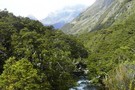
The Young River
Photograph
•
Distance: 3.4km away
The lower Young River passes through beech forest as the Gillespie Pass Circuit heads up its true left bank.
More ▶︎
route from Snowy Creek to Lochnagar via Shotover Saddle
Photograph
•
Distance: 3.4km away
Hand drawn route of above
More ▶︎
Lochnagar/Shotover Saddle/Matukituki Valley
Track
•
2 days. Medium/hard. One way.
•
Distance: 3.4km away
An alpine crossing of a saddle between 2 major river valleys. Usually done as part of a circuit of saddle ...
More ▶︎
Te Wāhipounamu - South West New Zealand World Heritage Area
Place
•
World Heritage Area. 26000.00km2.
•
Distance: 3.5km away
This UNESCO World Heritage Area occupies the southwestern corner of New Zealand. It includes four national parks, and covers 10% ...
More ▶︎
Shotover saddle tarn over the West Matukituki
Photograph
•
Distance: 3.6km away
With the Rob Roy glacier directly across the valley we're looking down valley toward Cameron corner where the East and ...
More ▶︎
Shotover Saddle
Photograph
•
Distance: 3.6km away
When we crossed a bridge near to the mouth of the Shotover river just near Queenstown i reminded Kathryn we ...
More ▶︎
Shotover stopover
Photograph
•
Distance: 3.6km away
Stopping short of descending to the West Matukituki and camping with sandflies on the valley floor we spent the last ...
More ▶︎
Mt Earnslaw from Earnslaw Burn
Photograph
•
Distance: 3.6km away
The cirque at the head of the Earnslaw Burn, taken from the descent from Lennox Pass
More ▶︎
Greenstone / Caples Tracks
Track
•
4 days. Easy/medium. Loop track.
•
Distance: 3.8km away
The Greenstone and Caples Tracks are often linked together to form a circuit from the shores of Lake Wakatipu. Long ...
More ▶︎
Mavora-Greenstone Walkway
Track
•
4 days. Easy. One way.
•
Distance: 3.9km away
Links with Greenstone Track.
More ▶︎
Hobbs Bivvy, Route Burn North Branch
Rock bivouac
•
Distance: 3.9km away
A dry and sheltered bivvy underneath a giant boulder in the North Branch of the Route Burn. Sleeps 4 or ...
More ▶︎
Hobbs Bivvy, Routeburn North Branch
Photograph
•
Distance: 3.9km away
Great dry bivvy located under a giant boulder in the north branch of the Routeburn. Sleeps 4 or 5 but ...
More ▶︎
Scott Creek Hut (removed)
Hut
•
Removed!
•
Distance: 4.0km away
Hut has been removed (2010?). Details below for old-time's sake ...
Scott Creek Hut (4 beds, fireplace, firewood available, creek water) ...
More ▶︎
McKellar Saddle (945 m), Upper Caples Valley
Photograph
•
Distance: 4.1km away
After a steep climb up from Lake McKellar in the Upper Greenstone, you are treated to spectacular views of the ...
More ▶︎
Joe Glacier
Photograph
•
Distance: 4.1km away
A view of the head of the Joe river and the remains of the Joe glacier in Aspiring National Park. ...
More ▶︎
Caples Valley Fallow Deer
Photograph
•
Distance: 4.1km away
Spooked a mob of 30+ deer back in 06/07.
More ▶︎
Caples Track
Track
•
2 days. Easy/medium. One way.
•
Distance: 4.1km away
A quiet track climbing alongside the Caples River through forest and grassy flats and over a sub-alpine saddle.
More ▶︎
Mt Earnslaw
Article
•
Distance: 4.2km away
This was a sweet day trip taken in Feb 2008, bluebird day.
More ▶︎
Mt Tyndall
Photograph
•
Distance: 4.2km away
from Cascade Saddle, looking south-east across Heads Leap to Mt Tyndall (2496m) (April 2009)
More ▶︎
Pearl Flat to Scott's Bivvy
GPX file
•
Distance: 4.2km away
A new track has been cut through bush up the true left of the Matukituki river from Pearl Flat to ...
More ▶︎
The spur between Snowy Ck and Pine Ck basin - Lochnagar route
Photograph
•
Distance: 4.3km away
The book at Tummel Burn hut in the upper Shotover would have you believe nine out of ten people descend ...
More ▶︎
Approaching Mt Tyndall
Photograph
•
Distance: 4.3km away
Mt Tyndall (2,496m) sits above the Isobel Glacier south of Cascade Saddle.
More ▶︎
Mt Betsy Jane
Photograph
•
Distance: 4.3km away
The Top Flats of the Wilkin valley are dominated by this mountain which towers about Top Forks hut. Named after ...
More ▶︎
Scott Saddle
Photograph
•
Distance: 4.4km away
Scott Saddle (1450m) between Scott Creek and Kay Creek. This is the easiest pass between the Dart and Caples valleys. ...
More ▶︎
Scott Saddle
Photograph
•
Distance: 4.5km away
Scott Saddle (1450m) between Scott Creek and Kay Creek. This is the easiest pass between the Dart and Caples valleys. ...
More ▶︎
Esquilant Bivvy Hut
Hut
•
Serviced Alpine Hut (NZAC). Capacity: 6.
•
Distance: 4.6km away
Small hut located on Wright's Col in the Rees Valley.
More ▶︎
Lake Marian
Photograph
•
Distance: 4.7km away
Taken in October 2010 the lake appeared tiny in comparison to other photos and videos Ive seen of it online, ...
More ▶︎
Dart Valley from Kay Saddle
Photograph
•
Distance: 4.7km away
Looking back down through Scott Basin to the Dart from Kay saddle
More ▶︎
Pleasant Flat Campsite
Campsite
•
Basic Campsite (DOC). 30 spaces.
•
Distance: 4.8km away
Campsite by the highway just north of Haast Pass.
More ▶︎
Death Valley Saddle
Photograph
•
Distance: 4.8km away
Death Valley is an offshoot of Kay Creek and makes an interesting and straight forward alternative to a crossing from ...
More ▶︎
Scott Basin
Photograph
•
Distance: 4.8km away
Scott Basin at the head of Scott Creek, between the Dart and Caples valleys. Scott Creek Hut (dilapidated) is located ...
More ▶︎
French Ridge Track
Photograph
•
Distance: 4.8km away
The French Ridge Track features tangled roots, steep gradients, and clambering down rock walls.
More ▶︎
The North Branch of the Routeburn
Photograph
•
Distance: 4.9km away
Our final camp in the North Branch of the Routeburn. North Col, which we have just come through, is in ...
More ▶︎
Bridge in the Rockburn
Photograph
•
Distance: 5.0km away
This fine bridge provides an easy crossing of the Rockburn just below Theatre Flat
More ▶︎
Snowy Creek
Photograph
•
Distance: 5.0km away
Snowy Creek - viewed from saddle 1950 on the way over from Lochnagar Hut
More ▶︎
Liverpool Hut
Hut
•
Serviced Alpine Hut (DOC). Capacity: 10.
•
Distance: 5.0km away
Located on the steep lower slopes of Mount Barff, this hut offers striking views and a route to the Arawhata ...
More ▶︎
Liverpool Hut From Behind
Photograph
•
Distance: 5.0km away
view of liverpool hut from behind ..mt apiring to the Left
More ▶︎
Liverpool Hut toilet
Photograph
•
Distance: 5.0km away
View from the drop toilet at Liverpool Hut
More ▶︎
Liverpool Hut
Photograph
•
Distance: 5.0km away
-Makeshift Campsite 200 meters from Liverpool Hut
-Hut was full so we could not sleep there but we did cook there
More ▶︎
Double Barrel Creek
Photograph
•
Distance: 5.0km away
Double Barrel Creek from the pass into Death Valley.
Catchment is blocked by twin falls at its lower end, but ...
More ▶︎
Upper Caples Hut
Hut
•
Club hut (Southern Lakes Deerstalkers Association). Capacity: 16.Bookings required.
•
Distance: 5.0km away
Comfortable hut in the Upper Caples Valley.
This hut was closed to the public in February 2014, but is now reopened ...
More ▶︎
Kay Lake and Death Valley Saddle
Photograph
•
Distance: 5.1km away
Death Valley is an offshoot of Kay Creek and makes an interesting and straight forward alternative to a crossing from ...
More ▶︎
Sleepy Hollow Pass route (Caples to Dart)
Track
•
Medium/hard. One way.
•
Distance: 5.1km away
The Sleepy Hollow pass route from the mid-Caples to the Dart Valley. This can be combined with either a walk ...
More ▶︎
Theatre Flat
Photograph
•
Distance: 5.1km away
Approaching Theatre Flat from down valley. On a nice day it's a pleasant place to camp, not so much this ...
More ▶︎
West Matukituki from Liverpool hut
Photograph
•
Distance: 5.1km away
Looking down valley from the hut, Rob Roy Peak dominates above Shovel Flat, the Cascade Saddle is visible in the ...
More ▶︎
Views from Liverpool hut
Photograph
•
Distance: 5.1km away
The triangle of Mt Aspiring pokes above the skyline to the left, with Mt French and French Ridge in the ...
More ▶︎
Liverpool hut
Photograph
•
Distance: 5.1km away
The new (2009) 10 bunk Liverpool hut beneath Mt Barff.
More ▶︎
Liverpool Hut
Photograph
•
Distance: 5.1km away
Liverpool Hut commands and excellent view down the West Matukituki Vallet
More ▶︎
Big Bay - Pyke - Hollyford Road-end Route
GPX file
•
Distance: 5.2km away
Big Bay - Pyke - Hollyford Road-end Route as tramped by us in May 2012 and recorded with Garmin GPS60csx
More ▶︎
The upper basin of Pine Creek. Mt.Aspiring NP NZ
Photograph
•
Distance: 5.2km away
After crossing over the pass from Snowy Ck, it was thought we'd get a break from the wind. Fortunately we ...
More ▶︎
Theatre Flat
Photograph
•
Distance: 5.2km away
Half way up the Rockburn is the giant Theatre Flats. Lake Nerine is at the top of the bluffs at ...
More ▶︎
Esquilant Biv
Photograph
•
Distance: 5.3km away
Gearing up in the early morning to climb Mt Earnslaw. Esquilant is a 6 bunk hut situated at 2,160m.
More ▶︎
Esquilant Biv
Photograph
•
Distance: 5.3km away
A small 6-bunk hut on the shoulder of Mt Earnslaw. Could comfortably sleep 8, although there is not much room ...
More ▶︎
Earnslaw Burn Rock Bivvy, underneath.
Photograph
•
Distance: 5.3km away
Underneath the Rock Bivvy. This one is about 20 minutes upstream from the official one on the top map and ...
More ▶︎
Earnslaw Burn Rock Bivvy
Rock bivouac
•
Distance: 5.3km away
This is an alternative bivvy to the one shown on topo maps. This bivvy is about 20 minutes upstream from ...
More ▶︎
Earnslaw Burn Rock Bivvy
Photograph
•
Distance: 5.3km away
Alternative rock bivvy from the biv shown on the topo map. This bivvy is on the true left of the ...
More ▶︎
Liverpool Hut
Photograph
•
Distance: 5.3km away
Viewed from the French Ridge Track across the valley
More ▶︎
Head of the Matukituki Valley West Branch
Photograph
•
Distance: 5.3km away
Viewed from French Ridge Track.
More ▶︎
Death Valley from Saddle
Photograph
•
Distance: 5.4km away
Death Valley is an offshoot of Kay Creek and makes an interesting and straight forward alternative to a crossing from ...
More ▶︎
Pine Creek
Photograph
•
Distance: 5.4km away
Upper basin of Pine Creek, crossing to Snowy from Lochnagar
More ▶︎
Death Valley glacier (rems.)
Photograph
•
Distance: 5.4km away
Death of a glacier.
Death Valley, Humboldt Mountains
More ▶︎
McKellar Hut
Hut
•
Serviced Hut (DOC). Capacity: 26.
•
Distance: 5.4km away
New hut is being built/opened November 2011. Capacity for 26, two separate bunkrooms and main room.
More ▶︎
Glacier burn - ascent to sleepy hollow pass
Photograph
•
Distance: 5.4km away
From Glacier Burn to Sleepy Hollow pass: route leaves the Glacier Burn track and climbs this scree gully on the ...
More ▶︎

Descent to Glacier Burn
Photograph
•
Distance: 5.4km away
The final descent to Glacier Burn from pt1731, on the route from the Caples valley via Sleepy Hollow.
More ▶︎
Mount Avalanche avalanche
Photograph
•
Distance: 5.5km away
Viewed from the French Ridge Track. Avalanches from here, from Rob Roy Peak, or from peaks across the valley can ...
More ▶︎
Gloomy Gorge
Photograph
•
Distance: 5.5km away
Viewed from the French Ridge Track, with Mount Avalanche in the background.
More ▶︎
Key Summit
Photograph
•
Distance: 5.5km away
Key Summit from the Humboldts, looking towards the Earl Mountains. Kay Creek in the foreground
More ▶︎
Key Summit
Photograph
•
Distance: 5.5km away
Key Summit from the Humboldts, looking towards the Earl Mountains. Kay Creek in the foreground
More ▶︎
On the Serpentine Range 2
Photograph
•
Distance: 5.5km away
Looking north from near Point 1489 over the saddle at Point 1410. There is good looking camping on the saddle. ...
More ▶︎
Beans Burn waterfall
Photograph
•
Distance: 5.5km away
On the five passes route. Waterfall mid Beans Burn. taken Jan 2010
More ▶︎
Cameron Hut Wanaka/Makarora
Hut
•
Standard Hut (DOC). Capacity: 4.
•
Distance: 5.6km away
Great wee hut- 4 bunk, pot belly stove.
More ▶︎
Cameron(s) Hut, Makarora
Photograph
•
Distance: 5.6km away
A cozy but spacious 4-bunk hut in the Camerons Creek valley off the Makarora - taken late July 2011. Accessible ...
More ▶︎
View from Cameron(s) Hut, Makarora
Photograph
•
Distance: 5.6km away
The view from a (briefly) open window in Cameron's Hut one late July evening. 3 feet of snow outside - ...
More ▶︎
The mind of a mischief at work
Photograph
•
Distance: 5.6km away
Kea show their usual boundless curiosity in Pine Ck basin.
More ▶︎
Have we met?
Photograph
•
Distance: 5.7km away
This may well be the same group that visit us on Shotover Saddle the night after next. The ones who ...
More ▶︎
Olivine Wilderness Area
Place
•
Wilderness Area. 830.00km2.
•
Distance: 5.7km away
Remote country in the Olivine Range. The wilderness area includes the Red Hills, the Olivine Ice Plateau, and the Joe ...
More ▶︎
Death Valley
Photograph
•
Distance: 5.7km away
Death Valley is an offshoot of Kay Creek and makes an interesting and straight forward alternative to a crossing from ...
More ▶︎
French Ridge Hut
Hut
•
Serviced Alpine Hut (NZAC). Capacity: 20.
•
Distance: 5.8km away
This new hut is located on the summer snowline on French Ridge, near the head of the Matukituki Valley West ...
More ▶︎
French Ridge Hut at night
Photograph
•
Distance: 5.8km away
210 second exposure @ f / 4.0, 17mm
More ▶︎
French Ridge Hut Reflection
Photograph
•
Distance: 5.8km away
Reflection of the French Ridge Hut in the tarn on a fine April day.
More ▶︎
Dart/Lochnagar
Track
•
1 – 2 days. Hard. One way.
•
Distance: 5.8km away
10 hour trip from Dart Hut to Lochnagar via Snowy Saddle
More ▶︎
McIntyre Hut
Hut
•
Standard Hut (DOC). Capacity: 5.
•
Distance: 5.9km away
Corrugated iron miners' hut dating from the 1960s.
More ▶︎
Glenorchy Lagoon
Track
•
Easy. Loop track.
•
Distance: 5.9km away
Stroll along boardwalks through this lagoon occupying an old bend of the Rees River. The lagoon is dominated by willows, ...
More ▶︎
Head wall of Wonderland Valley
Photograph
•
Distance: 5.9km away
Taken in Mar 2006 after bush bashing up the true right of Wonderland stream. No trail just picking a way ...
More ▶︎
Kay Creek Hut
Photograph
•
Distance: 6.0km away
Kay Creek Hut, between the Caples and Dart valleys.
More ▶︎
Lake Gunn to Falls Creek.
Track
•
1 – 2 days. Hard. One way.
•
Distance: 6.0km away
A challenging day trip or overnight trip in Fiordland.
More ▶︎
McIntosh hut
Photograph
•
Distance: 6.0km away
McIntosh hut. Mt Earnslaw in background. taken Sept 2015
More ▶︎
McIntosh Hut (Mac's Hut)
Hut
•
Basic Hut/Bivvy (DOC). Capacity: 4.
•
Distance: 6.0km away
Scheelite miners' hut high on Mount McIntosh, dated around 1915.
More ▶︎
French Ridge Hut
Photograph
•
Distance: 6.0km away
This NZAC hut is located on the summer snowline near Mount Aspiring.
More ▶︎
Lake Castalia
Photograph
•
Distance: 6.0km away
Completely ringed by rock walls, numerous waterfalls tumble off the towering Mercury Peak glaciers to feed Lake Castalia, the North ...
More ▶︎
Camping in the Jumboland
Photograph
•
Distance: 6.2km away
After 8 hours slogging up the True left side of the flooded Wilkin it was time to stop for the ...
More ▶︎
Mt Jumbo from Wonderland
Photograph
•
Distance: 6.3km away
View of Mt Jumbo from Wonderland valley
More ▶︎
Kay Creek - Upper Caples
Photograph
•
Distance: 6.3km away
April 2006 - Taken while coming back down Kay Creek to the Upper Caples DOC hut
More ▶︎
Standing above Lochnagar (Goat Lake) - Mt.Aspiring NP
Photograph
•
Distance: 6.3km away
No snow in March 2010 on the south facing slopes to the north of Lochnagar. Taken from the col between ...
More ▶︎
Whakaari Conservation Area
Place
•
Place. 94.00km2.
•
Distance: 6.3km away
Mountains east of Glenorchy, dotted with scheelite miners' huts and relics.
More ▶︎
Mmmmmm tasty
Photograph
•
Distance: 6.5km away
While stopping for a rest on the way back down to the hut a flock of thirteen Keas drop in ...
More ▶︎
Lake Castalia from the North
Photograph
•
Distance: 6.5km away
Sidling around the Eastern shore of the lake takes you into the upper reaches of the Castalia valley, a sea ...
More ▶︎
Paradise Road Glenorchy, New Zealand, Fiordland, April 2018
Photograph
•
Distance: 6.6km away
Paradise Road Glenorchy, New Zealand, Fiordland, April 2018
More ▶︎
A meeting with the water.
Photograph
•
Distance: 6.6km away
Providing a different perspective to show the scale of things. Still a couple of hundred metres above the lake. Lochnagar ...
More ▶︎
Scotts Rock Biv
Rock bivouac
•
Distance: 6.6km away
Located at the head of the Matukituki River West Branch, beyond Pearl Flat.
The biv is 500m upstream of the upper ...
More ▶︎
Rock Formations on French Ridge
Photograph
•
Distance: 6.6km away
Interesting formations on the way up the ridge to the Quarterdeck glacier.
More ▶︎
Descending to Lochnagar Hut
Photograph
•
Distance: 6.7km away
Standing above the lake to its north. Showing the outlet which becomes sub-terranian. This spur leads down from Pt.1865 which ...
More ▶︎
Lochnagar Hut
Hut
•
Private hut (PVT). Capacity: 4.Bookings required.
•
Distance: 6.7km away
Old style musterers hut yet rebuilt in 1990. Painted corrugated iron half buried in earth with a partial schist slabbed ...
More ▶︎
Kay Creek Hut
Hut
•
Basic Hut/Bivvy (DOC). Capacity: 3.
•
Distance: 6.8km away
Kay Creek Hut (sleeps 3-4, fireplace, firewood available, creek water) makes up for in character what it lacks in comfort. ...
More ▶︎
Kay Creek
Photograph
•
Distance: 6.8km away
Kay Creek, looking downstream from Kay Creek Hut
More ▶︎
Mt French
Photograph
•
Distance: 6.8km away
Dawn reveals an overnight dusting of snow covers Mt French and the Quarterdeck glacier.
More ▶︎
Lochnagar Hut
Photograph
•
Distance: 6.8km away
A hut was built here at Lochnagar in 1982. It was burnt down in 1988. As part of the 150th ...
More ▶︎
Scotts Bivvy
Photograph
•
Distance: 7.0km away
Standing on top of the Bivvy. The head of the valley beyond
More ▶︎
Scotts Bivvy
Hut
•
Natural shelter (NA). Capacity: 2.
•
Distance: 7.0km away
A poor shelter for two people. Beware of the resident stream within the bivvy when it rains
More ▶︎
Gloomy Gorge
Photograph
•
Distance: 7.0km away
An 800 odd metre drop off seperates French Ridge from Gloomy Gorges floor.
More ▶︎
Arawhata Rock Biv
Rock bivouac
•
Distance: 7.1km away
Rock bivouac in the upper Arawhata River.
More ▶︎
North Branch Route Burn
Photograph
•
Distance: 7.1km away
From near small tarn on Serpentine Range
More ▶︎
Summer 2017
Photograph
•
Distance: 7.3km away
January 2017 was complete garbage. While on the Serpentine Range we awoke to found our camp site under snow!
More ▶︎
Brewster track to Mt.Armstrong
Track
•
1 – 2 days. Hard. Return via same track.
•
Distance: 7.4km away
An ascent from the state hwy(SH6),just west of Haast Pass,of over 1700m to a summit on the main divide of ...
More ▶︎
On the Serpentine Range
Photograph
•
Distance: 7.4km away
Looking south down the range from flat topped Peak 1550, over the unnamed lake that drains into the North Route ...
More ▶︎
North Col from Serpentine Range
Photograph
•
Distance: 7.4km away
Looking north from Peak 1550 towards North Col. Peak 1796, which anchors the northern end of the Serpentine Range, rises ...
More ▶︎
Beans Burn camp
Photograph
•
Distance: 7.4km away
On the five passes route. Camping next to the Beansburn rock biv -- there is room for a couple of ...
More ▶︎
The upper Beansburn from the rock bivvy
Photograph
•
Distance: 7.5km away
Some rain appears on the lens as it blows directly into the bivvy site. Good for us we can get ...
More ▶︎
The Quarterdeck Glacier
Photograph
•
Distance: 7.5km away
Taken from the last rock outcrop at the base of the glacier at around about the 1860m mark, Mt French ...
More ▶︎
Rockburn Skyline
Photograph
•
Distance: 7.5km away
panorama of the Rockburn from Park Pass Glacier to Theatre Flat - from the outlet of Lake Nerine
Feb 2013
More ▶︎
Jean Hut
Hut
•
Overnight use prohibited (DOC).
•
Distance: 7.5km away
Historic miners' hut clad in flattened iron drums. It features a series of rocks suspended from the roof to hold ...
More ▶︎
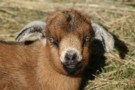
Goat kid
Photograph
•
Distance: 7.6km away
Near Jean Hut, Mount Alaska. This young goat was dozing comfortably in the sun, and quite confused about whether or ...
More ▶︎
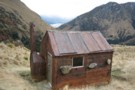
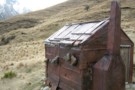
Heather Jock Hut
Track
•
1 – 2 days. Easy. Loop track.
•
Distance: 7.6km away
A gentle climb through a mining area to a small hut with panoramic mountain views.
More ▶︎

Snowy Creek
Photograph
•
Distance: 7.6km away
Snowy Creek - viewed from saddle 1950 on the way over from Lochnagar Hut
More ▶︎

Snowy Creek
Photograph
•
Distance: 7.6km away
Snowy Creek - viewed from saddle 1950 on the way over from Lochnagar Hut
More ▶︎
Buckler Burn Forks Hut (Delapidated)
Hut
•
Derelict hut (DOC).
•
Distance: 7.7km away
This old miners' hut is located at the confluence of Wallers Creek with the Buckler Burn.
More ▶︎
Upper Shotover
Photograph
•
Distance: 7.7km away
Shotover valley from the spur between Tummel Burn and Tyndall Creek.
More ▶︎
View north from Nereus Peak
Photograph
•
Distance: 7.8km away
The ridge east of Nereus Peak summit can be reached by a straight forward climb from North Col. Looking north ...
More ▶︎
Dusk, near Heather Jock Hut
Photograph
•
Distance: 7.8km away
Looking northwest, toward the Cosmos Peaks and Mount Earnslaw.
More ▶︎
Morning view from Heather Jock Hut.
Photograph
•
Distance: 7.8km away
From left: Tooth Peak 2061m near the Greenstone River mounth, Mount Judah 1416m (foreground), Bold Peak 2118m and Mount Bonpland ...
More ▶︎
Heather Jock Hut
Photograph
•
Distance: 7.8km away
Wrestling with the sticky door, August 2008.
More ▶︎
Heather Jock Hut
Photograph
•
Distance: 7.8km away
August evening with Mount McIntosh in the background.
More ▶︎
Heather Jock Hut
Hut
•
Basic Hut/Bivvy (DOC). Capacity: 3.
•
Distance: 7.8km away
A small miner's hut high on Mount Alaska, near Glenorchy. This little-used hut combines easy access with spectacular panoramic views ...
More ▶︎
Theatre Flat from above
Photograph
•
Distance: 7.9km away
Looking back down at Theatre Flat from the lip of the hanging valley that holds lake Nerine
More ▶︎
Toilet at Heather Jock Hut
Photograph
•
Distance: 7.9km away
This long drop toilet forms part of a scenic view from Heather Jock Hut.
The axle and remains of a solid ...
More ▶︎
A fresh look at the descent to Lake Nerine.
Photograph
•
Distance: 7.9km away
If visiting the lake from Park Pass it is inevitable you will find yourself at the top of this slope ...
More ▶︎
Heather Jock Hut
Photograph
•
Distance: 8.0km away
A spectacular location above Glenorchy where the old time Sheelite miners used to toil away. Reached via a track from ...
More ▶︎
Lake Nerine
Photograph
•
Distance: 8.0km away
The first view you get of Lake Nerine as you cross the saddle by Point 1594.
Jan 2017
More ▶︎
Close up of Park Pass Glacier
Photograph
•
Distance: 8.1km away
Showing the snout of the glacier with the tip obscured by the rock wall. Taken from above the steep snowgrass ...
More ▶︎
Sleepy Hollow
Photograph
•
Distance: 8.1km away
From near Bold Peak. Inspired by madpom, I went the opposite direction via Glacier Burn to Kay Creek
More ▶︎
Merkl Glacier
Photograph
•
Distance: 8.1km away
photo taken from the easily reached Sunset Peak, looking NE. Feb 2013
More ▶︎
Boozer Hut
Hut
•
Basic Hut/Bivvy (DOC).
•
Distance: 8.1km away
An historic hut named for a notorious 1930s scheelite miner. The hut is clad in flattened steel drums, and contains ...
More ▶︎
A tarn on the way to Lake Nerine
Photograph
•
Distance: 8.1km away
This tarn is a very attractive place to stop for a while on the way to Lake Nerine. While it ...
More ▶︎
Bonnie Jean hut interior
Photograph
•
Distance: 8.1km away
Bonnie Jean hut interior. taken Sept 2015
More ▶︎
Bonnie Jean Hut
Hut
•
Overnight use prohibited (DOC).
•
Distance: 8.1km away
Built in 1943, this hut near Bonnie Jean Mine is preserved as an on-site museum. It features an old tractor ...
More ▶︎
Camp at Lake Nerine
Photograph
•
Distance: 8.2km away
This has to be every tramper's dream. A camp at Lake Nerine in perfect windless conditions
More ▶︎
Lakelet in the Humboldt Mountains - Mt.Aspiring NP NZ.
Photograph
•
Distance: 8.3km away
Perched high above the Rockburn valley floor, near to Lake Nerine only a little northward toward Park Pass.
More ▶︎
Fraser Creek & Kay Creek
Photograph
•
Distance: 8.3km away
View from route to Steele Creek from the Upper Caples hut
More ▶︎
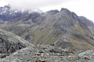
The route to Lake Nerine from Park Pass
Photograph
•
Distance: 8.3km away
Looking from the moraine of Park Pass glacier, the steep snowgrass slopes can be seen to the south. These slopes ...
More ▶︎
Cascade Creek Campsite
Campsite
•
Scenic Campsite (DOC). 120 spaces.
•
Distance: 8.3km away
Large campsite on the Milford Road at the foot of Lake Gunn. Wheelchair accessible toilet.
More ▶︎
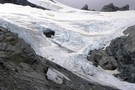
Park Pass glacier - close up the snout.
Photograph
•
Distance: 8.3km away
The neve certainly looks very accessible from the terminal end. It was only the time factor which disallowed us the ...
More ▶︎
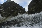
U Pass
Track
•
1 – 2 days. Medium. Loop track.
•
Distance: 8.3km away
A short loop track in the Earl Mountains.
More ▶︎
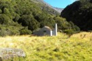
Tummel Burn Hut
Hut
•
Basic Hut/Bivvy (PVT). Capacity: 3.
•
Distance: 8.4km away
Low 3 person unbunked private hut with open fire. 3 mattresses present (2009). Water supply from Tummel Burn 20m distant. ...
More ▶︎
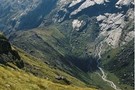
Looking back towards Park Pass
Photograph
•
Distance: 8.4km away
It is a steep snowgrass sidle from Park Pass to this point but the view is rewarding
More ▶︎
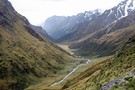
Beans Burn
Photograph
•
Distance: 8.4km away
On the five passes route. Upper Beans Burn valley from just below Fohn saddle. taken Jan 2010
More ▶︎
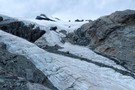
Park Pass Glacier
Photograph
•
Distance: 8.4km away
a highly recommended side trip on the 5 Passes tramp
Feb 2013
More ▶︎
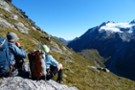
to Lake Nerine
Photograph
•
Distance: 8.4km away
on the sidle to Lake Nerine, looking back to Park Pass Glacier
More ▶︎
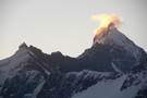
Is Aspiring erupting?
Photograph
•
Distance: 8.5km away
The sunset behind Mt.Aspiring provides some interesting effect.
More ▶︎
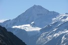
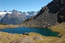
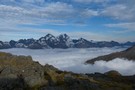
Hollyford Valley
Photograph
•
Distance: 8.5km away
thick cloud fills the Hollyford Valley as we sidle on the 1600m contour to North Col (Prospector Peak in the ...
More ▶︎
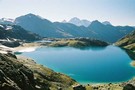
Lake Nerine
Photograph
•
Distance: 8.5km away
Looking back at Lake Nerine from the ridge at its head. Mt Earnslaw in the distance
More ▶︎
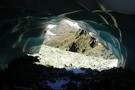
Ice Cave
Photograph
•
Distance: 8.5km away
Remnants of winter snow fall melted from underneath by the North Routeburn. Taken from just below North Col.
More ▶︎
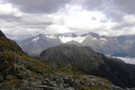
The tops of the Darran Mountains - Fjordland NZ
Photograph
•
Distance: 8.6km away
The exit from the Lake Nerine basin when heading to North Col overlooks the lower end of Hidden Falls Ck ...
More ▶︎
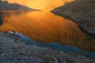
Sleepy Hollow
Photograph
•
Distance: 8.6km away
situated on the ridge between Glenorchy and Caples Valley
More ▶︎
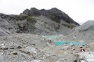
Terminal lakes of Park Pass glacier
Photograph
•
Distance: 8.6km away
To the north of Park Pass (1175m) is Poseidon Pk(2208m) from which flows Park Pass glacier to appx 1500m. It ...
More ▶︎
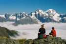
Tutuko & Madeline
Photograph
•
Distance: 8.6km away
Looking across at Mt Tutuko and Madeline across a cloud filled Hollyford Valley. This is during a rest on the ...
More ▶︎
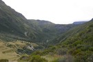
Lochnagar landslide dam
Photograph
•
Distance: 8.6km away
Lochnagar landslide dam, looking up Lake creek
More ▶︎
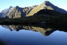
Early morning reflection
Photograph
•
Distance: 8.6km away
Taken from the top of Park Pass looking south towards the route into Lake Nerine
More ▶︎
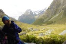
View of the Rockburn from Park Pass Bivvy
Photograph
•
Distance: 8.6km away
As you ascend the Rockburn, perhaps as part of the Five Passes Walk, you can take advantage of a rock ...
More ▶︎
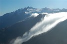
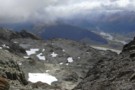
Gorge Creek / Dart Valley
Photograph
•
Distance: 8.7km away
Gorge Creek and the Dart Valley, from the Sleepy Hollow pass between the Caples and Dart valleys.
More ▶︎
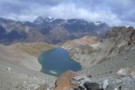
Sleepy Hollow
Photograph
•
Distance: 8.7km away
Sleepy Hollow from the top of the pass into the Dart.
More ▶︎
Sleepy Hollow
Photograph
•
Distance: 8.7km away
Sleepy Hollow above the mid Caples Valley. The pass to Gorge Creek / Glacier Burn and the Dart Valley is ...
More ▶︎
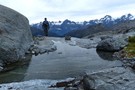
Park Pass Glacier
Photograph
•
Distance: 8.7km away
some of the breath-taking scenery on the descent from the glacier
Feb 2013
More ▶︎
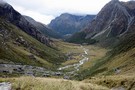
Park Pass
Photograph
•
Distance: 8.7km away
On the five passes route. The upper Rock Burn from Park Pass. taken Jan 2010
More ▶︎
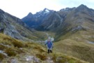
Park Pass and the Rockburn
Photograph
•
Distance: 8.8km away
the climb to Park Pass Glacier opens views down the Rockburn and the sidle to Lake Nerine
Feb 2013
More ▶︎
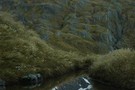
Mt Tantalus
Photograph
•
Distance: 8.9km away
Mt Tantalus over the Fohn Saddle. The Fohn Saddle is about the mid-point of the 5 passes tramp
More ▶︎
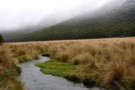
mid-Greenstone valley
Photograph
•
Distance: 8.9km away
Looking south, a few km from McKellar hut (April 2009)
More ▶︎
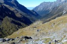
Down the Beansburn
Photograph
•
Distance: 9.0km away
looking down the Beansburn - on the climb to Fohn Pass
Feb 2013
More ▶︎
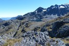
Fohn Lake
Photograph
•
Distance: 9.1km away
taken from above Fohn Pass, one possible route to the lake descends the gully on the right and sidles to ...
More ▶︎
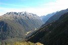
Hidden Falls Creek
Photograph
•
Distance: 9.2km away
Most of the creek above the big bend; from between North Col & Serpentine Saddle
More ▶︎
Wallers Hut
Hut
•
Basic Hut/Bivvy (DOC). Capacity: 5.
•
Distance: 9.2km away
Historic corrugated iron and beech pole miners' hut in the Whakaari Conservation Area. The hut was built on Wallers Creek ...
More ▶︎
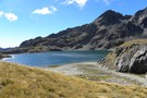
Fohn lake - Mt.Aspiring NP NZ
Photograph
•
Distance: 9.2km away
Along the Five Passes route and below Fohn saddle. The lake sits above the Olivine ledge. Fine weather at lunchtime.
March ...
More ▶︎
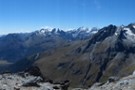
Sunset panorama
Photograph
•
Distance: 9.4km away
panorama from Sunset Peak, looking NE to NW.
From Skippers Range, across Lake Wilmot & Olivine River, Terminal Peak to the ...
More ▶︎
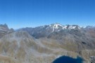
Sunset Peak
Photograph
•
Distance: 9.4km away
panorama from the summit of Sunset Peak - looking S to E across Fohn Pass and Lake and Fiery Col ...
More ▶︎
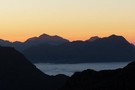
Sunset from Fohn Lake
Photograph
•
Distance: 9.5km away
looking W from the knoll above Fohn Lake
Feb 2013
More ▶︎
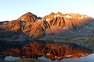
Sunset on Sunset Peak
Photograph
•
Distance: 9.5km away
deepening colours as the sun sets
Feb 2013
More ▶︎
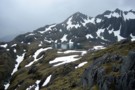
Fohn Lake
Photograph
•
Distance: 9.5km away
On the five passes route. Fohn lake with Sunset Peak (1800m) behind it. taken Jan 2010
More ▶︎
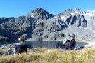
Fohn Lake
Photograph
•
Distance: 9.5km away
relaxing in the early evening - a great camp beside the tarn and below the aptly named Sunset Peak
More ▶︎
Brewster Hut
Photograph
•
Distance: 9.6km away
On the side of Mt Armstrong looking down at Brewster Hut and Haast Pass further still
More ▶︎
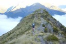
Returning to Haast Pass
Photograph
•
Distance: 9.6km away
Leaving Brewster hut for Haast pass 900M below
More ▶︎
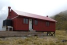
Brewster hut Jan 2009
Photograph
•
Distance: 9.6km away
An alpine hut in the Haast Pass area between Mt Armstrong and the highway. This hut is only a few ...
More ▶︎
Brewster Hut
Hut
•
Serviced Alpine Hut (DOC). Capacity: 12.Bookings required.
•
Distance: 9.6km away
An alpine hut in the Haast Pass area between Mt Armstrong and the highway. This hut is only a few ...
More ▶︎
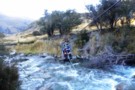
Crossing Lake Creek out of Lochnagar
Photograph
•
Distance: 9.6km away
The descent from Lochnagar to the Shotover river goes past a sub-terranian outlet before Lake Creek becomes anything significant.
The cableway ...
More ▶︎
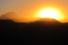
Fohn Lake sunset
Photograph
•
Distance: 9.6km away
Feb 2013. Sun setting behind the Bryneira Range as seen from point 1501
More ▶︎
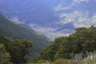
Mid Caples Valley
Photograph
•
Distance: 9.7km away
Mid Caples Valley from pt1168, just above the bushedge the way to Sleepy Hollow. Mid Caples Hut is just visible ...
More ▶︎
Upper Burn Hut
Hut
•
Removed!
•
Distance: 9.8km away
Private Hunter Valley Station hut in the upper High Burn. Hunter Valley own or lease two flats up this valley ...
More ▶︎