
Pleasant Flat to Makarora 2009
Wednesday 25 Feb (Day 1)
The Atomic shuttle picked me up from Frankton (near Queenstown) at 0740 and I arrived at Burke Flat at 1100.
I crossed the Haast River just above the confluence with the Burke, then crossed the Burke at the confluence where the river pools. It didn’t look that deep, but it turned out to be chest deep! I lunched on the sandbank before departing up the Burke at 1145. I arrived at Strachan Creek at 1530, longer than I expected, but in hindsight I sidled too high through the bluffs. (An old marked track exists if you can follow it!) This creek is certainly spectacular. As per Moir’s guide, the old swing bridge site is not crossable, so I climbed 100m further up the spur and dropped down a gut that led to a better crossing. I marked this gut with pink flagging tape as there was no sign of the plastic discs mentioned in Moir’s. Once over the creek, I again sidled too high but eventually picked up the permolat that marked the old track. I stopped at 1900 and made camp on the river shingle, 1.2km below Twirligig. The weather has been fine and warm.
Thursday 26 Feb (Day 2)
Up at 0700 and away at 0820. I arrived at the Howe junction at 1200. The crossing here was also chest deep but with minimum flow. Getting here today was slow and did not involve as much river travel as I had expected. After a quick lunch, I was keen to get going and warm up again. Initially I started up the Howe riverbed but it soon gorged. I had to climb steeply and high on the TR to get onto a terrace. At this point I picked up a very good game trail that I was able to follow all the way to the first flat. I imagine it probably started at the Howe/Burke confluence! I suggest anyone heading this way to pick up this game trail at the confluence, and don’t bother trying to go up the river. I arrived at the first flat at 1530, and as it was raining lightly and I was tired and wet, I decided to camp here the night. Once again the fine river gravel provided an ideal tent site. The going is slower than expected.
Friday 27 Feb (Day 3)
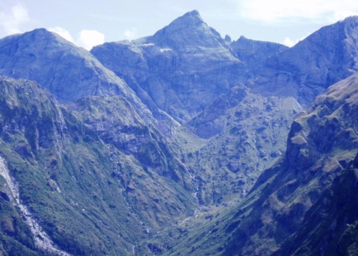
Departed at 0800, stepped into the bush on the TL and low and behold, another deer trail. I was able to follow this to the 600m contour, arriving at 1015. I then followed the river/grassy flats to the forks, except just below the forks, pick up a game trail on the TR at the top of the flat. Follow this up through a ferny gut at which point it sidles out to the top flat. I arrived at the forks at 1130, in sunny conditions with a warm breeze. I departed the forks at 1200, taking the southern branch. I boulder hopped initially, then at the first obstacle cut up a stream coming in on the TR, before bush bashing back to the river. At the next obstacle, I cut up into the bush on the TL, where once again a good deer trail was found and followed all the way to the tussock. It was an easy climb to Douglas saddle, arriving at 1600.
In retrospect, the Howe is relatively easy if you stick to the well worn deer trails. Start on the TR to the first flat, cross to the TL till the 600m contour. Follow the river/grassy flats until just before the forks, pickup another deer trail on the TR. From the forks take the TL to the top flats
I dropped down a gut at the saddle which didn’t turn out to be as easy as it looked. However I managed to sidle across to the south and drop down a scrubby gut. As per Moir’s guide, I made my way across to the first creek and scrub bashed down the second. However instead of cutting left into the bush, I went right. I got down to the Okuru ok except I had to keep cutting across gutty creeks to stay out of trouble. On the TL of the Okuru, another game trail was found and followed most of the way to the top flat. I arrived at the head of the top flat at 1930. It has been a longish but enjoyable day today. Temperature dropping as night approaches. I’m looking forward to a good restful sleep as the body is feeling weary.
Saturday 28 Feb (Day 4)
I woke to fine but breezy conditions, and red cloud out to the east. I thought Maori Saddle was going to be quite windy but it turned out not to be. Mist was slowly building on the tops but never quite got as low as the saddle. Departed at 0830. The initial scrub bash was a bit frustrating, but once to the grass the going was easy all the way down to the scrub zone in the Blue. I arrived at the crossing point at 1100. The saddle itself is not used due to bluffs on the Blue side and you actually cross at the next saddle to the south. The mist was lower in the Blue so I didn’t get to view the mountains at its head. I arrived at the river at 1215, where I stopped for lunch for ½ an hour. Started down the Blue on the TR initially, but was forced to cross to the TL where the going was easier. At the first finger of bush that comes down to the river, I picked up a newly cut DOC track which I was able to follow all the way out to the main road! At the first flat the track crosses to the TR and stays on that side to the north branch. Passed pt744 flat at 1445 and made camp further down at 1700. As I was erecting the tent it started to spit, then turned to steady rain as the evening progressed. The rain eased in the middle of the night to intermittent drizzle. Having travelled south on the west side of the divide, I am now travelling north on the east of the divide! Not the most direct route south! Very little deer sign in the Blue compared to the west.
Sunday 1 March (Day 5)
Away at 0840 in drizzly weather. Arrived at the forks at 1000, and the main road at 1240. A very good crossing point to the TL at the forks. I then had an 8km walk down the road to Makarora.