Te Wāhipounamu - South West New Zealand World Heritage Area
This UNESCO World Heritage Area occupies the southwestern corner of New Zealand. It includes four national parks, and covers 10% of the New Zealand's land area.
To the south, Fiordland's steep U-shaped valleys and coastal fjords are evidence of past glaciation. These are some of the most remote landscapes in the country. A variety of short walks are available, along with the famous Milford and Routeburn tracks.
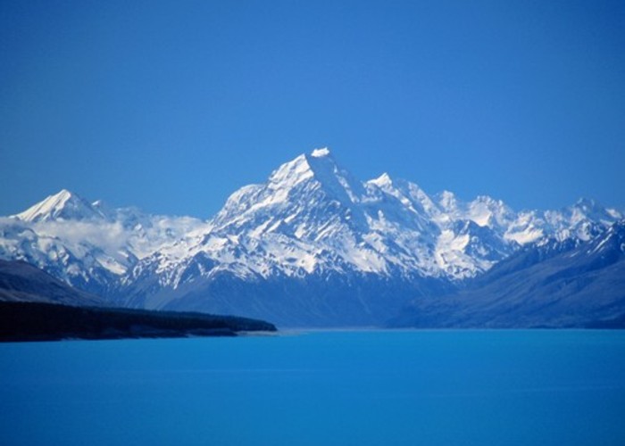
Further north, Aoraki / Mount Cook is New Zealand's highest peak at 3754m. A number of short walks are nearby, along with the more challenging Ball Pass and Copland Track.
The coastal rainforests of Westland include easy walks to the feet of Fox and Franz Josef Glaciers as well as the classic overnight walk to Welcome Flat Hot Pools.
|
Area
|
26,000 square kilometres |
|---|---|
|
Established
|
1990 |
|
Maps
|
NZTopo50-BX15
NZTopo50-CE07 NZTopo50-BZ12 NZTopo50-BY15 |
ID 8333
About this place
32 views in the past year (3 per month).