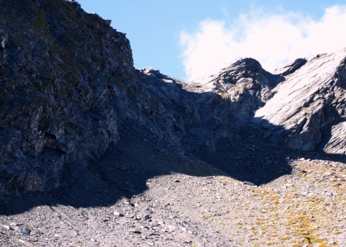
East Matukituki Cliff Route

Not a good picture of the route, but the best I have! The descent down starts in the sunny bit top centre of frame and zigzags down into the shade beneath. The handholdless gut is the V shaped cleft beneath and slightly to the right, with the sloping ledge just to the left above the gut. A much larger gut (more of a cliff really) is further to the right. The whole descent, about 2cm worth on this photo, is about 30m and takes about an hour for 2 people to get down due to falling rock. Whoever goes firs sets the pace for those higher up who cant move until the lower person is clear of the the inevitable rock shower.
Comments
-
andrew.s Of that 30m descent, we had no trouble scree sliding down to a snow pole 4m above the V-cleft in this photo. Then we hit the crux: a 4m drop down to the V-cleft with (to us) no useful handholds. You can't safely jump/tumble down this 4m section because the run-out is a further 15m slide down the V-cleft. Following others' advice, we had a 30m twin rope. Mike used the rope to rapelle to the top of the V-cleft then climbed down the true-left, outside of the V-cleft (about 6m with plenty of holds). Used the rope to slide our packs down the V-cleft, then I rappelled to top of V-cleft, recovered rope and clambered down the true-left route. We have no climbing (but many years tramping) experience so had sought advice and learned old-school (no harness or equipment) rapelling from youtube; it worked. Took us 1 hour from ridgeline to bottom of V-cleft. Going up would be trickier, I think. Note: this was a breeze compared to the fear generated when climbing the Waterfall Face several hours earlier.
13 February 2014
ID 5299
About this photograph
31 views in the past year (3 per month).
