Nearby
St Arnaud to Lewis Pass

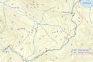
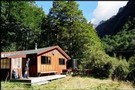
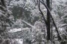
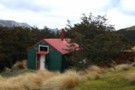
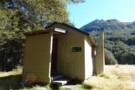
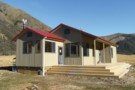
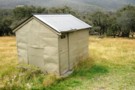
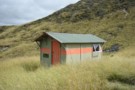
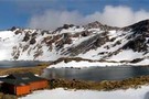
Blue Lake Hut - Bobs Hut
GPX file
•
Distance: 132m away
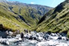
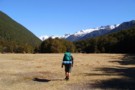
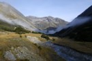
Blue Lake campsite to Bob’s Hut, via Lake Thompson and D’Urville Pass
An actual, recorded, gpx – the high route section ...
More ▶︎
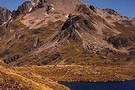
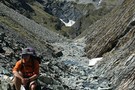
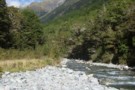
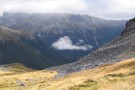
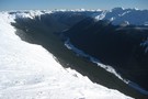
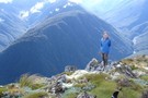
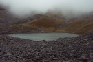
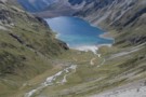
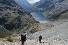
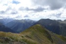
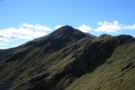
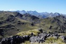
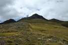
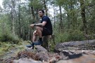
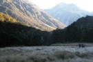
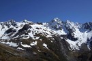
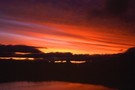
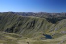
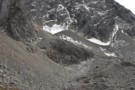
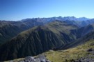
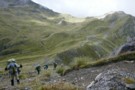
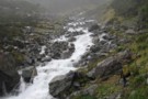
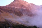
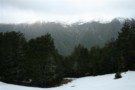
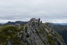
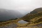
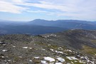
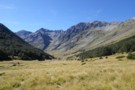
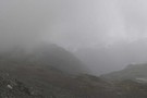
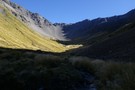
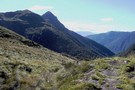
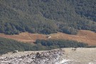
Waiau Pass towards Thompson Pass
Photograph
•
Distance: 202m away
Looking nearly due south towards Lake Thompson (blue horizontal strip above my head), a very prominent fault to its right ...
More ▶︎

St James Conservation Area
Place
•
Place. 781.96km2.
•
Distance: 203m away
A large new recreational area featuring tussock grasslands, and including the headwaters of the Waiau and Clarence Rivers.
More ▶︎
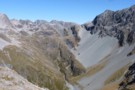
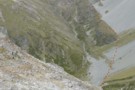
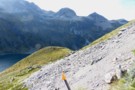
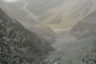
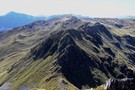
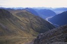
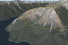
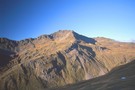
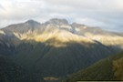
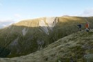
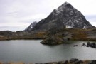
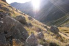
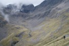
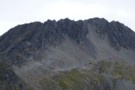
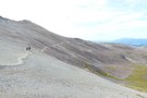
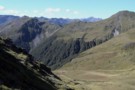
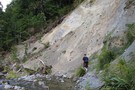
Thompson Pass & Sth Island Alpine Fault line
Photograph
•
Distance: 214m away
A view from Waiau Pass which clearly shows the alpine fault line as it heads south through Thompson Pass.
More ▶︎
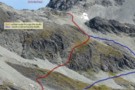
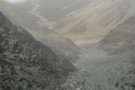
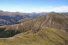
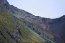
Thompson - D'Urville sidle
Photograph
•
Distance: 217m away
Cyan shows our actual route from Thompson Pass to D'Urville Pass. Red is Skiveoff's GPX route (downloadable from this website).
In ...
More ▶︎

Route Guide: St Arnaud to Lewis Pass
Article
•
Distance: 223m away
A 5-7 day north-south route from St Arnaud to the Lewis Pass, via Travers Pass, Waiau Pass, Thompson Pass and ...
More ▶︎
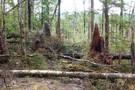
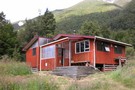
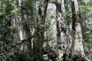
John Tait Hut
Photograph
•
Distance: 223m away
April 2010 - there is a large area of avalanche debris to the immediate right of this photo (out of ...
More ▶︎
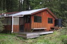
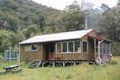
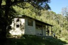
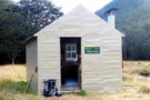
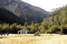
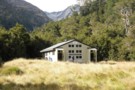
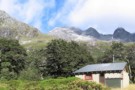
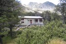
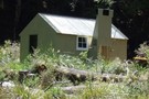
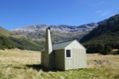
John Tait Hut
Hut
•
Serviced Hut (DOC). Capacity: 30.
•
Distance: 223m away
A good hut situated 5 hours easy walk from the head of Lake Rotoiti. Good views of Mt. Travers up ...
More ▶︎

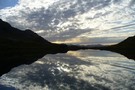
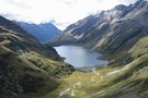
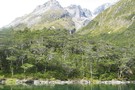
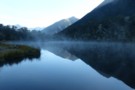
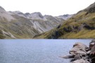
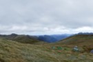
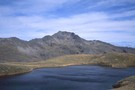
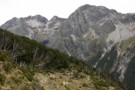
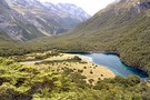
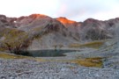
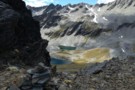
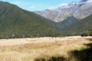
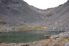
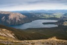
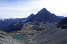
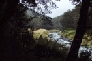
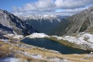
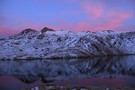
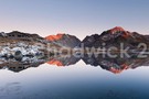
Lake Thompson
Photograph
•
Distance: 223m away
A view of the beautiful Lake Thompson, a short distance from Thompson Pass
More ▶︎
Nelson Lakes double figure eight with a reverse twist
Article
•
Distance: 277m away
January 2008.
A seven day epic up and over Lake Angelus from Speargrass Hut, then up the Sabine River, over Waiau ...
More ▶︎
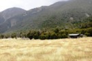
Waiau - Clarence Pass Lake Tennyson Circuit
Track
•
4 – 5 days. Medium/hard. Loop track.
•
Distance: 344m away
A challenging 4-5 day circuit in the St. James Conservation Area / Nelson Lakes National Park featuring two alpine pass ...
More ▶︎
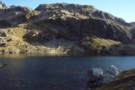
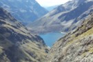
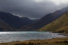
Lake Constance
Photograph
•
Distance: 344m away
Lake Constance, Nelson Lakes National Park. taken part way up to Waiau pass March 2003.
More ▶︎

Profile : St Arnaud - Lewis Pass
Photograph
•
Distance: 348m away
A useful profile of the 100km tramp - with a couple of bad weather alternatives :
1. low route past Speargrass ...
More ▶︎
St Arnaud - Lewis Pass
Article
•
Distance: 348m away
A 9-day 100km tramp via the Thompson, D'Urville and 3 Tarns Passes
Feb 2013
More ▶︎
Picton to Aspiring
GPX file
•
Distance: 358m away
An aborted alpine traverse. Picton to West Cape, but aborted at Aspiring due to real world emergencies back home. Posted ...
More ▶︎
Walking the length of the Richmond Ranges
Track
•
7 – 14 days. Medium/hard. One way.
•
Distance: 368m away
A 7-14 day walk along the spine of the Richmond Ranges. Alpine tops, crumbling ridgelines, untracked bush & scrub, boulders ...
More ▶︎
West Sabine Hut
Hut
•
Serviced Hut (DOC). Capacity: 34.
•
Distance: 394m away
Located in the West Branch of the Sabine River, south of Lake Rotoroa.
More ▶︎
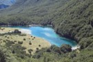
Blue Lake
Track
•
2 – 4 days. Easy/medium. Return via same track.
•
Distance: 394m away
Blue Lake is a small, pretty lake dammed by boulders at the head of the Sabine Valley. Beyond is Lake ...
More ▶︎
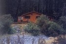
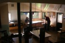
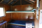
West Sabine Hut
Photograph
•
Distance: 394m away
April 2010 - small wood burner inside....but sufficient
More ▶︎
Sabine Valley - Blue Lake - D'Urville Valley
Track
•
4 – 5 days. Medium. Circuit.
•
Distance: 394m away
A circuit along neighbouring valleys at the hear of Lake Rotoroa, passing the picturesque Blue Lake, and crossing Moss Pass. ...
More ▶︎
Blue Lake Jan 2007
Photograph
•
Distance: 394m away
This was a 'rite-of-passage' tramp for my 13 year old son. We helicoptered in to the Waiau Pass and then ...
More ▶︎
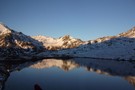
Lake Thompson
Photograph
•
Distance: 394m away
Lake Thompson, just below the Thompson Pass in the Nelson Lakes
More ▶︎
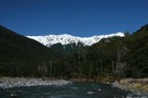
West Sabine River
Photograph
•
Distance: 404m away
West Sabine River, below West Sabine Hut, Nelson lakes
More ▶︎
Lewis Pass Lookout
Track
•
Easy. loop track.
•
Distance: 410m away
A loop track at Lewis Pass leading to a good view of the Cannibal Gorge.
More ▶︎
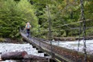
previous West Sabine bridge
Photograph
•
Distance: 427m away
washed away in 2012 and replaced with one just upstream of West Sabine hut
More ▶︎
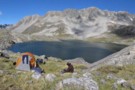
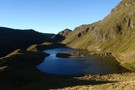
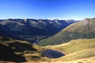
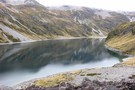
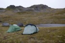
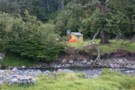
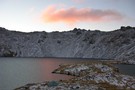
Lake Thompson, Nelson Lakes
Photograph
•
Distance: 434m away
A good summer camping spot at Lake Thompson in the Nelson Lakes. This lake is at 1700m, at the head ...
More ▶︎

Lake Thompson, Nelson Lakes
Photograph
•
Distance: 434m away
A good summer camping spot at Lake Thompson in the Nelson Lakes. This lake is at 1700m, at the head ...
More ▶︎
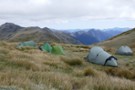
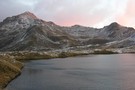
Lake Thompson Panorama
Photograph
•
Distance: 435m away
Making dinner at Lake Thompson, alpine upper Waiau River.
Just outside of Nelson Lakes National Park
More ▶︎
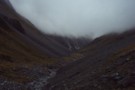
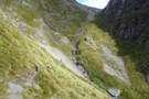
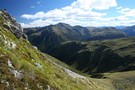
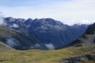
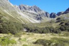
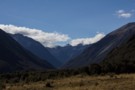
Descent from Lake Thompson
Photograph
•
Distance: 435m away
This is the route we took from our camp at the outlet of Lake Thompson down to the Waiau Valley ...
More ▶︎
Travers-Sabine
Track
•
4 – 7 days. Medium. Loop track with a road section.
•
Distance: 456m away
Two river valleys linked by a straightforward alpine saddle at 1800m
More ▶︎
Travers-Sabine Saddle
Photograph
•
Distance: 456m away
Going over the saddle looking west towards the Sabine Valley - April 2010.
More ▶︎
Route Guide: Richmond Ranges (west) main ridge
Article
•
Distance: 456m away
The main ridge of the western Richmond Ranges from Mt Riley, near Okamario on SH6 to the Red Hills above ...
More ▶︎
New Porters Creek Hut
Photograph
•
Distance: 456m away
moved to spot from right branch wairoa.
has beenlovingly restored with a new lick of 'rescue orange' paint and sports a ...
More ▶︎
Saint Arnaud
Place
•
Place.
•
Distance: 457m away
An alpine village on the shore of Lake Rotoiti in Nelson Lakes National Park.
More ▶︎

Te Araroa Trail
Track
•
95 days. Medium. One way.
•
Distance: 458m away
Te Araroa is a walking trail running the entire length of the North and South Islands. The trail opened 3 ...
More ▶︎
Pell Stream
Track
•
2 – 3 days. Medium. Loop track with a road section.
•
Distance: 469m away
This highly recommended valley not far from the highway west of the Lewis pass, is accessible to most people with ...
More ▶︎
St James Walkway
Track
•
5 days. Easy/medium. One way.
•
Distance: 492m away
A long and easy walk on St James Station near Lewis Pass. Beech forest, mountain scenery, farmland, wild horses, mud.
More ▶︎
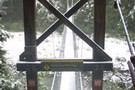
West Sabine Bridge
Photograph
•
Distance: 493m away
Feb 2013 - Just upstream from the hut, the new bridge was a pleasant surprise as the DOC website didn't ...
More ▶︎
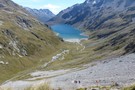
Lake Constance
Photograph
•
Distance: 527m away
above the loose scree section of the climb to Waiau Pass (looking to Lake Constance) - easier going from here
Feb ...
More ▶︎
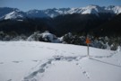
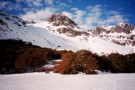
Alpine Tarn
Photograph
•
Distance: 536m away
early morning at Lewis Pass (start of the St James Walkway)
Feb 2013
More ▶︎
Travers Peak - Trovatore - Henry Saddle
Track
•
2 days. Medium. Loop track.
•
Distance: 537m away
An interesting circuit exploring the alpine tops around Lewis Pass.
More ▶︎
Lewis Pass tops
Photograph
•
Distance: 537m away
Looking toward Cannibal Gorge and the St James.
More ▶︎
Lewis Pass Tops
Track
•
Medium. Return by the same track.
•
Distance: 537m away
A superb track which provides quick access to the open tops of the Lewis Pass.
Allow around 1.5 hours to reach ...
More ▶︎
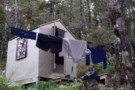
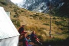
Lonely camper
Photograph
•
Distance: 612m away
The hut became rather full with a boy's school excursion. A (clever) tutor decided the nightlife outside may be quieter.
More ▶︎
Lewis Pass Tops
Photograph
•
Distance: 612m away
View of the Maruia River and Cannibal Gorge from Lewis Pass Tops
More ▶︎
Cannibal Gorge, Ada Pass
Track
•
2 days. Easy. Return via same track.
•
Distance: 612m away
An easy overnighter through the pretty bush of Cannibal Gorge and on to the alpine views of Ada Pass.
More ▶︎
Rolleston Pack Track
Track
•
Easy. One way.
•
Distance: 612m away
An old pack track near Lewis Pass. This is a pleasant forest walk, and an alternative to walking along the ...
More ▶︎
Tarn Nature Walk
Track
•
Easy. loop track.
•
Distance: 612m away
A nature trail exploring the wetland plants on Lewis Pass
More ▶︎
Boyle Flats Hut
Photograph
•
Distance: 612m away
Perched high on a river terrace, accessed from a swingbridge 'on the Boyle'.
More ▶︎
Exploring Lewis Pass
Article
•
Distance: 612m away
There is a good range of tracks and routes around Lewis Pass to suit all abilities. Here is a selection ...
More ▶︎
Ada Cullers Hut
Photograph
•
Distance: 612m away
Tidy old shack provides shelter and shade from the elements. No mattresses or water supply.
More ▶︎
St James Walkway June 2009
Photograph
•
Distance: 612m away
Gloriana and the Faerie Queene, on a brilliant winter's day.
More ▶︎
Lewis Tops
Article
•
Distance: 613m away
A light hearted trip report up onto the Lewis Tops, Lewis Pass in winter.
More ▶︎
Lewis Pass National Reserve
Place
•
Reserve. 182.95km2.
•
Distance: 613m away
A small park occupying the forested valleys around Lewis Pass and bordering Lake Sumner and Victoria Forest Parks as well ...
More ▶︎
Nelson Lakes - Lakehead, Angelus and Speargrass Circuit
GPX file
•
Distance: 619m away
From St Arnaud along Lake Rotoiti to Lakehead Hut, then crossing the Travers River and via the Cascade Track to ...
More ▶︎
Gibbs Walk
Track
•
Easy. One way.
•
Distance: 687m away
Short link track betweem St Arnaud village and campground.
More ▶︎
Kerr Bay campsite
Campsite
•
Basic Campsite (DOC). 21 spaces.
•
Distance: 731m away
Grassy lakeside camping surrounded by a wealth of walking options, from short walks to alpine tops trips and multi-day tramps. ...
More ▶︎
Black Valley Walk
Track
•
Easy. One way.
•
Distance: 760m away
Link track between St Arnaud village and the campground.
More ▶︎
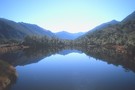
Lake Rotoiti
Photograph
•
Distance: 782m away
from the shore of St Arnaud, looking to the head of the lake and up the Travers Valley - Apr ...
More ▶︎
Loop Track, Lake Rotoiti
Track
•
Easy. Loop track.
•
Distance: 805m away
A short walk through the Rotoiti Nature Recovery Project at St Arnaud. Lakeside beech forest.
More ▶︎
Honeydew Walk, Lake Rotoiti
Track
•
Easy. Loop track.
•
Distance: 805m away
This short loop leads into the edges of the Rotoiti Nature Recovery Project area, a "mainland island" with pest numbers ...
More ▶︎
W Matakitaki - Ada Pass Hut
GPX file
•
Distance: 822m away
Treeline in West Matakitaki Valley to Ada Pass Hut, via 3 Tarns Pass
An actual, recorded, gpx – the only thing ...
More ▶︎
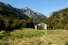
Ada Pass Hut
Photograph
•
Distance: 884m away
20-bunker nested into the bush edge with excellent sub-apline vista from the balcony.
More ▶︎
Ada Pass Hut
Hut
•
Serviced Hut (DOC). Capacity: 20.
•
Distance: 884m away
Ada Pass Hut (sleeps 14 on platform beds, matresses, stove, tank & river water) is a large, comfortable two-room hut ...
More ▶︎
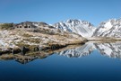
Lake Constance, Nelson Lakes
Photograph
•
Distance: 1.1km away
Lake Constance in the Nelson Lakes, viewed from the Waiau Pass
More ▶︎
Thompson Pass
GPX file
•
Distance: 1.1km away
Caroline Creek Hut, Upper Waiau Valley to East Matakitaki Hut via Thompson Pass & Unamed Pass
More ▶︎
Thompson Pass
GPX file
•
Distance: 1.1km away
Caroline Creek Hut, Upper Waiau Valley to East Matakitaki Hut via Thompson Pass & Unamed Pass
More ▶︎
Upper D'Urville valley
Photograph
•
Distance: 1.1km away
Upper D'Urville valley, descending from Thompson Pass towards D'Urville Hut. Nelson Lakes.
More ▶︎
Nelson Lakes National Park
Place
•
National Park. 1017.53km2.
•
Distance: 1.4km away
An alpine park of beech forests, valleys, and glacial lakes, offering some relatively easy walking. Established in 1956. Highest point: ...
More ▶︎
descent to the head of Lake Constance
Photograph
•
Distance: 1.5km away
after sidling across tussock grass, the descent from the bluff above the lake is pretty much tracked - and poled ...
More ▶︎
Travers Falls
Place
•
Place.
•
Distance: 1.5km away
The whole of the Travers River funnels through this narrow slit - must be awesome after heavy rain.
About 1km upstream ...
More ▶︎
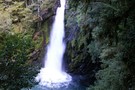
Travers Waterfall
Photograph
•
Distance: 1.5km away
a 15m fall - just a few minutes off the main Travers track (sign-posted) - Apr 2011
More ▶︎
Sidling above Lake Constance
Photograph
•
Distance: 1.7km away
recent discussion about the track above Lake Constance (Campfire forum, Lake Constance - Waiau Pass Safety topic) has prompted me ...
More ▶︎
Lake Constance
Photograph
•
Distance: 1.7km away
From the ascent to Waiau Pass.
Looking down the West Sabine valley.
More ▶︎
Lake Constance
Photograph
•
Distance: 1.7km away
Looking south across the lake to Waiau Pass. The southern end of the lake is dammed by an ancient, massive ...
More ▶︎
Lewis Tops
Track
•
1 – 2 days. Medium. Return by the same track.
•
Distance: 1.7km away
A short climb onto the tops at Lewis Pass, providing panoramic views of the area. With camping on the valley ...
More ▶︎
Anglers Walk, Lake Rotoiti
Track
•
Easy. One way.
•
Distance: 1.7km away
This track follows the first 2km of the Buller River from its source at Lake Rotoiti. It is well used ...
More ▶︎
Lake Constance
Photograph
•
Distance: 1.8km away
View down to Lake Constance from Waiau Pass
More ▶︎
D'Urville Pass
Photograph
•
Distance: 1.9km away
an easier route (red) to D'Urville Pass
Feb 2013
More ▶︎

Upper Waiau Uwha River
Photograph
•
Distance: 2.0km away
Having descended from Waiau Pass, the photo is looking upstream to the start of the climb up the fault line ...
More ▶︎
East Matakitaki Hut
Photograph
•
Distance: 2.0km away
beside the river and at the southern end of the flats, we found this 6-berth hut in great condition
Feb 2013
More ▶︎
East Matakitaki Hut
Hut
•
Standard Hut (DOC). Capacity: 6.
•
Distance: 2.0km away
East Matakitaki Hut (6 bunk, matresses, fireplace, creek water) lies on river flats in the upper Matakitaki valley (east branch). ...
More ▶︎
East Matakitaki Hut
Photograph
•
Distance: 2.0km away
East Matakitaki Hut in the east branch of the Matakitaki Valley.
More ▶︎
Lewis tops
Photograph
•
Distance: 2.2km away
Panorama (click to see the whole pic) from near SH1535, looking along the tops to the descent to Lewis Pass.
The ...
More ▶︎
Lewis Tops camping
Photograph
•
Distance: 2.3km away
2 small tarns and a shallow gully to provide good shelter make for a good campsite, after reaching the Lewis ...
More ▶︎
Lewis Tops camping 3
Photograph
•
Distance: 2.3km away
Panorama with Mt Technical & the Apprentice as backdrop to the Lewis Tops - just past pt 1561, 2 small ...
More ▶︎
Lewis Tops camping 2
Photograph
•
Distance: 2.3km away
2 small tarns and a shallow gully to provide good shelter make for a good campsite, after reaching the Lewis ...
More ▶︎
East Matakitaki Valley from David Saddle
Photograph
•
Distance: 2.3km away
East Matakitaki Valley from David Saddle, Nelson Lakes
More ▶︎
East Matakitaki from David Saddle
Photograph
•
Distance: 2.3km away
East Matakitaki valley from David Saddle
More ▶︎
Lake Constance
Photograph
•
Distance: 2.4km away
from the bolder field above the lake, near the track to Waiau Pass - Apr 2011
More ▶︎
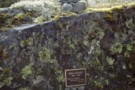
Max Smart memorial plaque, Matakitaki valley
Photograph
•
Distance: 2.5km away
Memorial plaque to Max Smart on the true left of the Matakitaki upriver of the East Matakitaki Hut. The quote ...
More ▶︎
Tarn, Trovatore
Photograph
•
Distance: 2.5km away
Comfortable camping just east of Trovatore.
More ▶︎
Travers Peak from Trovatore
Photograph
•
Distance: 2.5km away
The ridgeline between Travers and Trovatore is rough.
More ▶︎
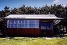
Cupola basin Hut
Photograph
•
Distance: 2.8km away
A snow covered Cupola Basin Hut visited on 6th and 7th July 2008.Stunning views of the surrounding mountains make the ...
More ▶︎
Cupola Basin Hut
Photograph
•
Distance: 2.8km away
Walked in from St. Arnaud and stayed overnight April 2002, as part of the popular Travers/Sabine circuit. I must have ...
More ▶︎
Cupola basin Hut
Hut
•
Standard Hut (DOC). Capacity: 8.
•
Distance: 2.8km away
A hut on the bushline with great views, well worth the up-hill grunt to get there.Even more spectacular when visited ...
More ▶︎
Blue Lake, Nelson Lakes
Photograph
•
Distance: 2.8km away
Blue Lake in the Nelson lakes. Viewed from the moraine wall below Lake Constance.
More ▶︎
Deer Valley Campsite
Campsite
•
Informal campsite (DOC). 10 spaces.
•
Distance: 3.0km away
A minimal roadside camping area near Lewis Pass. Water is available from the nearby stream. Foleys Creek and Rolleston Pack ...
More ▶︎
Mt Franklin
Photograph
•
Distance: 3.0km away
taken on the descent from Travers Pass into the E Sabine River - Apr 2011
More ▶︎
Trovatore Peak
Photograph
•
Distance: 3.0km away
The ridge to Trovatore Peak from Travers peak
More ▶︎
Top of Travers Peak
Photograph
•
Distance: 3.0km away
View north from Travers Peak towards Gloriana Peak and the Fairie Queen
More ▶︎
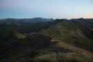
Libretto Range
Photograph
•
Distance: 3.0km away
View south along Libretto Range from Travers Peak
More ▶︎
Foleys Creek Track - Travers Peak
Track
•
1 day. Medium. Return via same track.
•
Distance: 3.0km away
A poled route to the summit of Travers Peak near Lewis Pass
More ▶︎
Blue Lake
Photograph
•
Distance: 3.0km away
Tiny Blue Lake viewed from the track to Lake Constance.
More ▶︎
Lewis Tops from Travers Peak
Photograph
•
Distance: 3.1km away
Lewis Tops and Mount Technical are in the distance. The spur southwest of Trovatore is closer, and the northern slopes ...
More ▶︎
Upper D'Urville bivi
Hut
•
Basic Hut/Bivvy (DOC). Capacity: 2.
•
Distance: 3.3km away
2 bunk no toilet just a shovel. good base for hunting welcome shelter or last stop before david saddle before ...
More ▶︎
Cannibal Gorge Hut
Hut
•
Serviced Hut (DOC). Capacity: 20.
•
Distance: 3.4km away
The first hut on the western end of the St James Walkway.
More ▶︎
Cannibal Gorge Hut
Photograph
•
Distance: 3.4km away
Cannibal Gorge Hut is the first hut on the St James walkway from the Lewis Pass end
More ▶︎
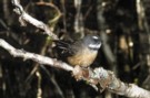
Fantail
Photograph
•
Distance: 3.4km away
Fantail near Cannibal Gorge Hut on the Saint James Walkway
More ▶︎
Cannibal Gorge Hut
Photograph
•
Distance: 3.4km away
Cannibal Gorge Hut is the first hut on the St James walkway from the Lewis Pass end. Sleeps 20. Nice ...
More ▶︎
Frosty Morning Maruia River
Photograph
•
Distance: 3.4km away
Trampers on a frosty morning in the upper Maruia River near Cannibal Gorge.
More ▶︎
The Maruia Valley from the Lewis Tops
Photograph
•
Distance: 3.5km away
Springs Junction and Mount Haast in the distance
More ▶︎
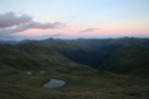
South side of 3 Tarns Pass
Photograph
•
Distance: 3.5km away
campsite and tarn as sunset approaches
Feb 2013
More ▶︎
Mt Hopeless 2278m Nov 2012
Photograph
•
Distance: 3.5km away
This picture of Mt Hopeless 2278m was taken on a perfect morning from a knob above the Cupola Basin hut. ...
More ▶︎
Paddy's Pinchgut circuit
Track
•
Easy. Loop track.
•
Distance: 3.5km away
Mt Robert carpark to carpark via Paddy Track, Bushline hut, Relax Shelter and Pinchgut track - 4 hours. 575m up ...
More ▶︎
Paddy's Pinchgut circuit
Photograph
•
Distance: 3.5km away
Great morning or afternoon walk with great lake and mountain views.
More ▶︎
Caroline Creek Bivvy
Hut
•
Basic Hut/Bivvy (DOC). Capacity: 2.
•
Distance: 3.5km away
A nice little bivvy with 2 canvas bunks and an open fire
More ▶︎
Blue Lake
Photograph
•
Distance: 3.5km away
considering the grey skies at the time, Blue Lake lives up to the name - and throws in some irridescent ...
More ▶︎
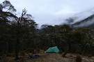
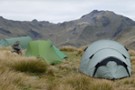
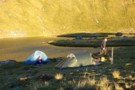
Blue Lake campsite
Photograph
•
Distance: 3.6km away
nestled in and around a clump of trees, in front of the lake - Feb 2013
More ▶︎
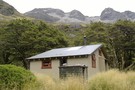
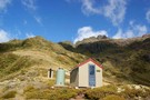
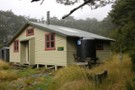
Blue Lake Hut
Hut
•
Serviced Hut (DOC). Capacity: 16.
•
Distance: 3.6km away
Located beside tiny Blue Lake at the head of the Sabine Valley. West, Moss Pass leads to the D'Urville Valley. ...
More ▶︎
Blue Lake Hut
Photograph
•
Distance: 3.6km away
This hut is located next to the cold but pretty Blue Lake just north of Waiau Pass.
More ▶︎
Drying Out
Photograph
•
Distance: 3.6km away
Got drenched on the way up to Blue Lake Hut.
Tried to dry out once we'd gotten the stove alight.
More ▶︎
Blue Lake Hut Panorama
Photograph
•
Distance: 3.6km away
Taken outside Blue Lake Hut, Nelson Lakes NP.
Moss Pass is up there somewhere, but our route was past Lake Constance ...
More ▶︎
Blue Lake Hut
Photograph
•
Distance: 3.6km away
popular in season, this is a busy spot - although there is always floor-space at least, a tent is highly ...
More ▶︎
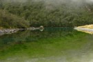
Blue Lake
Photograph
•
Distance: 3.6km away
at the outlet end, the greens of Blue Lake dominate - considering the mists hovering above, the colour is indeed ...
More ▶︎
Zampa Lake
Photograph
•
Distance: 3.7km away
2 hectare lake under Zampa Peak.Idyllic campsite at 1450m
More ▶︎
Zampa Kampas
Photograph
•
Distance: 3.7km away
a campsite beside Zampa Lake.300m under & east of Zampa herself.
More ▶︎
Head of the Henry River
Photograph
•
Distance: 3.7km away
Between Trovatore and Henry Saddle.
More ▶︎
3 Tarns Pass
Photograph
•
Distance: 3.9km away
from the Pass, looking back to the 3 tarns
the better camping is on the south side of the pass
Feb 2013
More ▶︎
Philosophers Knob
Photograph
•
Distance: 3.9km away
from the tarn below Zampa Peak (March 2020).
Main access route is up (500m) an unnamed stream from Maruia River (right ...
More ▶︎
Phil and Lori at Travers Saddle
Photograph
•
Distance: 4.0km away
A couple of American trampers I met back in 06. Soon after this crossing we got hit by a bit ...
More ▶︎
Phil and Lori at Travers Saddle
Photograph
•
Distance: 4.0km away
A couple of American trampers I met back in 06. Soon after this crossing we got hit by a bit ...
More ▶︎
Travers Pass
Photograph
•
Distance: 4.2km away
final ascent to Travers Pass - Mt Travers in the background - Apr 2011
More ▶︎
Three Tarns, Three Tarns Pass
Photograph
•
Distance: 4.2km away
Three Tarns, Three Tarns Pass - at the head of the West Matakitaki Valley
More ▶︎
Zampa panorama
Photograph
•
Distance: 4.2km away
180 panorama from the tarn below Zampa
(click the photo to see the whole thing)
(L to R) : Zampa tops, Philosophers ...
More ▶︎
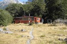
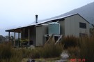
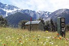
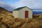
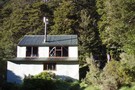
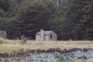
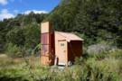
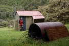
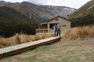
Bob's Hut
Photograph
•
Distance: 4.3km away
First view of Bob's Hut across the grassy flat (in the middle of the photo at the treeline - it ...
More ▶︎
Upper Travers Hut
Photograph
•
Distance: 4.3km away
Upper Travers Hut with Travers Pass beyond, Nelson Lakes
More ▶︎
Bushline Hut
Hut
•
Standard Hut (DOC). Capacity: 14.
•
Distance: 4.3km away
A cute hut with a grand outlook over Lake Rotoiti and down to St Arnaud. Loo with a view!
More ▶︎
Rainbow Pass
Photograph
•
Distance: 4.4km away
looking across the tarn, the climb to the top of the pass is steeper than it looks in this photo ...
More ▶︎
Lewis tops
Photograph
•
Distance: 4.5km away
climbing up to the tops with Mt Technical (left) and the Apprentice (right) behind - Feb 2018
More ▶︎
Kea hut
Hut
•
Private hut (NA).
•
Distance: 4.5km away
An older but lovingly restored hut in the Mt Robert area of Nelson Lakes National Park. This hut is only ...
More ▶︎
Kea hut Nov 2012
Photograph
•
Distance: 4.5km away
An older but lovingly restored hut in the Mt Robert area of Nelson Lakes National Park. This hut is only ...
More ▶︎
Rainbow Tarn
Photograph
•
Distance: 4.5km away
the tarn below Rainbow Pass, looking to Mt Travers - Apr 2011
More ▶︎
St Arnaud Range Track
Track
•
1 day. Medium. Return by the same track.
•
Distance: 4.6km away
This walk climbs steadily through beech forest to a height of over 1650 metres.
Above the bushline (at 1400 m), ...
More ▶︎
The hills are alive
Photograph
•
Distance: 4.6km away
Walking from West Sabine Hut to Blue Lake, the heavens opened and the mountainside just came alive, sprouting waterfalls all ...
More ▶︎
Travers Pass
Photograph
•
Distance: 4.6km away
beginning of the climb to Travers Pass, looking down the Travers Valley - Apr 2011
More ▶︎
Relax Shelter
Hut
•
Shelter (DOC).
•
Distance: 4.6km away
Basic shelter on Robert Ridge (Mt Robert, Nelson Lakes National Park)
More ▶︎
Relax Shelter Nov 2012
Photograph
•
Distance: 4.6km away
On the Pinchgut track Mt Robert close to the junction with Paddys track and the Robert Ridge route.
More ▶︎
West Matakitaki Valley
Photograph
•
Distance: 4.7km away
traveling up the valley to 3 Tarns, it's easiest to keep to the river until the last push to the ...
More ▶︎
Parachute Rocks Track
Photograph
•
Distance: 4.8km away
View of Lake Rotoiti from point 1738
More ▶︎
Lake Sumner Conservation Park
Place
•
Conservation Park. 1057.71km2.
•
Distance: 4.9km away
Lakes and forested hills in this sprawling park provide good tramping, and contrast with the rugged alpine environment of Arthur's ...
More ▶︎
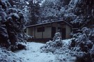
Hopeless Creek Hut
Hut
•
Standard Hut (DOC). Capacity: 6.
•
Distance: 5.0km away
An older , little used hut off the Travers Valley leading to Sunset Saddle and Angelus Hut.
More ▶︎
Hopeless Hut
Photograph
•
Distance: 5.0km away
A six bunk hut situated near Hopeless Creek, which is a tributary of the Travers River. The lower story is ...
More ▶︎
Travers Pass
Photograph
•
Distance: 5.0km away
Looking down onto Travers Pass from Rainbow Pass. The main track is on the far side.
More ▶︎
Rainbow Pass from the south
Photograph
•
Distance: 5.0km away
Rainbow Pass: a steep, tricky pass with serious exposure. I took the green route shown ... the red may, or ...
More ▶︎
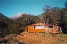
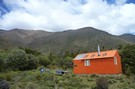
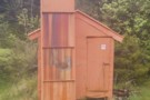
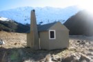
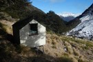
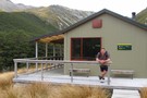
Bob's Hut
Photograph
•
Distance: 5.1km away
Bob's Hut, located in wide valley flats on the west branch of the Matakitaki River.
More ▶︎
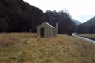
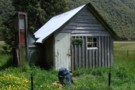
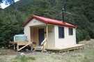
Bob's Hut
Hut
•
Standard Hut (DOC). Capacity: 8.
•
Distance: 5.1km away
Bob was to be absent when I arrived - though a cross outside hints at possible reasons. Hut book entries ...
More ▶︎
Clarence Pass
Photograph
•
Distance: 5.1km away
Climbing towards Clarence Pass from the East Branch of the Sabine River.
More ▶︎
Upper Travers Basin
Photograph
•
Distance: 5.2km away
The pot belly stove in the new hut at Upper Travers got a strong workout in the winter of 2004. ...
More ▶︎
Mt Travers
Photograph
•
Distance: 5.2km away
Mt Travers from Upper Travers Hut - 2338m - Apr 2011
More ▶︎
Upper Travers Hut
Hut
•
Serviced Hut (DOC). Capacity: 24.
•
Distance: 5.2km away
The original hut has been replaced by a larger hut. The new hut is in the shelter of the trees ...
More ▶︎
Mueller Tarn Track
Track
•
Easy/medium. Return via same track.
•
Distance: 5.6km away
A steep but easy climb to a pretty alpine tarn near Lewis Pass
More ▶︎
Downies Hut
Hut
•
Basic Hut/Bivvy (DOC). Capacity: 4.
•
Distance: 5.6km away
Historic hut on the Matakitaki River, dating back to 1902 or earlier. The hut is perhaps the second oldest in ...
More ▶︎
Snow hole lunch
Photograph
•
Distance: 5.6km away
Taking refuge in a snow hole for lunch during a white out on the Lewis Tops, Lewis Pass.
More ▶︎
Lewis Tops from Mueller Tarn
Photograph
•
Distance: 5.6km away
This is the view south across the valley.
More ▶︎
Mueller Tarn
Photograph
•
Distance: 5.6km away
A snowy tarn just above the treeline near Maruia Springs.
More ▶︎
Apprentice tarns
Photograph
•
Distance: 5.6km away
our camp under the Apprentice - hoping for some shelter from the approaching cyclone Gita but it was a restless ...
More ▶︎
Morgan Hut
Photograph
•
Distance: 5.9km away
Morgan Hut on the D'Urville River. 10 bunks and lots of sandflies.
More ▶︎
Morgan Hut
Hut
•
Standard Hut (DOC). Capacity: 10.
•
Distance: 5.9km away
Located on the D'Urville River south of Lake Rotoroa.
More ▶︎
Morgan Hut
Photograph
•
Distance: 5.9km away
The new hut, about 1km further up from the old site.
More ▶︎
Downie Hut
Hut
•
Basic Hut/Bivvy (DOC). Capacity: 4.
•
Distance: 6.1km away
Downie Hut is an old board and batten hut with a large open fire place. The original shingle roof now ...
More ▶︎
Lucretia
Photograph
•
Distance: 6.1km away
with cyclone Gita approaching (blowing from right to left and just able to stand against it), we were taking it ...
More ▶︎
Tarns on range south of Mt Misery
Photograph
•
Distance: 6.2km away
Tarns below pt1609, rapidly losing their emerald colour as mist sets in..
Nearly at the end of a long climb ...
More ▶︎
Waiau Hut
Hut
•
Standard Hut (DOC). Capacity: 6.
•
Distance: 6.3km away
New hut on the Waiau Pass Track and Te Araroa Trail. This hut was opened 27 January 2018, and constructed ...
More ▶︎
Freyberg Range, Pell Stream
Article
•
Distance: 6.4km away
A 3 day trip, climbing up onto the range to go over Mt Mueller and camp. Followed by a descent ...
More ▶︎
George Lyon Hut
Photograph
•
Distance: 6.4km away
George Lyon Hut on the D'Urville River is a 16 bunk DoC hut. The hut is divided into 2 rooms ...
More ▶︎
George Lyon Hut
Hut
•
Standard Hut (DOC). Capacity: 16.
•
Distance: 6.7km away
Formerly Ella Hut, located on the D'Urville River.
More ▶︎
Anne Cullers Hut
Hut
•
Basic Hut/Bivvy (DOC). Capacity: 4.
•
Distance: 6.7km away
Viewed across the Anne River. A newer, larger hut was adjacent to this old timer but burned down in Jul ...
More ▶︎
Lucretia Hut
Hut
•
Basic Hut/Bivvy (DOC). Capacity: 2.
•
Distance: 6.7km away
Very basic 2 bunk hut with open fire in the head of Lucretia Stream, Lewis Pass area
More ▶︎
Lucretia biv
Photograph
•
Distance: 6.8km away
inside the biv - basic but welcome in bad weather - Feb 2018
More ▶︎
Lucretia biv
Photograph
•
Distance: 6.8km away
a good lunch stop on the route to the tops - Feb 2018
More ▶︎
Lucretia Hut Route
Track
•
1 day. Easy/medium. Return by the same track.
•
Distance: 6.8km away
Lucretia biv via Nina Valley
More ▶︎
Mt Technical
Photograph
•
Distance: 6.9km away
south-west face, from the saddle SW of Lucretia - Feb 2018
More ▶︎
New Anne River Hut
Photograph
•
Distance: 7.0km away
The new Anne River Hut on the St James Walkway nearing completion on March 17th 2011. The hut replaces the ...
More ▶︎
Anne Hut
Hut
•
Serviced Hut (DOC). Capacity: 20.
•
Distance: 7.0km away
The new Anne Hut replaces the hut that burned down in July 2010, and opened 18 February 2012. This hut ...
More ▶︎
West Matakitaki valley
Photograph
•
Distance: 7.1km away
West Matakitaki valley, heading from Bob's Hut to Three Tarn Pass
More ▶︎
D'Urville windfall
Photograph
•
Distance: 7.3km away
This is a little bit of the windfall on the D'Urville track between D'Urville Hut and Morgan Hut. It may ...
More ▶︎
Molesworth Recreation Reserve
Place
•
Reserve. 1807.87km2.
•
Distance: 7.3km away
An iconic high country station located behind the Kaikoura Ranges.
More ▶︎
Begley Hut
Hut
•
Standard Hut (DOC). Capacity: 8.
•
Distance: 7.3km away
An old NZ Forest Service hut up the Begley Valley. Fire doesn't draw well and door has to be left ...
More ▶︎
Begley Hut
Photograph
•
Distance: 7.3km away
An old NZ Forest Service hut up the Begley Valley. Fire doesn't draw well and door has to be left ...
More ▶︎
Upper Glenroy Hut [Removed]
Hut
•
Removed!
•
Distance: 7.3km away
Hut located on the upper Glenroy River. Removed about 2005.
More ▶︎
Mount Richmond Forest Park
Place
•
Conservation Park. 1660.00km2.
•
Distance: 7.4km away
A wedge of land at the base of the Marlborough Sounds, south of Nelson and north of the Wairau River, ...
More ▶︎
Robert Ridge
Photograph
•
Distance: 7.4km away
looking down the ridge from Flagtop - Apr 2011
More ▶︎
Pell Stream hut Dec 2008
Photograph
•
Distance: 7.5km away
We visited this hut as a day trip from the Marble Hill camping area.
It seemed a good comfortable hut with ...
More ▶︎
Pell Stream hut August 2011
Photograph
•
Distance: 7.5km away
Neil B & I recently visited this hut. There have been some track improvements since I was last there. Hut ...
More ▶︎
Pell Stream Hut
Hut
•
Basic Hut/Bivvy (DOC). Capacity: 4.
•
Distance: 7.5km away
Small hut at the end of the Pell Stream Track.
More ▶︎
Nelson Lakes - Angelus to Sunset Saddle
GPX file
•
Distance: 7.9km away
Route marked by cairns from Angelus Hut to Sunset Saddle. (The first part of the route to Hopeless Creek and ...
More ▶︎
Christopher Hut
Hut
•
Serviced Hut (DOC). Capacity: 14.
•
Distance: 8.0km away
Christopher hut.
More ▶︎
Coldwater hut
Hut
•
Standard Hut (DOC). Capacity: 12.
•
Distance: 8.0km away
A concrete hut with 12 bunks. When I was there during the Summer the fire had been removed to prevent ...
More ▶︎
Coldwater Hut
Photograph
•
Distance: 8.0km away
The hut, from the Lakehead jetty, looking across Lake Rotoiti - Apr 2011
More ▶︎
Tarns and Brass Monkey biv Dec 2011
Photograph
•
Distance: 8.1km away
This pic shows a couple of the tarns near the biv. The biv, an ex NZFS one, is in a ...
More ▶︎
Brass Monkey Bivouac
Hut
•
Basic Hut/Bivvy (DOC). Capacity: 2.
•
Distance: 8.2km away
A basic 2 bunk bivvy on the Lewis Tops
More ▶︎
Ada Cullers Hut
Photograph
•
Distance: 8.2km away
Ada Cullers Hut is an historic Hut about 15 minutes from Christopher Hut on the St James Walkway. 4 bunks
More ▶︎
Ada Cullers Hut
Hut
•
Basic Hut/Bivvy (DOC). Capacity: 4.
•
Distance: 8.3km away
Christopher (Ada) Cullers Hut.
More ▶︎
Rokeby Hut
Hut
•
Basic Hut/Bivvy (DOC). Capacity: 3.
•
Distance: 8.3km away
Hidden on a high bench above the Boyle River. Three canvas bunks, 2 cute seats and a woodstove make for ...
More ▶︎
Paske Hut
Hut
•
Standard Hut (DOC). Capacity: 6.
•
Distance: 8.3km away
Hut in the headwaters of Paske Creek, beneath the St Arnaud Range. Passes beyond the hut lead into the head ...
More ▶︎
Rokeby Hut
Photograph
•
Distance: 8.4km away
Rokeby Hut is an old cullers hut about 1 hour upstream from the Boyle Flats Hut. Three canvas bunks and ...
More ▶︎
Paske Hut
Photograph
•
Distance: 8.4km away
Paske Hut and the towering walls of the head basin beyond. The two valley cutting left lead to the Paske-Clarence ...
More ▶︎
Lakehead Hut
Hut
•
Standard Hut (DOC). Capacity: 28.
•
Distance: 8.5km away
A large modern hut. Lots of sandflies. Note that access to Coldwater Hut across the valley is either a 2-3 ...
More ▶︎
Lakehead hut
Photograph
•
Distance: 8.5km away
Lakehead hut close to Lake Rotoiti in Nelson Lakes National Park
More ▶︎
Pell Stream
Photograph
•
Distance: 8.6km away
open travel just above the second gorge section (going up)
More ▶︎
Christopher Hut
Photograph
•
Distance: 8.6km away
Christopher Hut on the Ada River. Part of the Saint James Walkway
More ▶︎
Mount Misery Hut
Hut
•
Basic Hut/Bivvy (DOC). Capacity: 4.
•
Distance: 8.6km away
Mount Misery hut
More ▶︎
Over the Sabine River
Photograph
•
Distance: 8.7km away
First bridge after Sabine Hut, I think
More ▶︎
Bull Paddock Creek Track
GPX file
•
Distance: 8.8km away
GPS file of track from Bull Paddock Creek Biv to the Wairau River
More ▶︎
Bull Paddock Creek Track
Track
•
1 – 3 days. Medium. Return by the same track.
•
Distance: 8.8km away
Access To Bull Paddock Creek Biv from The Wairau river, this track follows Sand Fly Stream before dropping Bull Paddock ...
More ▶︎
Robert Ridge
Photograph
•
Distance: 8.8km away
looking NE along the ridge - in good weather, the views are expansive.
More ▶︎
Robert Ridge in the Rain
Photograph
•
Distance: 8.9km away
On our last day, we decided to walk out from Speargrass Hut via Robert Ridge (to avoid retracing our walk ...
More ▶︎
Maling Pass to Lake Guyon
GPX file
•
Distance: 9.0km away
From Lake Tennyson, cross Maling Pass into the deep Waiau Valley, then turn off to Lake Guyon.
More ▶︎
Maling Pass to Lake Guyon junction
GPX file
•
Distance: 9.0km away
Northernmost section of the St James Cycle Trail
More ▶︎
Hinapouri Tarn
Photograph
•
Distance: 9.2km away
looking across the tarn into the Hukere Stream/Valley (through which the Cascade track runs)
More ▶︎
Wairau-Paske saddle
Photograph
•
Distance: 9.5km away
The saddle at the head of the Wairau, crossing into the Paske. Tiring climbing on loose scree, but a non-technical ...
More ▶︎
Burn Ck Bivvy
Photograph
•
Distance: 9.5km away
A basic 2 bunk bivvy that has seen better days.
Burn ck is fairly tight and gorgey with plenty of sidling ...
More ▶︎
Burn Creek Hut
Hut
•
Basic Hut/Bivvy (DOC). Capacity: 2.
•
Distance: 9.5km away
The little hut with a steep-pitched roof is located just under the Emily Peaks next to some beech forest. Given ...
More ▶︎
Waiau Valley
Photograph
•
Distance: 9.5km away
The view up toward Waiau Pass from beneath Maling Pass. The Waiau Pass is up to the left.
More ▶︎
Lake Daniels to Lake Rotoroa
GPX file
•
Distance: 9.6km away
Route tracing of Alternate route from the Lewis Pass to St Arnaud
More ▶︎
Sunset over Lake Angelus
Photograph
•
Distance: 9.7km away
An awesome day and evening, taken May 2011.
More ▶︎
Lake Angelus at Sunset
Photograph
•
Distance: 9.7km away
looking towards Bristol Pass, some hardy campers in front of the Angelus Hut - Apr 2011
More ▶︎
Angelus Peak
Photograph
•
Distance: 9.7km away
evening light on the Angelus Peak (2075m), looking across the lake - Sunset Saddle is in the middle of the ...
More ▶︎
Rough Creek track
Photograph
•
Distance: 9.7km away
Rough Creek track on one of the steeper parts
More ▶︎
Rough Creek Tops
Photograph
•
Distance: 9.7km away
2010 in the hanging basin at the head of Rough Creek
More ▶︎
Rough Creek tops, view east
Photograph
•
Distance: 9.7km away
View down Rough Creek from slightly north of the track
More ▶︎
Rough Creek Track
Track
•
Medium. Return via same track.
•
Distance: 9.7km away
The track leads up to Rough Creek Saddle from where there is a great view on Lake Christabel and the ...
More ▶︎
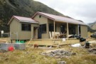
Speargrass Hut
Photograph
•
Distance: 9.7km away
The old small cosy hut at the top of a clearing. Since replaced by a modern hut.
Water from Speargrass Creek ...
More ▶︎
Speargrass slip
Photograph
•
Distance: 9.7km away
One of a number of slips to negotiate back to the car park.
More ▶︎
Speargrass Hut
Hut
•
Standard Hut (DOC). Capacity: 12.
•
Distance: 9.7km away
Previously a small cosy hut, but now a brand new roomy hut with two sleeping platforms, L shaped stainless steel ...
More ▶︎
The new Speargrass Hut
Photograph
•
Distance: 9.7km away
Same layout as Morgan. Two sleeping platforms for 10 people in total. Stainless steel L shaped bench. Table, fixed benches, ...
More ▶︎

Angelus Hut
Hut
•
Serviced Hut (DOC). Capacity: 28.Bookings required.
•
Distance: 9.7km away
New hut opened in April 2010. A well sited and busy hut next to a lake in an alpine landscape. ...
More ▶︎
Lake Angelus, June 2011
Photograph
•
Distance: 9.7km away
Late in the day as we arrived at the hut with the last light catching the tops
More ▶︎
Angelus Hut Campsite
Campsite
•
Backcountry Campsite (DOC). 5 spaces.
•
Distance: 9.7km away
Alpine campsite located near Angelus Hut and Lake Angelus. During peak season, this campsite must be booked in advance with ...
More ▶︎
Travers Valley flats, Nelson Ranges
Photograph
•
Distance: 9.8km away
Travers Valley flats above Lakehead Hut, Nelson Ranges
More ▶︎
Lake Angelus with no snow
Photograph
•
Distance: 9.9km away
Unusually snow free - January 2008
More ▶︎
Route Guide: Lake Angelus
Article
•
Distance: 9.9km away
Between the lakes of Rotoiti and Rotoroa in New Zealand's South Island, is the high alpine tarn of Lake Angelus ...
More ▶︎
Lake Angelus
Track
•
2 – 3 days. Medium. loop track.
•
Distance: 9.9km away
Between the lakes of Rotoiti and Rotoroa in New Zealand's South Island, is the high alpine tarn of Lake Angelus ...
More ▶︎
Lake of the Angels
Photograph
•
Distance: 9.9km away
We arrived at Lake Angelus as a thick fog descended and the temperature dropped to zero. Next morning we were ...
More ▶︎