
Tramping hours given here include all stops – we were a group of 7, not trying to break records. I wanted a tramp that allowed sufficient time to take in the stunning skylines. A faster pace is possible but, for us, not desirable. Positional references are NZTM2000 grid, WGS84 datum.
Day 1 : 11km 5hrs Robert Ridge carpark – Lake Angelus
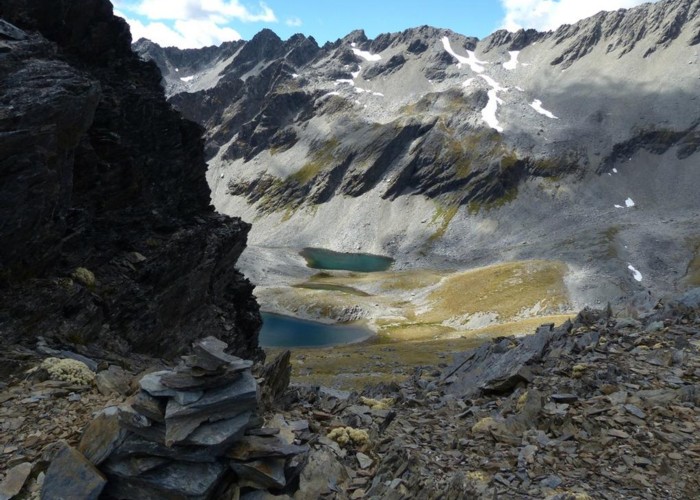
Having walked the ridge previously, we knew what to expect – a very stiff climb to the treeline, and a rising, undulating track all the way to the lip of the Angelus Basin - there a short simple descent to the Angelus Hut. Great weather afforded fabulous views in all directions. We had elected to camp as the hut is busy (and often noisy into the wee hours) – we needed an early start the next morning as the plan took us to West Sabine Hut (or, failing that, a clearing downstream).
Day 2 : 16km 9.5hrs to a clearing on Sabine River (1574428 5354096)
A light rain overnight had cleared by dawn but cloud was hugging the tops. Two years before we had climbed the Cedric Track from the Sabine in high wind, horizontal sleet and little visibility – this time we were hoping for views across Lake Rotoroa and up the Sabine Valley but that was looking doubtful.
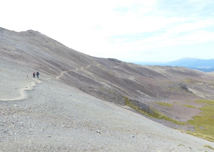
Cedric is an obvious track (if you can see further than the next snow-pole) with an initial short climb away from Lake Angelus followed by an extended traverse of boulders before swapping to the opposite side of the ridge (and, for us, gaining a little wind protection). With the track beginning to descend to the treeline, the clouds lifted somewhat and an enormous scree slope sweeping down to the Sabine was revealed.
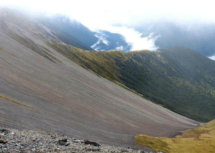
After a short break at the trees, the descent began in earnest. From the high point, it’s 1200m down to Sabine Hut and my quads were screaming well before that – it’s definitely easier going up! With just on 150m to descend, one of our group slipped on some of the myriad of tree-roots and fell awkwardly – we all heard the crack. With a trip-ending broken wrist bandaged and immobilised, we hobbled the last few hundred metres to the hut with the intention of calling the water-taxi and heading to Murchsion? Nelson? for medical support. As it transpired, a couple of fisherman offered to transport our colleague to Nelson – and we were able to continue the tramp (albeit still a little shocked at the morning’s events).
A quiet and thoughtful plod up the Sabine took us to a clearing about 5km before West Sabine Hut – a favourite sandfly hangout, it would seem, so we retired to tents early. A nocturnal visit by a fellow Aussie (aka possum) disturbing the peace only briefly.
Day 3 : 12km 6hrs to Blue Lake
This was intended to be an easy day – all on-track - in preparation for the following two hard days that would see us through to the Matakitaki Valley. It was an easy 90 minutes to West Sabine Hut sporting new heater, sink, benches and indoor plumbing (I was very pleased to see the new bridge – less than a week old). A half hour break and we set off for Blue Lake – it’s a lovely track, especially the last few km. Arriving in the early afternoon provided plenty of time to relax in the beautiful surroundings. Camping beside the lake allowed us to avoid a crowded hut and a very loud snorer.
Day 4 : 10.5km 7.5hrs to Lake Thompson
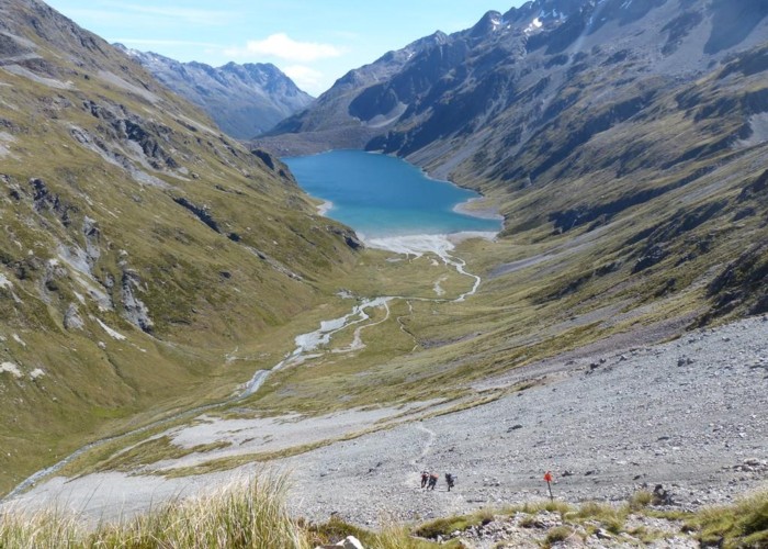
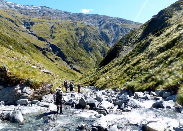
Waking to ice on the tent, but away by 0815, we were immediately climbing towards Lake Constance. The track through the trees is quite steep but the grade soon lessens as we push to the true left of the lake. From Blue Lake, the route is poled all the way to the Waiau Valley floor. Now a short sharp scree climb leads to a sidle above the lake and then a steep descent in a gut to the lake shore – then along to the lake head and across the valley floor (good campsites 100m before the start of the climb) and up up up to Waiau Pass. Yes, it’s steep but the initial section on larger rocks is taken in our stride. The track moves onto a grass tongue until an obvious footpad angles up towards the pass. This is the testing bit – from the valley floor, it looks short and easy. However, it’s 3 steps forward, 1 back – hard work. Once past this, it’s still steep through the snow-grass but at least every step is forward (and up). A useful tarn at the base of the final ascent to the pass means less water needs to be hauled up from the valley.
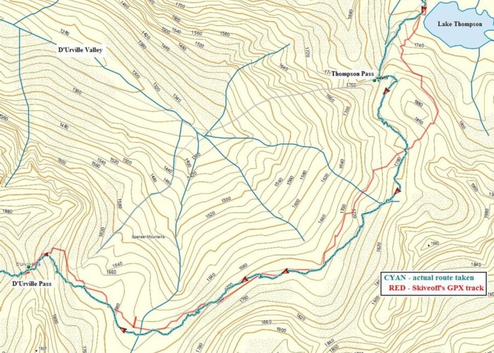
The climb to Waiau Pass took 90 minutes and we stopped for a well-earned lunch and to drink in the views. Still following the poles, we headed down to the valley floor – steep but the rocks are amazingly grippy and there is no sense of risk, just a straight-forward descent. The easier route to Lewis Pass is down the Waiau Valley but we are intent on camping at Lake Thompson so it’s up again for us. First traveling on the true right to cut the corner, we cross to the true left (1570528 5337541) and climb away from the river. Turning left into the gut (fault line), we stuck to it all the way to Lake Thompson but realised later an alternative would be to climb up onto the ridge between the gut and the river and follow that to the lake.
Lake Thompson at the 1700m contour is our highest campsite on this trip and the chill is obvious – still, a quick swim was refreshing and, after 1300m up and 800m down, well-deserved !
Day 5 : 16km 9.5hrs to East Matakitaki Hut
Wow! What a day – and what scenery and terrain. From what I had read, this section looked very challenging and I had some apprehension as the day dawned. Continuing great weather meant we would climb to Thompson Pass and contour around to D’Urville Pass - rather than the longer poor-weather alternative of descending to the valley floor and climbing back up to D'Urville Pass. Then we would descend to the Matakitaki Valley floor and tramp down the river to the hut. We are certain of a long day and perhaps a camp somewhere before the hut.
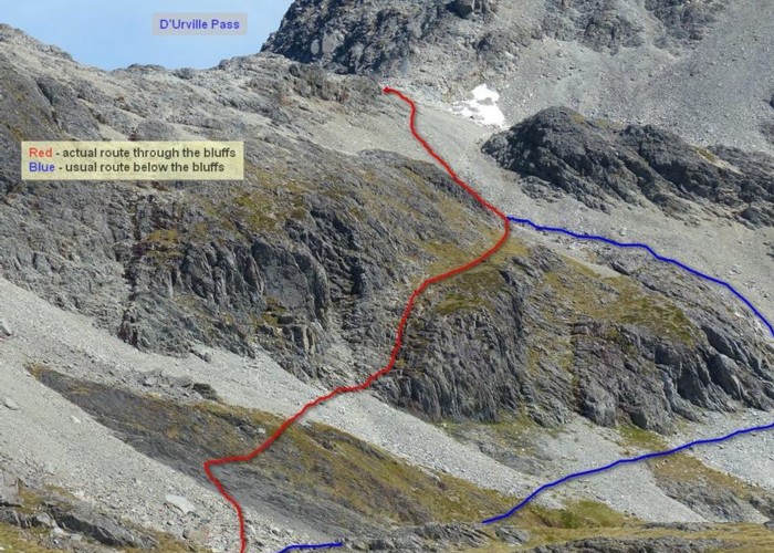
From the lake, it's a short climb to Thompson Pass. From the Pass we climbed to the east (there is an obvious grassy ramp back from the middle of the pass) and picked our way through the rocks (occasionally spotting cairns) to descend to a bit of a ledge, initially at the 1800m contour and then at 1700m. Rather than traverse below the final bluffs, we climbed a steep shallow gut – a very easy approach to D’Urville Pass (see pic). We paused to survey our route and revel in the achievement.
Now it’s down down down. From the top there is good scree for slide-stepping and we reach the obvious tarn in quick time and another well-earned lunch. Then we moved to the top of the gut descending SW to the Matakitaki Valley floor. Initially steep, is starts to look like bluffing out – a waterfall? No, it’s a simple boulder-hop to the bottom. We now found progress easiest on the rocks in the river until almost the treeline. From here there were intermittent footpads, with frequent river crossings to pick up easier travel on the grassy flats. Time was wearing on and I was thinking we might not make our target when, just 2km from the hut on the true left, we hit a newly cut 1km track, initially climbing away from the river and then back to the flats above the hut - we motored through this and the last of the flats to the hut. 1200m of descent and 400m ascent and another great sense of achievement.
Day 6 : 8km 3.5hrs to Bob’s Hut
The plan has this as a short and easy day – providing time to clean up (us and our clothing) and recover for what I expect will be a tough (and maybe long) climb to 3 Tarns Pass the following day. All on-track and in the trees, we set off at 9am following the obvious markers on the true left. A few boggy sections but nothing serious to slow us down, we hit the 3-wire bridge at 1030 and crossed to the true right of the West Matakitaki River (having disturbed a wasp nest on the opposite side and collected a few stings for our trouble).
From the bridge it’s a short 100m climb, the only serious one for the day, followed by a pleasant 2.5km stroll through the beech to grassy flats with Bob’s Hut at the far end. We crossed Mt Mailing Creek at the hut and settled in for a relaxing afternoon, sun sparkling on the water.
Day 7 : 11km 8hrs to south side of 3 Tarns Pass (1555134 5319126)
Expecting a hard day perhaps makes it seem easier? My research of the West Matakitaki Valley section above the treeline suggested difficult sidles and a gorge to negotiate – time-consuming and tiring. True, the first 5km on the true right I expected to be tracked (most of it was) but, from the cairn marking the river crossing, the going would be more demanding.
In fact, the route from the cairn is very simple – on the true left, climb (steeply) away from the river to an obvious saddle, avoiding the Spaniard grass, and then gradually descend back to the river, below a major gut on the true left. From here, stay in the river, boulder-hopping, until (1555206 5320336) just below the final climb to the tarns – easy travel. After 7hrs tramping, a decent break was in order at the 3 Tarns to soak in the surroundings.
Attractive as 3 Tarns is, the south side of the Pass makes a better campsite so we climbed to the Pass and descended the massive boulder-field, now expert at this type of terrain.
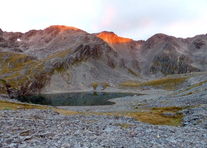
Another brilliant campsite lit by a flaming sunset.
Day 8 : 8km 5.5hrs to Cannibal Gorge Hut (including a 2hr stop at Ada Pass Hut)
Thanks to MadPom’s trip report Route Guide: St Arnaud to Lewis Pass, rather than seeking a route down to the east of the tarn, we just headed directly over the edge on the boulders/scree – simple, quick – we were down to the creek in just 30 minutes. From here it’s a cairned route (mostly) to the treeline (1555288 5317043) and a marked track from there to the St James Walkway. We would be sleeping in the hut this time as we needed an early start and dry tents – catching the East-West Bus Service at 1010 from Lewis Pass back to Christchurch meant we would set off at dawn to ensure a timely arrival (in fact we had oodles of time as the bus was 30 minutes late).
Day 9 : 7km 2.5hrs to Lewis Pass
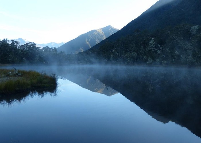
An 0630 start with head-torches and light packs, we followed the walkway (which was sporting quite a bit of weather damage along the way) through Beech all the way to Lewis Pass – the last few meters heavily shrouded in moss and mist rising from Alpine Tarn.
It’s difficult to find enough superlatives to describe these 9 days – the varied terrain, vistas, peaks, passes, rivers, slopes, climbs, descents – all brilliant, dazzling, astonishing, surprising, startling – and 9 days of perfect weather didn’t hurt, either.
