Mueller Tarn Track
Lewis Pass National Reserve
- 3 hr return via same track
- Easy/medium
A steep but easy climb to a pretty alpine tarn near Lewis Pass
|
Walking time
|
3 hr |
|---|---|
|
Distance
|
3.0km |
|
Type
|
Return via same track
|
|
Grade
|
Easy/medium |
|
Bookings
|
No bookings — open access
No — open access
|
|
Starts
|
500m west of Maruia Springs, SH7 |
|---|---|
|
Maps
|
NZTopo50-BT23
|
|
Altitude
|
570m
–
1,190m
Altitude change 620m
|
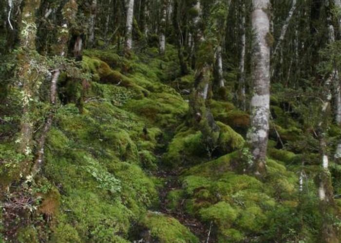
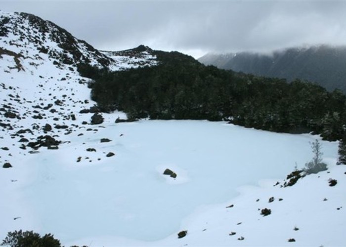
A brief climb through mossy beech forest leads to a pretty tarn at the tree line. There are good views across the valley to the Lewis Tops. This is a recommended trip. Walking times are about 1:45 up and 1:15 down.
Pull off the road on the grass just west of the Maruia Springs Hotel and cross the wide river flats. Look for a pair of rather ancient cairns in the riverbed. These cairns point to the track beginning at the bush edge on the north side of the valley.
The track is steep and vague, leading through red beech then light silver beech forest. After a little over an hour, the track eases off then sidles to the right before dropping into a creek bed. Follow the creekbed until it steepens, then either continue up or climb out on the true left bank and push through the forest (the track seems to be lost at this point). It is just a few minutes to the tops from here. Head over to the right to reach the tarn.
It's easy to lose the track on the return journey. The forest is such that the track disappears when you are just a few metres away from it.