Peaks

Jacks Pass Track
Track.
Medium. Return by the same track.
Updated
23 January 202323 January 2023.
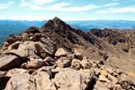
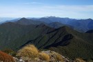
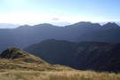
A quick subalpine route onto Mount Isobel.
More ▶︎
Maungakura/Red Hill - Ben Nevis Loop
Track.
3 days. Medium/hard. Loop track with a road section.
Updated
17 January 202117 January 2021.
3 day tramp in Richmond Ranges. Requires good weather.
A few river crossing on 1st day to Top Wairoa Hut from Wairoa Gorge.
Day trip to summit Maungakura/Red Hill, back the same way, stayed at Top Wairoa Hut on 2nd ...
More ▶︎
Langsview track
Track.
Easy/medium. Return by the same track.
Updated
2 January 20192 January 2019.
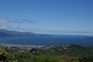
An easy walk overlooking Langs Beach with views out to Mangawhai and inland to Kaiwaka
More ▶︎
Matukituki to Paradise by roads less travelled
Track.
3 – 6 days. Medium/hard. One way.
Updated
25 January 201825 January 2018.
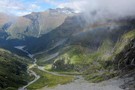
A rough, tough crossing from Raspberry Flat (Aspiring Road, Wanaka) to the Earnslaw Burn (Glenorchy-Paradise road) via Shotover Saddle, Lochnagar, Lennox Pass.
This is the latest leg in madpom's East Cape to West Cape traverse.
More ▶︎
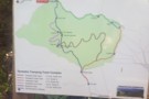
Kawakawa Station Walk
Track.
2 – 3 days. Medium. Loop track.
Created
15 March 201715 March 2017.
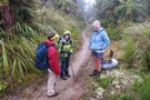
Get together with mates, work colleagues or family for a weekend escape to walk, eat and be merry! The food provided is locally inspired, sourced and produced and certainly won’t leave you hungry.
All delicious home cooked meals, including morning and ...
More ▶︎
Te Rau-o-te-Huia / Mount Donald McLean
Track.
Easy. Return by the same track.
Updated
14 September 201714 September 2017.
A very short walk to a summit in the southern Waitakere Ranges.
More ▶︎
Anatoki Forks Hut to Boulder Lake Hut
Track.
1 day. Hard. Return by the same track.
Updated
27 December 201427 December 2014.
An off-track route description for a "direct" one-day connection between these two huts.
Could be used to create numerous loop trips either with just these two huts or extending to take in the Dragons Teeth or even adding on Waingaro Forks ...
More ▶︎
Mount Fishtail
Track.
1 day. Easy/medium. Return by the same track.
Updated
9 November 20149 November 2014.
A moderate day hike to the summit of Mount Fishtail a prominent peak in the Richmond Range. Great views can be had once above the bush line.
More ▶︎
Mount Reeves Track
Track.
1 day. Easy/medium. Return by the same track.
Updated
6 October 20146 October 2014.
Mt. Reeves is a nice little peak on the eastern side of the Tararua ranges. There are good views over the patchwork of farmland in the Wairarapa plains and west into the hills. It has the distinction of being part ...
More ▶︎
St Arnaud Range Track
Track.
1 day. Medium. Return by the same track.
Updated
6 October 20146 October 2014.
This walk climbs steadily through beech forest to a height of over 1650 metres.
Above the bushline (at 1400 m), there are spectacular views from Parachute Rocks, which gained their name from a parachute‐shaped gravel scree located just to the ...
More ▶︎
Mt Oxford
Track.
0 – 1 day. Medium. Return by the same track.
Created
21 September 201421 September 2014.
Day trip with several variations to make it a loop if desired.
More ▶︎
Patutu
Track.
1 day. Easy/medium. Return by the same track.
Updated
3 July 20163 July 2016.
Day trip to the summit of Patutu (1162m). The track starts basically at sea level.
More ▶︎
Paringa Valley to Tunnel Creek
Track.
Easy/medium. Return by the same track.
Updated
4 April 20154 April 2015.
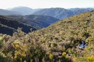
Its a Southern West Coast gem: the valley floor is surprisingly gentle, the track currently well marked and for the most part easy to follow. Dense west coast bush and open river flats lead to a classic backcountry hut with ...
More ▶︎
The Kaweka Main Range - a NS traverse
Track.
5 – 10 days. Easy/medium. One way.
Updated
25 April 201625 April 2016.
A Kaimanawa-Kaweka traverse from Rangataiki to the Gentle Annie (Napier-Taihape) summit.
5-10 days of good track-tramping through the beech & manuka forest, vividly coloured sub-alpine ridges and barren rocky tops of the Kaimanawa and Kaweka Range.
This route formed one leg of ...
More ▶︎
East Cape to West Cape - the length of NZ's main divide
Track.
125 – 300 days. Hard. One way.
Updated
3 February 20213 February 2021.
A guide to my route from East Cape to West Cape, the length of NZ's main divide.
More ▶︎
Raukumara East-West Traverse
Track.
5 – 12 days. Hard. One way.
Updated
21 January 202121 January 2021.
An east-west traverse of either the Raukumara range, or the entire East Cape. A minimum of 5-8 days in it's shortest version (of which two are half days), but 9+ days for a complete traverse.
The main highlight of the trip ...
More ▶︎
Banks Peninsula Tops
Track.
2 days. Easy/medium. One way.
Updated
7 August 20157 August 2015.
Two day walk across the never completed bit of the Summit Road.
More ▶︎
St Arnaud to Lewis Pass
Track.
5 – 9 days. Medium/hard. One way.
Created
8 January 20148 January 2014.
A 5-9 day north-south route from St Arnaud to the Lewis Pass, via Travers Pass, Waiau Pass, Thompson Pass and Three Tarn Pass. takes in good sections of the Travers, Sabine, Matakitaki and Maruia valleys.
More ▶︎
Walking the length of the Ruahines
Track.
10 – 25 days. Medium/hard. One way.
Updated
8 January 20148 January 2014.
A 10+ day trip down to backbone of the Ruahine Range from Wharite (Palmerston Sth) to the Napier Taihape (Gentle Annie) Rd.
The details of the route are in the associated article (see 'More Information').
More ▶︎
Mt Owen via Sunrise Peak, return Fyfe Rive
Track.
3 days. Hard. Loop track.
Created
14 November 201314 November 2013.
Southern approach to Mt Owen, steep terrain, epic rock formations on the tops - making for stunning views but slow horizontal travel.
Fyfe River valley - pools, great bird life and plenty of whio to be seen
More ▶︎
Jane Peak, Eyre Mountains
Track.
2 days. Medium. Return by the same track.
Updated
13 March 201313 March 2013.
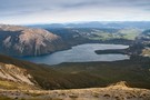
The Eyre Mountains are located south of Lake Wakatipu, just next to the Mavora Lakes. Jane Peak is the highest mountain in Southland outside of Fiordland -- and presumably a wry reference to the 1847 novel by Charlotte Brontë.
More ▶︎
Mount Alexander
Track.
2 days. Medium. Return by the same track.
Updated
4 March 20144 March 2014.
A long climb to the summit of Mount Alexander (1958m) on the Kaimata Range. This range lies directly north of the Taramakau River and the highway between Jacksons and Aickens.
More ▶︎
Mt French
Track.
1 day. Easy/medium. Return via same track.
Created
26 October 201226 October 2012.
The track starts approximately 12 km east of Kumara on the Inchbonnie-Kumara Road, or 26 km from Moana following the Lake Brunner Road before turning onto the Inchbonnie-Kumara Road. The route is well marked, passing through mixed lowland rimu forest ...
More ▶︎
Aspiring Flat and Sisyphus Peak
Track.
3 days. Medium. Return via same track.
Updated
29 August 201229 August 2012.
A one and two-half day tramp up the East Matukituki to overnight in Aspiring Flats, with a day trip up Sisyphus Peak via Rainbow Stream. Summer trip only.
Easy to coordinate with transport company, or leave your car over two nights. ...
More ▶︎
Walter Peak
Track.
1 day. Medium. Return via same track.
Updated
17 June 201217 June 2012.
Walter Peak is the prominent peak on the other side of Lake Wakatipu, where the Earnslaw boat goes.
Most of the terrain is easy to navigate - tussocks and rocky outcrops. Towards the end it's quite a scramble.
For experienced trampers only. ...
More ▶︎
Whakaupoungaku
Track.
Easy. Return via same track.
Created
4 June 20124 June 2012.
The summit of Whakapoungakau is just off the Western Okataina Walkway. The summit is a pleasant place, with grassy clearing among the scrub and good views to the north and east if the weather is clear.
More ▶︎
Mt Rolleston- Low Peak (via Rome ridge)
Track.
Medium/hard.
Created
18 March 201218 March 2012.
Track starts off at SH73 (Coral track). Steep ascent through the bush line on a marked track leading you up onto Rome Ridge, which is no longer marked, yet obvious where to go due to sheer drops both sides of ...
More ▶︎
Belmont Trig & Korokoro Dam, Loop
Track.
0 – 1 day. Easy/medium. Loop track.
Updated
4 March 20124 March 2012.
Loop track up Belmont Trig, down to Korokoro Dam and back to Stratton Street.
Belmont Trig: 458m (1503feet), Total loop track ascent: 608m (1995feet), 10km (6.2 mile) loop
More ▶︎
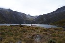
Temple Valleys Circuit
Track.
2 – 3 days. Medium. Loop track.
Updated
19 April 202019 April 2020.
Tramping the North and South Temple Valleys connecting the two over Gunsight Pass.
More ▶︎
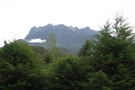
Mount Kinabalu
Track.
2 days. Medium/hard. Return via same track.
Updated
28 June 201128 June 2011.
The highest mountain in south east asia is located in Sabah, East Malaysia, Borneo. Not easy but a rewarding climb. Day 1 you climb from 1800m to 3200m, 6 km in length. Day 2 after staying in a comfortable lodge ...
More ▶︎