Paringa Valley to Tunnel Creek
- 5 hr – 7 hr return by the same track
- Easy/medium
Its a Southern West Coast gem: the valley floor is surprisingly gentle, the track currently well marked and for the most part easy to follow. Dense west coast bush and open river flats lead to a classic backcountry hut with good views of the surrounding mountains.
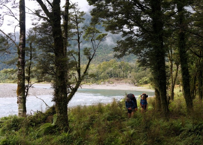
Starting on real west coast farmland, you're soon traveling beside a remote and less visited west coast river. Above Stew Creek the track is mostly well marked, across grassy flats, under forest, and along the main river with stunningly clear water, large still pools and mossy boulders. The bush covers fairly gentle terraces with a canopy of silver beech and a crown fern (piu piu) understory.
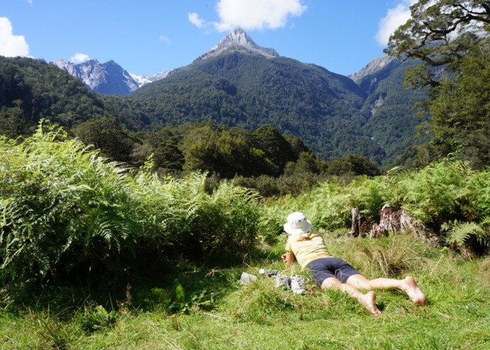
At the head of the valley the flats open up to views of glaciated peaks above steep buffs and tussock tops offering high routes further into the heart of the Hooker wilderness.
|
Walking time
|
5 hr – 7 hr |
|---|---|
|
Type
|
Return by the same track
|
|
Grade
|
Easy/medium
Take a good map. The Paringa is NOT a tourist track but it is very suitable for anyone with common sense who wants to experience tramping beyond the Great Walks. Don't cross flooded rivers. Grades explained
|
|
Bookings
|
No bookings — open access
No — open access
|
|
Starts
|
Paringa Road bridge, West Coast Highway |
|---|---|
|
Ends
|
Tunnel Creek Hut, Upper Paringa River |
|
Maps
|
NZTopo50-BY13
|
|
Link
|
www.remotehuts.co.nz/huts/tunnel_creek/http://www.remotehuts.co.nz/huts/tunnel_creek/ |
|---|
The walk begins just South of the Paringa bridge on SH6. Ben Monk (Tel: 03 751 0899) farms the River flats up the first couple of hours to Stew Creek and likes folk going through to ring and let him know. The route up the TL is a mix of old farm track, easy grassy flats and shingle riverbed sections. Just below Stew Creek there is a small bluff where, depending on river levels, it may be possible to walk around the base. If the river conditions make it dangerous there is a short cruise-taped trail over the bluff.
Across Stew Creek there is a locked hut belonging to Ben.
The track starts again by the wood shed and goes up the TR of Stew Creek for around 500m, then zigzags South through open grassy meadows and dense patches of forest to re-connect with the Paringa River a couple of kilometres above the Otoko confluence. The next three hours to Tunnel Creek Hut stay on the TL and mostly on a track with several short sections of river travel.
There are no bridges. A large unnamed side-creek around an hour up from Stew Creek can be particularly awkward and would be dangerous to cross if it was high. Nearer the top of the valley, Serpentine Creek has blown out into two separate channels about 200m apart, The track restarts both times within 50m of the main Paringa. From the second crossing it is an easy 15 minutes on a good track to the Hut.
Tunnel Creek Hut in the Paringa
Allow 2+ hours from the west coast highway to Stew Creek, and 3+ from there to Tunnel Creek Hut.