Mount Alexander
- 2 days return by the same track
- Medium
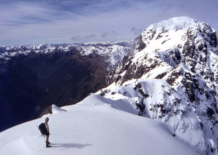
A long climb to the summit of Mount Alexander (1958m) on the Kaimata Range. This range lies directly north of the Taramakau River and the highway between Jacksons and Aickens.
2 members favourited
4 members checked in
|
Walking time
|
2 days
12 hr – 20 hr
|
|---|---|
|
Distance
|
16.0km |
|
Type
|
Return by the same track
|
|
Grade
|
Medium |
|
Bookings
|
No bookings — open access
No — open access
|
|
Starts
|
Vehicle track on the true right of the Camp Creek bridge, Lake Brunner Road. |
|---|---|
|
Maps
|
NZTopo50-BU20
|
|
Altitude
|
170m
–
1,958m
Altitude change 1,788m
|
|
Link
|
www.doc.govt.nz/parks-and-recreation/tracks-and-walks/west-coast/greymouth/greymouth-backcountry-routes/http://www.doc.govt.nz/parks-and-recreation/tracks-and-walks/west-coast/greymouth/greymouth-backcountry-routes/ |
|---|
The route leads up Camp Creek, near Lake Poerua. The route soon follows the creekbed and turns onto a ridge and sidling above the creek. The route crosses the creek just below Camp Creek Hut (760m), a cosy forest cottage.
From the hut, a track climbs persistently past the bushline to 1400m, before easing up to point 1795. A narrow 2km ridgeline leads to Mount Alexander (1958m). From here, views extend west along the Taramakau River, south into Arthur's Pass, East toward Harper Pass, and north across the Grey-Inangahua Depression to the distant Paparoa Range.
ID 8263
About this track
506 views in the past year (42 per month).