Conservation parks
Conservation parks are multi-use environments that are subjected to fewer restrictions than national parks. Some mining and forestry occurs in conservation parks. Conservation parks were formerly known as forest parks.
In contrast, "conservation areas" are low-value or unsorted stewardship areas managed by the Department of Conservation.
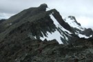
Ahuriri Conservation Park
Place.
Conservation Park. 490.00km2.
Updated
11 September 201311 September 2013.
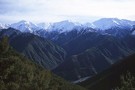
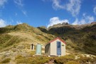
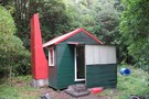
This park was established following the purchase of Birchwood Station in 2004. It is centred around the Ahuriri Valley and occupies much of the land between Lakes Hawea and Ohau.
More ▶︎
Aorangi Forest Park
Place.
Conservation Park. 183.81km2.
Updated
20 June 201120 June 2011.
Aorangi (Haurangi) Forest Park. A remote area of the Aorangi Range east of Wellington. Highest point: 983m (Mt Ross)
More ▶︎
Aotea Conservation Park
Place.
Conservation Park. 121.10km2.
Created
13 April 201513 April 2015.
New conservation park located on Aotea / Great Barrier Island.The park aggregates together prior stewardship areas and other DOC reserves, covering 43% of the island.
More ▶︎
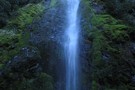
Catlins Conservation Park
Place.
Conservation Park. 240.00km2.
Updated
17 August 201817 August 2018.
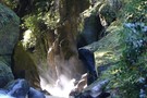
A small coastal park south of Dunedin famous for waterfalls, penguins and a petrified forest. Highest point: 728m (Mt Pye).
More ▶︎
Coromandel Forest Park
Place.
Conservation Park. 749.61km2.
Created
10 June 200610 June 2006.
A popular park on the volcanic Coromandel peninsula with a history of mining and milling. Highest point: 795m (Table Mountain).
More ▶︎
Craigieburn Forest Park
Place.
Conservation Park. 441.65km2.
Updated
18 November 201318 November 2013.
A small park south of Arthur's Pass National Park including a series of ski fields. Highest point: 2141m (Mt Avoca).
More ▶︎
Eyre Mountains/Taka Rā Haka Conservation Park
Place.
Conservation Park. 651.60km2.
Updated
8 February 20148 February 2014.
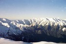
Located southwest of Lake Wakatipu and southeast of the Mavora Lakes, the Eyre Mountains include the highest Southland peaks outside of Fiordland.
More ▶︎
Hakatere Conservation Park
Place.
Conservation Park. 600.00km2.
Updated
20 July 201420 July 2014.
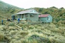
This park protects high country between the Rakaia and Rangitata Rivers in the Ashburton Lakes District, Mid-Canterbury.
More ▶︎
Hanmer Forest Conservation Park
Place.
Conservation Park. 130.00km2.
Updated
22 November 201222 November 2012.
This park surrounding Hanmer Springs is popular with families, offering easy walking and biking through both exotic and indigenous forests.
More ▶︎
Hāwea Conservation Park
Place.
Conservation Park. 1050.00km2.
Updated
9 February 20149 February 2014.
A large park at the head of Lake Hāwea between Mount Aspiring National Park and Ahuriri Conservation Park.
More ▶︎
Ka Whata Tu o Rakihouia Conservation Park
Place.
Conservation Park. 880.65km2.
Created
8 June 20088 June 2008.
A new conservation park established 2008 to protect the high country of the Seaward Kaikoura Range.
More ▶︎

Kaimai-Mamaku Forest Park
Place.
Conservation Park. 371.41km2.
Updated
11 March 201411 March 2014.
A narrow strip of land including the Kaimai Ranges and the Mamaku Plateau.
More ▶︎
Kaimanawa Forest Park
Place.
Conservation Park. 763.48km2.
Updated
23 March 201023 March 2010.
Mountain wilderness east of Tongariro National Park. Highest point: 1727m (Makorako).
More ▶︎
Kaweka Forest Park
Place.
Conservation Park. 661.47km2.
Updated
5 January 20155 January 2015.
A popular park in Hawke's Bay.
More ▶︎
Korowai/Torlesse Tussocklands Park
Place.
Conservation Park. 210.00km2.
Updated
9 February 20149 February 2014.
This park incorporates the Torlesse and Big Ben Ranges either side of Porter's Pass. The Torlesse Gap is a prominent feature visible from Christchurch.
More ▶︎
Lake Sumner Conservation Park
Place.
Conservation Park. 1057.71km2.
Updated
3 September 20143 September 2014.
Lakes and forested hills in this sprawling park provide good tramping, and contrast with the rugged alpine environment of Arthur's Pass National Park to the southwest. Highest point: 1980m (Mt Crossley).
More ▶︎
Mount Richmond Forest Park
Place.
Conservation Park. 1660.00km2.
Updated
4 December 20114 December 2011.
A wedge of land at the base of the Marlborough Sounds, south of Nelson and north of the Wairau River, the park includes the ultramafic geology of the Nelson mineral belt. Highest point: 1790m (Red Hill).
More ▶︎
Oteake Conservation Park
Place.
Conservation Park. 648.05km2.
Updated
9 February 20149 February 2014.
A new park covering the ranges near St Bathans, south of the Waitaki River.
More ▶︎
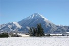
Pirongia Forest Park
Place.
Conservation Park. 171.41km2.
Updated
12 November 200712 November 2007.
Two ancient volcanic cones south and west of Hamilton: Pirongia (959m), and the smaller Karioi on the coast at 756m.
More ▶︎

Pureora Forest Park
Place.
Conservation Park. 780.00km2.
Updated
9 November 20079 November 2007.
A less-visited park of forested hill country that includes beautiful podocarp forests, a variety of short walks and a few tramping tracks.
More ▶︎
Raukumara Forest Park
Place.
Conservation Park. 1151.00km2.
Created
10 June 200610 June 2006.
An area of isolated wilderness in the Eastern Bay of Plenty, featuring the famous Motu River and the Raukumara Wilderness Area. Highest point: 1754m (Hikurangi).
More ▶︎
Rimutaka Forest Park
Place.
Conservation Park. 220.00km2.
Updated
27 March 201527 March 2015.
A small block of forest close to Wellington, and abutting Tararua Forest Park. A popular spot for picnics, day walks and overnighters.
More ▶︎
Ruahine Forest Park
Place.
Conservation Park. 932.60km2.
Updated
9 February 20149 February 2014.
A slim park running along the Ruahine Range from the Manawatu Gorge to the southernmost point of Kaweka Forest Park west of Napier. Highest point: 1731m (Mangaweka). Ruahine FP has the distinction of being the park with the most huts ...
More ▶︎
Ruataniwha Conservation Park
Place.
Conservation Park. 368.00km2.
Updated
9 February 20149 February 2014.
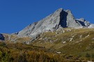
The Ruataniwha Conservation Park occupies a mountainous landscape, and includes the valleys of the Dobson, Hopkins, Huxley, Temple and Maitland Rivers. It includes land bordering Lakes Ohau and Pukaki, including the Ohau skifield and much of the Ohau and Ben ...
More ▶︎
Tararua Forest Park
Place.
Conservation Park. 1165.35km2.
Updated
20 June 201120 June 2011.
The first of New Zealand's forest parks, this is a large and famous park near Palmerston North and Wellington. Highest point: 1571m (Mitre).
More ▶︎
Te Kahui Kaupeka Conservation Park
Place.
Conservation Park. 938.00km2.
Updated
25 February 201425 February 2014.
Canterbury high country park including the Two Thumb Range and large portions of Mesopotamia Station.
More ▶︎
Te Papanui Conservation Park
Place.
Conservation Park. 210.00km2.
Updated
1 February 20131 February 2013.
A region of tussock grassland on the Lammermoor and Lammerlaw Ranges, 50km west of Dunedin.
More ▶︎
Victoria Forest Park
Place.
Conservation Park. 2107.31km2.
Updated
8 February 20148 February 2014.
An historic park centred around the gold town of Reefton, rich in beech forests and mining relics. Highest point: 1640m (Mt Victoria).
More ▶︎
Whirinaki Te Pua-a-Tāne Conservation Park
Place.
Conservation Park. 609.00km2.
Updated
4 April 20164 April 2016.
Rich podocarp forest in the Bay of Plenty.
More ▶︎
| Number of parks | 29 |
|---|---|
| Total area |
1,956,321
square kilometres
|
| That's |
7.3%
of New Zealand
|
| Largest park |
Victoria Forest Park
2,107.31 square kilometres
|
| Smallest park |
Aotea Conservation Park
121.10 square kilometres
|