Hauhungaroa Range (Northern Section)
Pureora Forest Park
- 2 – 3 days one way
- Easy/medium
A two or three day trip incorporating the Northern part of the Hauhungaroa Range in Pureora Forest Park. Because the two huts on this route are 10 hours apart, this trip is going to inevitably involve camping out.
|
Walking time
|
2 – 3 days
14 hr – 20 hr
|
|---|---|
|
Distance
|
37.9km |
|
Type
|
One way
|
|
Grade
|
Easy/medium |
|
Bookings
|
No bookings — open access
No — open access
|
|
Starts
|
State Highway 32 at the Waihaha Bridge |
|---|---|
|
Ends
|
Link Rd |
|
Maps
|
NZTopo50-BG35
NZTopo50-BF35 NZTopo50-BG34 |
|
Altitude
|
475m
–
1,165m
Altitude change 690m
|
The northern part of this trip starts with the 3 hour trip up the Waihaha Valley to the Waihaha Hut.
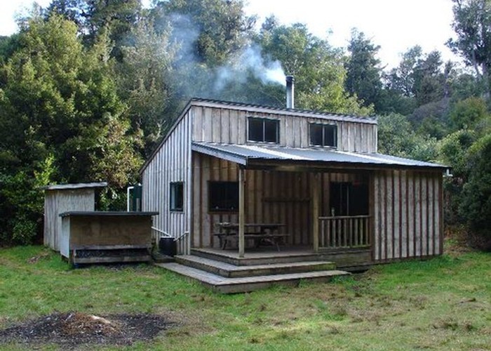
From the hut the Hauhungaroa Track heads north. The sign at the hut says 10 hours to Bogg Inn Hut.
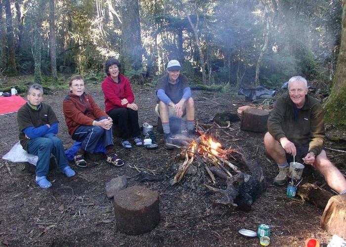
This is probably best split in to two days so a tent is fairly much essential.
The track is good all the way and starts by going north for about an hour through bush before a steep
descent into the Mangatu Stream. Just as you begin to descend, note the mats of Kidney ferns. The
translucent leaves make a wonderful photo on a sunny day.
At the Mangatu Stream there is a good campsite on the northern bank of the stream just before the track
climbs very steeply up the other side of the valley. There used to be a rope to help you up this section
but I notice it is now gone. There are plenty of good secure roots to hang onto so keep a good grip.
Once above the steep section the track continues to climb but at a more gentle rate. Note the changes in
the bush as you proceed. There are plentiful Totora and Rimu trees plus the occasional Northern Rata.
There are no landmarks or viewpoints for the next couple of hours until you reach the sign marking the
track to the Waihora Road end. From here the track curves gently to the left, descends, crosses a couple
of small streams and then you come to the edge of one of the many sphagnum moss swamps that seem
to be a feature of Pureora Forest.
From here it is only a short distance to a well-used campsite amongst a grove of Totora trees and next
to a small stream. The point is almost exactly half way between the two huts so is a great place to break
the trip.
From the campsite the track begins to climb to the top of Weraroa. The top of Weraroa is just above the
bush but not quite above the scrub line. There is the hint of good views but the scrub is quite high on
each side. I have often felt that I should bring a stepladder when coming here, but haven’t felt tempted
to carry it. Certainly Ruapehu and Ngauruohoe are visible from here, if you can get yourself high
enough to see them.
The track to Bogg Inn Hut is a long easy descent through spectacular goblin forest. The moss hangs
heavy from the trees, reminding you that this can be a very damp place. The Hauhungaroa Range is one
of the main barrier ranges wringing the rain out of the westerly winds that cross the Tasman Sea.
As you approach Bogg Inn Hut you pass signpost indicating the route to Bogg Inn Road and then the next
one to Mt Pureora. The track continues in a wide curve to the left to the Hut. The reason for this is to
protect the large sphagnum moss swamp next to the hut. These are delicate ecosystems so please don’t
be tempted to follow the old route that crossed right through the middle of the swamp.
After visiting the hut, double back to the sign that indicated the route to Mt Pureora. The track
continues in its high quality fashion, slowly climbing to the foot of Pureora. For the last 100m of ascent
the track deteriorates somewhat into a scoured water channel. Attempts to use wooden barriers to
deflect the flow of water lie scattered around, demonstrating man’s failure when it comes to managing
water.
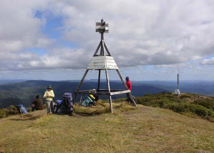
The track pops out of the bush onto the summit of Mt Pureora and the only spot on this whole trip with
a clear 360-degree view. It is a fitting climax to this trip. Of course, if the cloud is down then there is
nothing more to see so you may as well continue down the track to Link Rd. It is only about an hour down to
the carpark, the track alternating between boardwalks with handrails to washed out gullies, which once again
just go to demonstrate man's folly when trying to contain water.