Kelly Range - Hunts Saddle
Arthur's Pass National Park
- 2 – 3 days loop route
- Medium/hard
A challenging circuit route traversing the Kelly Range and returning along Kelly's Creek. The direction described is the only realistic option.
|
Walking time
|
2 – 3 days
12 hr – 15 hr
|
|---|---|
|
Distance
|
19.0km |
|
Type
|
Loop route
|
|
Grade
|
Medium/hard |
|
Bookings
|
No bookings — open access
No — open access
|
|
Starts
|
Kelly's Creek Shelter, SH73, north of Otira |
|---|---|
|
Maps
|
NZTopo50-BV20
|
|
Altitude
|
350m
–
1,411m
Altitude change 1,061m
|
Note: The minimum time indicated assumes you turn directly down Kelly's Creek from Hunt Saddle. The maximum time includes a detour to Hunts Hut.
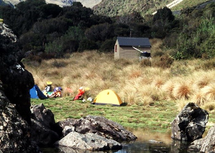
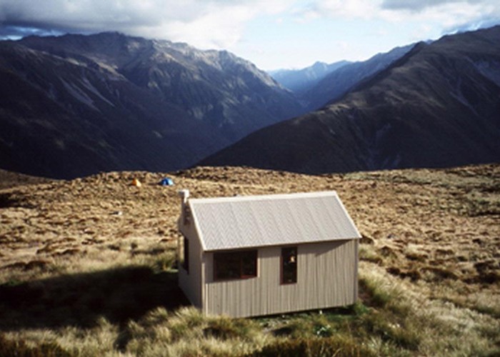
From the car park and camping area at Kelly's Creek, follow the steep trail to Carroll Hut (3 hr). The track climbs steeply for about an hour before easing and then entering scrub after 2 hours. The hut is located on a handsome tussock plateau.
From here, follow the track up to the tarns at Kelly Saddle (1165m) and head left (to the southwest) along the range. The walking is a gentle ascent, and easy going. Follow the tops as far as the map point marked 1313m near the end of the range (about 3 hr from the hut). Drop down to the left of the ridge toward the bog marked just above point 935m. This is not visible from high on the tops -- the tussock area you can see is Hunts Saddle itself. After almost an hour descent you will encounter thick scrub. This is largely a mixture of muttonbird scrub and mountain neinei. There is nothing to do but push through it directly downhill. It is very hard going, and involves climbing, scrambling, crawling, falling, but nothing you might call "walking". Trousers and gaiters are recommended. The descent through scrub to the bog takes about 1 hr. You could camp here.
From the bog, it is relatively easy to follow the creek down. A track picks up at one point on the true right, which is slightly easier than the creekbed. The descent to the Kelly's Creek Track takes 20 min.
If you are heading to Hunts Hut, turn right and follow the trail over Hunts Saddle. The saddle is hard to navigate, being muddy, and covered with head-high tussocks. Look for marker poles. A very rough track continues in forest, climbing and falling regularly. The track crosses the first of two large screes 20 minutes before the hut. Time from the saddle to the hut is about 1 hr 30 min. The hut is located at the edge of a handsome tussock clearing.
From Hunts Hut, return to Hunts Saddle and follow the Kelly's Creek Track to the car park. Beyond the saddle, an easy track heads through light forest for a while before the track crosses a slip and becomes very vague. From here on, travel is in the rough riverbed with brief marked sections that are often probably best regarded as high water tracks. One of the lower tracks is particularly steep and best avoided if possible. Time from the creek at Hunts Saddle to the car park is about 3 hr 30 min.