Nearby
Klondyke Spur
Klondyke Valley
Track
•
1 day. Easy/medium. Return by the same track.
•
Distance: less than 100m away
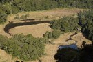
Valley track to tarns near the bushline.
More ▶︎
Mt Haast
Track
•
Easy/medium. Return by the same track.
•
Distance: 1.8km away
A steep but satisfying climb. Great views and an alpine environment reasonably accessable from the road
More ▶︎
Good views from Mt Haast
Photograph
•
Distance: 3.0km away
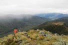
There are good views from anywhere above the bushline
More ▶︎
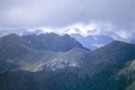
Mount Haast
Photograph
•
Distance: 3.1km away
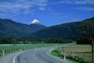
The peak of Mount Haast as seen from the Springs Junction road.
More ▶︎
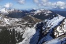
View SW from Mt Haast Sept 2012
Photograph
•
Distance: 3.1km away
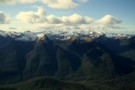
There are some great views from Mt Haast of the Victoria Range.
In the distance to the east you get a ...
More ▶︎
Mount Haast
Track
•
Medium. Return via same route.
•
Distance: 3.1km away
Short but steep clamber up a prominent peak near Springs Junction.
More ▶︎
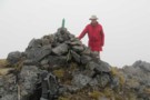
Mt Haast summit in the fog
Photograph
•
Distance: 3.1km away
A cairn marks the summit of Mt Haast
More ▶︎
Lake Stream
Track
•
2 days. Easy/medium. Return via same track.
•
Distance: 5.1km away
An irregularly-used track up to a tarn surrounded by granite ridges, and a tiny hut in the Victoria Ranges.
More ▶︎
Mount Haast
Photograph
•
Distance: 6.7km away
A striking profile from the road into Springs Junction.
More ▶︎
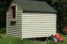
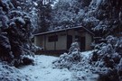
Lake Stream Hut
Hut
•
Basic Hut/Bivvy (DOC). Capacity: 2.
•
Distance: 7.5km away
A good biv located in a picturesque spot.
More ▶︎
Lake Stream Bivvy
Photograph
•
Distance: 7.5km away
Lake Stream Bivvy on a nice spring evening
More ▶︎
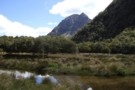
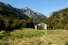
View SW from Lake Stream biv Dec 2009
Photograph
•
Distance: 7.5km away
There are some nice views to be obtained from the hanging valley where the biv is situated and even better ...
More ▶︎
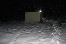
Lake Stream biv Jan 2009
Photograph
•
Distance: 7.5km away
A nice wee biv in a picturesque spot.
Good nearby camping if the biv is occupied.
(pity the small stove was pulled ...
More ▶︎
Lake Daniels to Lake Rotoroa
GPX file
•
Distance: 8.8km away
Route tracing of Alternate route from the Lewis Pass to St Arnaud
More ▶︎
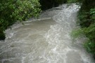
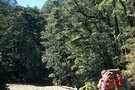
Sluice Box
Track
•
Easy. Return by the same track.
•
Distance: 9.3km away
A narrow slot cut into marble by the Maruia River on the Lake Daniell Track
More ▶︎
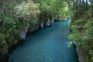
The Sluice Box
Photograph
•
Distance: 9.3km away
A short walk from Marble Hill Camping Area.
More ▶︎
Lewis Pass National Reserve
Place
•
Reserve. 182.95km2.
•
Distance: 9.3km away
A small park occupying the forested valleys around Lewis Pass and bordering Lake Sumner and Victoria Forest Parks as well ...
More ▶︎
Pell Stream
Track
•
2 – 3 days. Medium. Loop track with a road section.
•
Distance: 9.6km away
This highly recommended valley not far from the highway west of the Lewis pass, is accessible to most people with ...
More ▶︎