Mount Haast
Victoria Forest Park
- 4 hr return via same route
- Medium
Short but steep clamber up a prominent peak near Springs Junction.
|
Walking time
|
4 hr |
|---|---|
|
Distance
|
4.0km |
|
Type
|
Return via same route
|
|
Grade
|
Medium |
|
Bookings
|
No bookings — open access
No — open access
|
|
Starts
|
Car park, Upper Inangahua River Bridge, 1.5km west of Rahu Saddle, SH7 |
|---|---|
|
Maps
|
NZTopo50-BT22
|
|
Altitude
|
650m
–
1,587m
Altitude change 937m
|
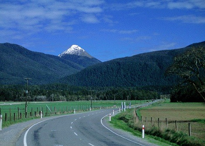
Mount Haast (1587m) is the prominent triangular peak clearly visible to the west from Springs Junction. In fact from this angle it looks just like a volcanic cone (which it is not). Despite its profile, it is a relatively easy walk up with good, panoramic views of Victoria Forest Park.
Access
From Springs Junction, take the winding Reefton road (SH7) west and look for the Inangahua River bridge about 2km beyond Rahu Saddle. There is a car park here, on the left just over the bridge.
Mount Haast summit: 4 hr return
The mossy, seemingly infrequently used (and discreetly signposted) track sets off from here, climbing directly up a spur under low, mixed beech forest.
After an hour the first patch of mountain neinei is encountered, along with a few glimpses of view, and the track bursts onto tops about 15 minutes later. The route continues up the steepening spur, heading for a triangular outcrop on the skyline. The easiest way up is perhaps to climb the stable scree of boulders here. A vague track continues from the outcrop, keeping to the spur, finally reaching the cairned summit after about 40 minutes climb from the bushline.
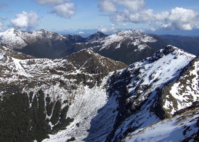
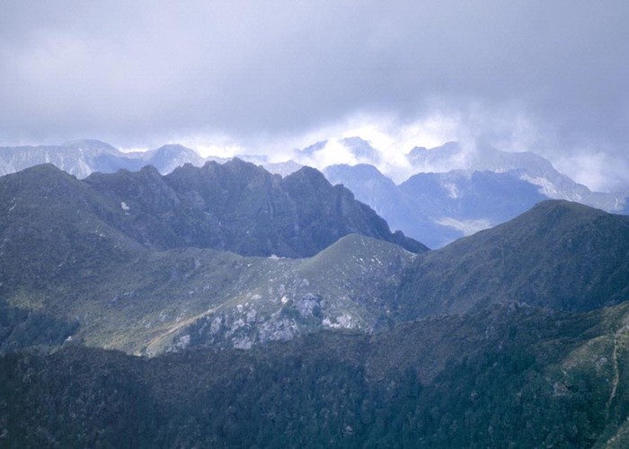
From the summit, a steep-sided ridge extends away to the west and southeast, while the route back down is to the east. Over the back of Mount Haast is the deep valley of the Rahu River Left Branch with Mount Kemp (1637m) beyond. Back across the Inangahua River is the long valley of Lake Stream and a crowd of unnamed peaks. Rahu Saddle is to the right, and Springs Junction is the flat land visible further east.
It's easy to lose the route on the way back down the tops. Keep to the right of the spur, with the entrance to the forest in sight. In fact, the forest track is so vague that it's easy to lose too. I lost the track about ten minutes from the end, bursting out of the undergrowth at the car park just metres to the right of the track entrance. Later that day, chatting in a Maruia Springs hot pool with two other trampers I'd met earlier, they said they'd done the very same thing. Not to worry though, the bush is not too hard to push through.