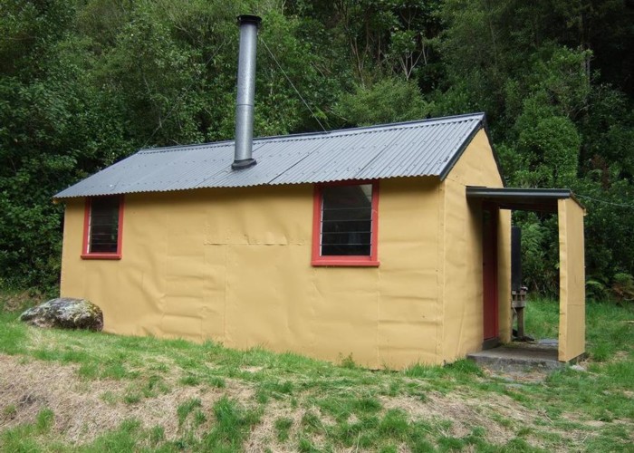
Scone hut
This hut is situated near the confluence of Scone Creek and the Perth River & is on the TL of both. It is an NZFS style six bunker. It was originally a smaller hut built in the 1960's that was extended at a later date. It is a comfortable days walk into Scone hut from the Whataroa road end. The hut is mainly used by thar & chamois hunters but also gets used by trampers and 'extreme' kayakers.
There are hot springs near the hut. A number of hut users commented that they couldn't find them. They are on the TL of the Perth about 50 - 75m below the Redfield swing bridge. There are two hot water sources with the further downstream one being the better one. It is right on the rivers edge at normal flows. We dug out a bath & tried to restrict the cold water inflow. These efforts will only last till the next floods. Three kayakers who had smelt the sulphur in the past but not managed to locate the spring got to use the bath when we told them where it was.
|
Owner
|
Owner: DOC |
|---|---|
|
Category
|
Standard Hut |
|
Sleeps
|
Sleeps 6
6
|
|
Facilities
|
Toilet, Enclosed wood/coal burner |
|
Water supply
|
Tap or tank water |
|
Getting there
|
Up the TL bank of the Whataroa River as far as a swing bridge just before the Whataroa & Perth Rivers track junction. From the track junction follow the Perth River track to Nolans hut and then on upstream to Scone hut. This route is a mixture of 4x4 track, boulder hopping & good semi benched cut track. The DOC guideline times from the roadend to Scone hut are 8 - 9hrs but in good conditions most parties should find they can walk in a lot quicker than that. (The tracks are well maintained!) |
|---|---|
|
Unlocked
|
This hut is unlocked and open to access. |
|
Bookings
|
No bookings — open access
No — open access
|
|
Altitude
|
400m |
|---|---|
|
Mobile phone coverage
|
No coverage |
|
Maps
|
NZTopo50-BW17
|