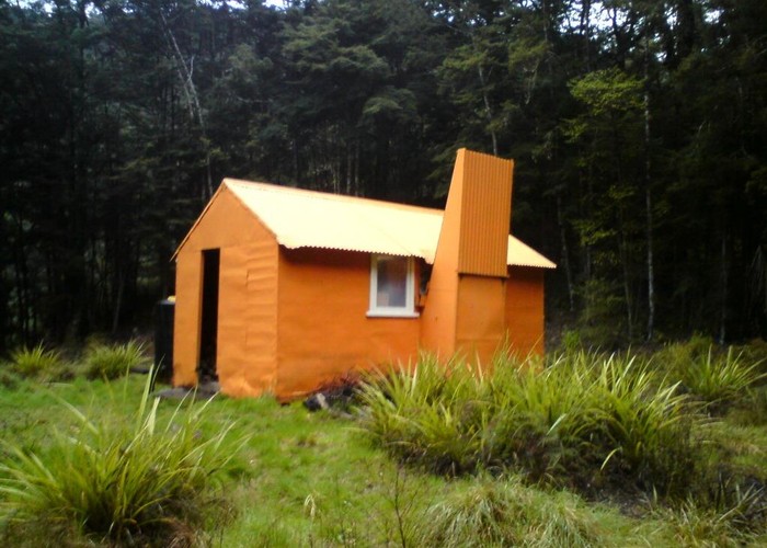
Ikawetea Forks Hut
Ruahine Forest Park
Ikawetea (Ikawatea) Forks Hut has become one of the remotest huts in the Ruahines. Land to its east has been transferred to Iwi ownership, closing legal access from that direction. The valley is bordered on the west by the private Mangaohane Station.
It is, however, well worth a visit. Upriver, the valley is gorged, but fun and travelable, especially in summer. 12 pairs of blue ducks counted in the last survey. Kiwi are also resident in the valley.
Access is not impossible either, a good marked route leads from Ruahine Corner hut. Upriver provides great summer riverbed travel to Rockslide Hut and the now-private (but effectively abandoned) Mistake Biv. The hut can, at a push be visited in a weekend from Sentry Box / Masters Shelter on the Mangahao road, and more easily from No Mans roadend (balloted access) either via the river or along the old track through the now-Maori land. Access down the ridge route from the Main Range is 'simple' (says hut book).

|
Owner
|
Owner: DOC |
|---|---|
|
Category
|
Standard Hut |
|
Sleeps
|
Sleeps 7
7
|
|
Facilities
|
Toilet, Open fireplace |
|
Water supply
|
Tap or tank water |
|
Getting there
|
Ruahine Corner Hut: 6km, poled / marked route down trap-line. Pink triangles on tops / ridge, blue triangles mark final descent to the hut No Mans Hut / Road: 7km, overgrown track (crosses private land) Rockslide Biv: 7km, 1.5 - 3 hrs, track / riverbed route. Track climbs the ridge behind hut before dropping steeply back to Apias Creek, avoiding waterfalls. River travel to Rockslide. -> Mistake Biv (3km, 1-2hrs, river route) -> Aranga Hut/No Mans Hut (3km 1.5-3hrs, route) |
|---|---|
|
Unlocked
|
This hut is unlocked and open to access. |
|
Bookings
|
No bookings — open access
No — open access
|
|
Altitude
|
600m |
|---|---|
|
Mobile phone coverage
|
No coverage |
|
Maps
|
NZTopo50-BK36
|
|
Link
|
www.doc.govt.nz/p...http://www.doc.govt.nz/parks-and-recreation/places-to-stay/backcountry-huts-by-region/hawkes-bay/ikawatea-forks-hut/ |