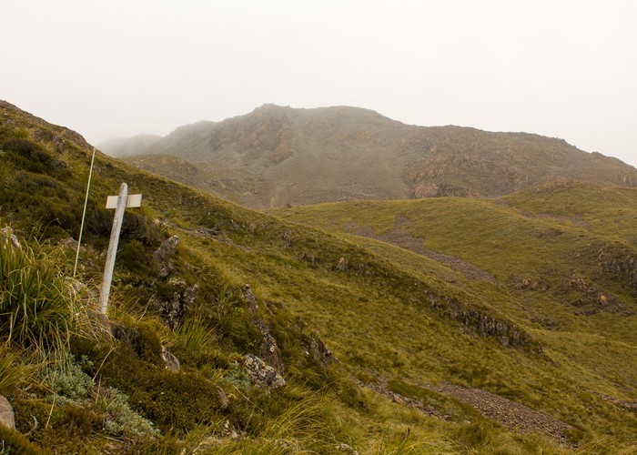
Rolleston River Landfill Road track to Mt Barron
Arthur's Pass National Park
- 3 hr – 4 hr loop track with a road section
- Hard
Other branch of loop of tracks up and down Mt Barron
|
Walking time
|
3 hr – 4 hr |
|---|---|
|
Distance
|
2.0km |
|
Type
|
Loop track with a road section
|
|
Grade
|
Hard
track only recut to just above bushline as of May 2010 Grades explained
|
|
Bookings
|
No bookings — open access
No — open access
|
|
Starts
|
Just across road bridge over Otira on true left bank |
|---|---|
|
Ends
|
Tussock zone on way to Mt Barron |
|
Maps
|
NZTopo50-BV20
|
|
Altitude
|
1,340m |
This was one end of a great loop up and down Mt Barron. This track is signposted from just over the Otira road bridge, near the old Rolleston River landfill site.
This Rolleston River branch was cut in May 2010 by Hokitika DoC to just above the bushline only. Hopefully they will finish the job. They have left a scrub cutter there so it looks as though they plan to come back shortly.
Unfortunately the track cutters have not followed the upper part of the original line of the benched packhorse track created by railway surveyors. This is either because they were unable to find it hidden by thick regrowth or were too bloody lazy and just decided to cut straight uphill as it would be less work. At least they haven't banged the nails all the way in the track markers as they sometimes do so the markers should last a few years...Perhaps someone coming down from the tops can mark the original line and recut it. Same goes for the Goat Creek track too.