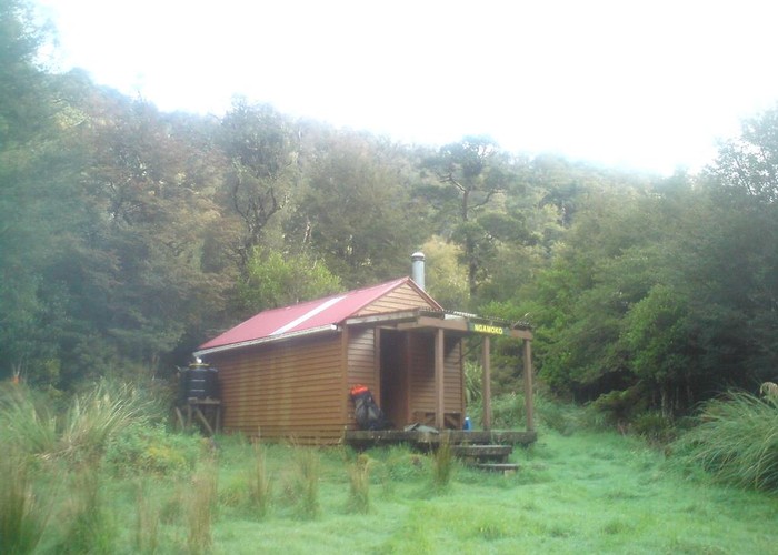
Ngamoko Hut
Ruahine Forest Park
Ngamoko Hut (6 bunks, stove, river water) is a pleasent hut located in scrub on the western bank of the Pohongina River at its confluence with Apiti Creek. The location gets morning and midday sun.
Routes upriver and downriver to Leon Kirvig Hut or Mid Pohongina Hut are valley floor routes, often on the riverbed and with various deep pools to wade. Note that centre creek biv has been removed.
A reasonable route heads up the Apiti valley east of the hut to join the ridgeline track north of Cattle Creek. Look out for the marked but uncut track shown on maps on the true left 100m from the hut. This bypasses unnavigable falls on the lower river. The remainder of the route is riverbed until the unmarked climb to the main ridge: just chose a good spur and follow it!
A route also climbs to the Ngamoko range west of the hut.
|
Owner
|
Owner: DOC |
|---|---|
|
Category
|
Standard Hut |
|
Sleeps
|
Sleeps 6
6
|
|
Facilities
|
Toilet, Enclosed wood/coal burner |
|
Water supply
|
Tap or tank water |
|
Getting there
|
Pohongina Base: -> Mid Pohongina Hut (4km, 2-3 hrs, river route) -> road (8km, 2-4 hrs, track) Takapari Road (2764100, 6122100): -> Mid Pohongina Hut -> old Centre Crk Biv site (3.5km, 1-2 hrs) -> road (2km, 1-2hrs, STEEP track) Leon Kirvig Hut: 5km, 2.5-5hrs, riverbed route Piripiri Hut: 6km 2.5-5hrs via Ngamoko range. Overgrown track, leatherwood on ridge, left at tarn then right at saddle. Steep route descends Piripiri creek. Triangle marks climb to hut |
|---|---|
|
Unlocked
|
This hut is unlocked and open to access. |
|
Bookings
|
No bookings — open access
No — open access
|
|
Altitude
|
740m |
|---|---|
|
Mobile phone coverage
|
No coverage |
|
Maps
|
NZTopo50-BL36
|