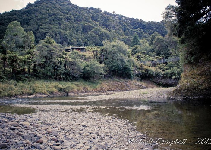
Hanamahihi Hut
Te Urewera
Hanamahihi hut (10 bunk, stove, firewood available) sits on cleared terraces overlooking the Whakatane River and swingbridge. The hut is popular with hunters and also sees some trampers walking the Whakatane River track.
The hut has a large verandah and is probably a lovely spot on a nice day (hosed it down endlessly when I was here!)
Downriver the Whakatane River Track crosses to the true right over the swingbridge and climbs a ridge to avoid the detour round the river bend. It then climbs again to reach Waikere Junction Hut. These are the only two sections of the track not on the valley floor. The rest is easy and fast going. (Semi-?)Wild horses and bush-dwellers make for an interesting walk!
Unmarked routes also lead up the Manaohou Stream 100m north of the hut to either Manaohau Right Branch Hut or out to Galatea via the rough track over Pukira Peak.

|
Owner
|
Owner: DOC |
|---|---|
|
Category
|
Standard Hut |
|
Sleeps
|
Sleeps 10
10
|
|
Facilities
|
Toilet, Enclosed wood/coal burner |
|
Water supply
|
Tap or tank water |
|
Getting there
|
Ruatoki Valley Rd, Waikirikiri (W16 2860400, 6325900): -> Waikare Jn Hut (9km, 2.5-4hrs, track) -> Ohora Hut (11km, 2.5-4 hrs, valley floor track) -> roadend (13km, 2-4.5 hrs, valley floor track) Mataatua Rd, Ruatahuna: -> Ngahiramai Hut -> Tawhiwhi Hut -> roadend (see DOC guide for times) Troutbeck Rd, Galatea (2843920,6303355): -> old Kaitawa Hut site (6km, 2-3 hrs, riverbed route) -> roadend (11km, 3.5-5hrs, riverbed route, rough track over tops) |
|---|---|
|
Unlocked
|
This hut is unlocked and open to access. |
|
Bookings
|
No bookings — open access
No — open access
|
|
Altitude
|
160m |
|---|---|
|
Mobile phone coverage
|
No coverage |
|
Maps
|
NZTopo50-BF39
|
|
Link
|
www.doc.govt.nz/p...http://www.doc.govt.nz/parks-and-recreation/tracks-and-walks/east-coast-hawkes-bay/opotiki-area/whakatane-river-tramping-tracks/ |