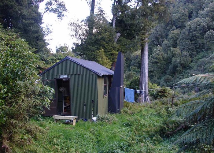
Makakoere Hut
Te Urewera
Located about half way up the Makakoere Stream this hut could easily be missed and I have heard stories of this happening. Valley floor is good gravel going most of the way up from Tawa, but just before the hut is a narrow section of large boulders. Watch for the orange triangle on the true right just beyond this, or carry a GPS. It comes in very handy.
|
Owner
|
Owner: DOC |
|---|---|
|
Category
|
Standard Hut |
|
Sleeps
|
Sleeps 4
4
|
|
Facilities
|
Toilet, Open fireplace |
|
Water supply
|
Tap or tank water |
|
Getting there
|
Moanui Rd: Carpark -> Tawa Hut: Track, 6km, 1.5-3 hrs. Tawa-> Here: 5km, 1.5-3hrs, Riverbed route the Makakoere Stream. Turn off the track at signpost 500m upstream of Tawa Hut. Te Rangaakapua Biv: 8km, 2.5-5hrs. Riverbed route / rough track. 5km up river. Triangles mark start of track. Overgrown but well marked for 700m ascent (3km) to Te Rangaakapua. Crossings to Anini Str (and thence Ruas Track) and also over to Kahunui Hut are also not uncommon. |
|---|---|
|
Unlocked
|
This hut is unlocked and open to access. |
|
Bookings
|
No bookings — open access
No — open access
|
|
Altitude
|
544m |
|---|---|
|
Mobile phone coverage
|
No coverage |
|
Maps
|
NZTopo50-BF40
|
ID 3559
About this hut
72 views in the past year (6 per month).