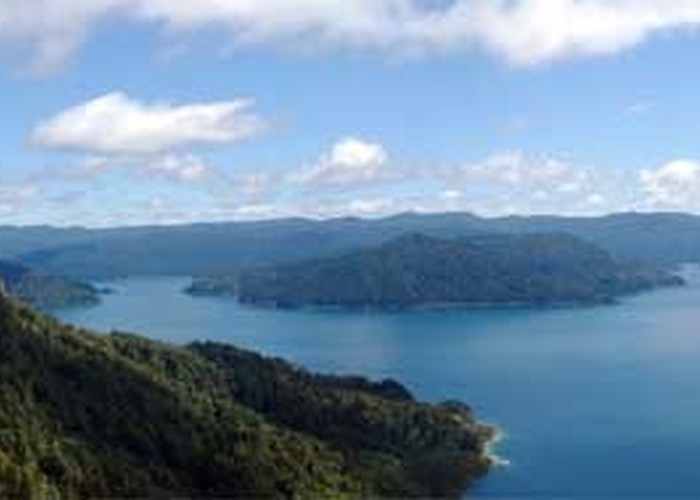
Lake Waikaremoana Track
Te Urewera
- 3 – 4 days one way
- Easy/medium
- Bookings required
"The Lake Track." Busy track in summer with swimming and fishing along the lake-side.
9 members favourited
18 members checked in
|
Walking time
|
3 – 4 days
15 hr – 20 hr
|
|---|---|
|
Distance
|
46.0km |
|
Type
|
One way
|
|
Grade
|
Easy/medium |
|
Bookings
|
Bookings required
Required
Bookings for huts and campsites are required: https://booking.doc.govt.nz/
|
|
Starts
|
SH38, Onepoto |
|---|---|
|
Ends
|
SH38, Hopuruahine Landing |
|
Maps
|
NZTopo50-BG40
|
|
Altitude
|
614m
–
1,180m
Altitude change 566m
|
|
Link
|
www.doc.govt.nz/parks-and-recreation/tracks-and-walks/east-coast/te-urewera/lake-waikaremoana-great-walk/http://www.doc.govt.nz/parks-and-recreation/tracks-and-walks/east-coast/te-urewera/lake-waikaremoana-great-walk/ |
|---|
ID 249
About this track
176 views in the past year (15 per month).