Shamrock Hut (Ahuriri)
Ahuriri Conservation Park
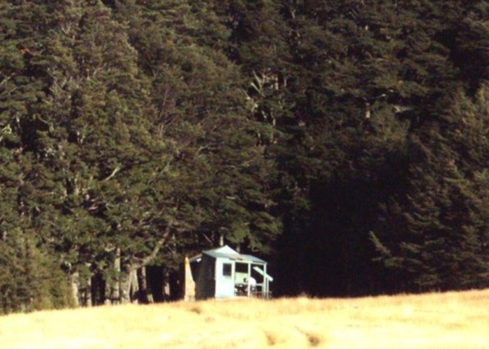
Shamrock Hut (2 bunks, matreses, fireplace, firewood avail., stream water) is an old station hut in the mid-reaches of the Ahuriri. The hut sits on the bushline beside a small stream and firewood / water are readily available.
The hut gets moderate use from hunters, trampers and fishermen. Red deer are present in beech forests on the valleyside, and chamois and thar at their respective altitudes both above the main valley and side valleys. For more information on the hut and track in see link below.
|
Owner
|
Owner: DOC |
|---|---|
|
Category
|
Basic Hut/Bivvy |
|
Sleeps
|
Sleeps 2
2
|
|
Facilities
|
Toilet, Open fireplace |
|
Water supply
|
Tap or tank water |
|
Getting there
|
Ahuriri Base Hut / roadend: 8km, 4WD track Huxley / Hopkins: Shamrock Hut -> Hagens Hut (6km, 4WD) -> Top Hut (4km, 4WD) -> Sth Huxley Biv (13km, unmarked alpine route) -> Huxley Forks Hut (7km, unmaintained track) -> Lake Ohau roadend / Huxley Lodge (16km, 4-8 hrs, track) South Temple Hut (14km, 5-10hrs) unmarked alpine route via Watson Strm & 1900m col (G38 475662) Scrubby Hut (Hunter): (14km, 6-12hrs) very hard, unmarked alpine route via Little Canyon Creek |
|---|---|
|
Unlocked
|
This hut is unlocked and open to access. |
|
Bookings
|
No bookings — open access
No — open access
|
|
Altitude
|
820m |
|---|---|
|
Mobile phone coverage
|
No coverage |
|
Maps
|
NZTopo50-BZ14
|
|
Link
|
https://www.youtu...https://www.youtube.com/watch?v=ozm89Rqdvd4 |