Section: Edwards River - McArthur Track
St James Conservation Area
- 2 days one way
- Easy/medium
- Car park to Scotties Camp Hut: 14.5km, 3 hours 30 minutes
- Scotties Camp Hut to Pool Hut: 8.2km, 2 hours 30 minutes
- Pool Hut to Lake Guyon junction: 18.2km, 5 hours 30 minutes
- Maling Pass - Moki Track, 1 day to Tophouse Road at Lake Tennyson
- Lake Guyon - Fowler Pass, 1 day to Tophouse Road
The southernmost section of the St James Cycle Trail, between Tophouse Road and the Lake Guyon junction on the Waiau Uwha River.
|
Walking time
|
2 days
11 hr 30 min
|
|---|---|
|
Distance
|
40.8km |
|
Type
|
One way
|
|
Grade
|
Easy/medium |
|
Bookings
|
No bookings — open access
No — open access
|
|
Starts
|
Edwards River Track car park, Tophouse Road, north of St James Homestead |
|---|---|
|
Ends
|
Lake Guyon junction, Waiau Uwha River |
|
Maps
|
NZTopo50-BT24
|
|
Altitude
|
610m
–
946m
Altitude change 336m
|
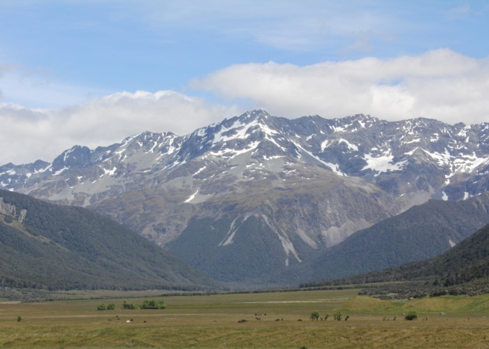
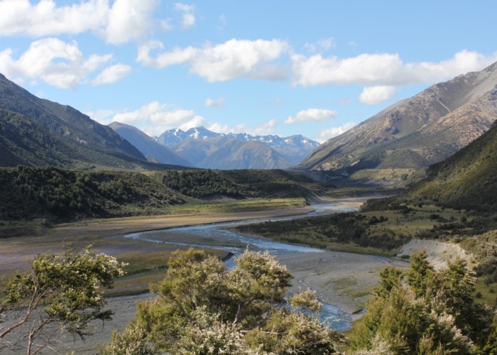
The St James Cycle Trail is open to walkers, horses, and mountain bikes, with some motorised vehicle access. This section leads down the Edwards River and over Charlies Saddle into the deep Waiau Uwha Valley, Turning upriver, the McArthur Track leads on up to the junction west of Lake Guyon. From here, you can continue the trail north, or cut eastward back across Fowler Pass.
Access
To reach the track start, take the road out of Hanmer Springs over Jacks Pass. Turn off at the Clarence River and take Tophouse Road. The road is dirt and suitable for regular vehicles. However, it may be corrugated, and slow going.
The southern end of the St James Cycle Trail is at the nearby St James Homestead. The route described here starts just north, at the signposted Edwards River track end, although you could start at either point.
Car park to Scotties Camp Hut
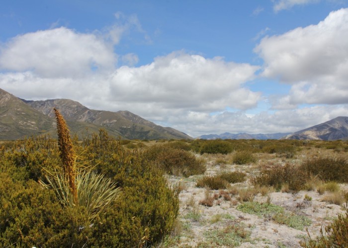
Over a stile, a vehicle track leads gently up and over alpine herbfields: daisies, gentians, orchids, harebells, and bog pine. The track flattens off and bends into a stand of shrubby mānuka before meeting the track from the homestead.
The track drops quickly to meet Edwards River in the valley floor. The grassy valley is clad in matagouri, briar rose, with stands of bulbinella occupying the damp spots. After an hour, the track crosses to the true right, then crosses Sadds Stream from the right.
A long eroded terrace marks the point where Cow Stream and Cadwallo Stream enter from the true left and right respectively. Cadwallo Stream has dumped a load of fresh rubble in the river bed. Crossing Edwards and climbing onto the terrace, the track branches left and right. The left branch leads up to the Cow Stream hot spring. The right branch continues onward.
After a small gorge, the track turns out at Scotties Camp Hut, located next to the Edwards Swingbridge. The small hut features solar lighting.
Scotties Camp Hut to Pool Hut
Pool Hut to Lake Guyon junction
Walking times
Connecting sections