Maling Pass / Lake Guyon / Fowler Pass
St James Conservation Area
- 2 days loop track with a road section
- Easy/medium
- Car park to Maling Pass: 1 hour 20 minutes
- Maling Pass to Waiau Pass Track turn-off: 1 hour 45 minutes
- Waiau Pass Track turn-off to Lake Guyon turn-off: 50 minutes
- Lake Guyon turn-off to Lake Guyon Hut: 30 minutes
This circuit is a double-crossing of the St James Range, dropping into the deep Waiau Valley. The first day's walk is part of the St James Cycle Trail and is easier, smoother walking than the second day.
|
Walking time
|
2 days
9 hr
|
|---|---|
|
Distance
|
38.2km |
|
Type
|
Loop track with a road section
|
|
Grade
|
Easy/medium |
|
Bookings
|
No bookings — open access
No — open access
|
|
Starts
|
Marked car park at Molesworth boundary gate, Tophouse Road behind Hanmer Springs. |
|---|---|
|
Ends
|
Fowlers Hut, Tophouse Road. |
|
Maps
|
NZTopo50-BT24
|
|
Altitude
|
760m
–
1,308m
Altitude change 548m
|
The dry, barren hills of the St James are in the rain shadow of the Spenser Mountains. Dry beech forests were burned off, leaving a golden country of tussock and herbfields. These hills are steeped in history. The long Waiau and Clarence Valleys were both traditional Maori routes. European history is represented by several historic huts and archaeological sites along the way.
This overnight route has track ends that are 10km apart along the Tophouse Road. You could walk into Lake Guyon and return the same way, or you could drop a bicycle at the Fowlers Hut track end to close the loop.
To reach the track start, take the road out of Hanmer Springs over Jacks Pass. Turn off at the Clarence River and take Tophouse Road. The road is dirt and suitable for regular vehicles. However, it may be corrugated, and slow going. The St James Cycle Trail starts at the St James Homestead, which is nearby. Fowlers Hut is further along on the left, clearly visible. At a boundary gate, a car park marks the northern end of the St James Cycle Trail. This is the starting point for the route described here. A toilets and information board is here. The Lake Tennyson campsite is also nearby, just up the road.
Car park to Maling Pass (1308m)
The route sets off along a 4WD track through handsome alpine herbfields, following the line of Maling Pass Stream. It is marked by blue cycle trail posts, and open to both vehicles and bicycles as well as walkers.
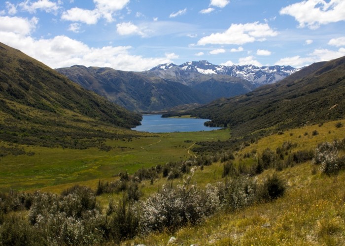
The climb begins after almost an hour, as the trail bends past Mts McCabe and Princess. The final climb next to the stream is painless, yet dramatic, as the deep void of the Waiau Valley opens up, with the rugged Spenser Mountains opposite.
The pass is named after Christopher Maling, a military man turned surveyor, whose father was killed at the Wairau Incident. Maling and Henry Lewis would discover the Lewis Pass in 1860 (it was already known to Ngai Tahu Maori).
Maling Pass to Waiau Pass Track turn-off
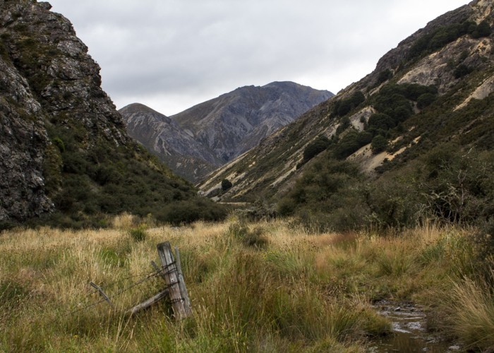
Over the pass, the road sidles above the valley floor, dropping steeply down to the river. On the right is a rabbit proof fence, completed in 1889 and once running for 78 miles from the Main Divide to the coast.
The track passes through a pocket of dry forest and levels out amongst manuka, coprosma, and matagouri scrub. The track turns down valley, leading away from the enticing views toward Waiau Pass. Markers for the Waiau Pass Track are sometimes visible on the far bank of the river.
Eventually, signs mark the end of vehicle access down the valley. A toilet is located here, and there is often an informal vehicle camp. A marked track junction to Waiau Pass is just a little further on.
Waiau Pass Track turn-off to Lake Guyon turn-off
The track follows the top edge of the river flats, climbing above a bend in the river and soon crossing a bridge amongst scrub. This is the Lake Guyon outlet. The track junction is nearby. The cycle trail continues south toward Pool Hut, while our route turns left.
Lake Guyon turn-off to Lake Guyon Hut
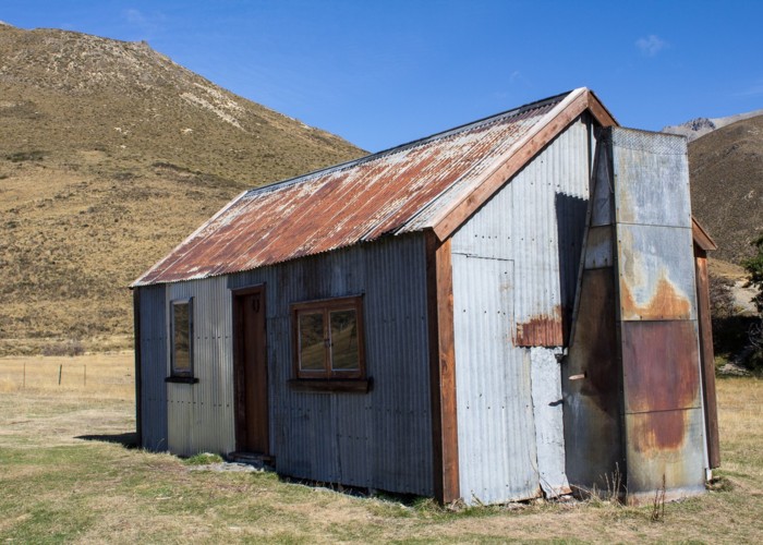
An old vehicle track climbs the gentle rise to the lake, crossing the stream and leading around the northern shoreline. Through a pocket of beech forest, the hut is located on the far side of a small peninsula at the edge of a clearing.
Lake Guyon Hut is very small, and well used by cyclists and fisher folk. There is however ample space to camp around the hut.
Lake Guyon Homestead was sited here in 1860, and remains of the cob house are still present, along with poplar trees, signs of a garden and walls.