Maling Pass, Lake Guyon, Fowler Pass circuit
St James Conservation Area
- 2 days loop track with a road section
- Easy/medium
- Maling Pass - Moki Track, 1 day from Lake Tennyson to the Lake Guyon junction
- Lake Guyon - Fowler Pass, 1 day from Lake Guyon junction to Fowler Hut on Tophouse Road
- Edwards River - McArthur Track, 2 days from Lake Guyon junction to Tophouse Road at Edwards River
This circuit is a double-crossing of the St James Range, dropping into the deep Waiau Uwha Valley. The first day's walk is part of the St James Cycle Trail and is easier, smoother walking than the second day.
|
Walking time
|
2 days
9 hr
|
|---|---|
|
Distance
|
35.8km |
|
Type
|
Loop track with a road section
|
|
Grade
|
Easy/medium |
|
Bookings
|
No bookings — open access
No — open access
|
|
Starts
|
Marked car park at Molesworth boundary gate, Tophouse Road behind Hanmer Springs. |
|---|---|
|
Ends
|
Fowlers Hut, Tophouse Road. |
|
Maps
|
NZTopo50-BT24
|
|
Altitude
|
760m
–
1,308m
Altitude change 548m
|
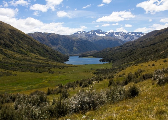
The barren hills of the St James are in the rain shadow of the Spenser Mountains. Dry beech forests were burned off, leaving a golden country of tussock and herbfields. These hills are steeped in history. The long Waiau Uwha and Waiau Toa (Clarence) Valleys were both traditional Māori routes. European history is represented by several historic huts and archaeological sites along the way.
This overnight route has track ends that are 10km apart along the Tophouse Road. Close the loop by stowing a bicycle at one end, by swapping cars, or by hitchhiking along the road (north in the morning or south in the evening).
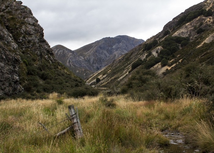
Access
Take the road out of Hanmer Springs over Jacks Pass. Turn off at the Clarence River and take Tophouse Road. The road is dirt and suitable for regular vehicles. However, it may be corrugated, and slow going. The St James Cycle Trail starts at the St James Homestead, which is nearby. Fowlers Hut is further along on the left, clearly visible. At a boundary gate, a car park marks the northern end of the St James Cycle Trail. This is the starting point for the route described here. A toilet and information board is here. The Lake Tennyson campsite is also nearby, just up the road.
The route
The track sections are described separately: