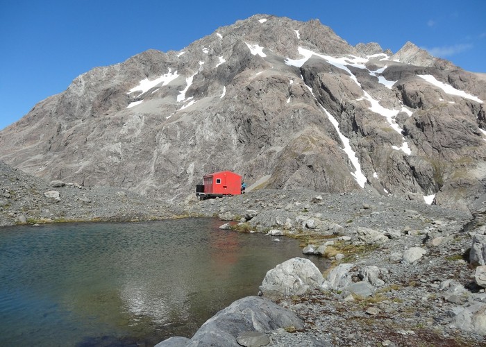
Barker Hut
Arthur's Pass National Park
- 2 days return by the same track
- Medium
Surrounded by glaciers at the head of the White River, this is the highest hut in Arthur's Pass National Park.
|
Walking time
|
2 days
13 hr – 17 hr
|
|---|---|
|
Distance
|
48.0km |
|
Type
|
Return by the same track
|
|
Grade
|
Medium
Unsafe during winter and early spring due to avalanche hazard. Significant river crossings, and some alpine route finding. Grades explained
|
|
Bookings
|
No bookings — open access
No — open access
|
|
Starts
|
Klondyke Corner, SH73 12km south of Arthur's Pass Village |
|---|---|
|
Maps
|
NZTopo50-BV20
|
|
Altitude
|
640m
–
1,560m
Altitude change 920m
|
From Klondyke Corner, cut directly up the Waimakariri Riverbed. A flood track is available on the true right river bank, but this is much slower going. Anti Crow River is dangerous to ford in flood anyway. From Carrington Hut, follow the true right bank of the White River and cross to the true left near the confluence with the Taipoiti: either ford or use the Clough Cableway. Beyond Kilmarnock Falls (152m), a vague trail continues through forest the scree and grass. Further up the valley, the track crosses avalanche chutes, then drops into the stream below the Cahill Glacier. Cairns mark a route across the stream to a ravine. The bridge here no longer exists. Beyond, cairns lead beneath cliffs up to the hut.