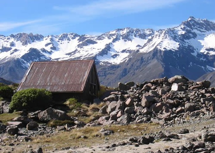
Ball Shelter
Te Wāhipounamu - South West New Zealand World Heritage Area
- 5 hr – 6 hr return via same track
- Easy/medium
Follow the old Ball Hut Road from the Blue Lakes car park along the moraine wall of the Tasman Glacier near Aoraki / Mount Cook. Although this track approaches Mount Cook, the peak is never visible.
5 members favourited
1 member checked in
|
Walking time
|
1 – 2 days
5 hr – 6 hr
|
|---|---|
|
Distance
|
16.0km |
|
Type
|
Return via same track
|
|
Grade
|
Easy/medium |
|
Bookings
|
No bookings — open access
No — open access
|
|
Starts
|
Blue Lakes car park, near Aoraki / Mount Cook Village |
|---|---|
|
Maps
|
NZTopo50-BX15
NZTopo50-BX16 |
|
Altitude
|
800m
–
1,020m
Altitude change 220m
|