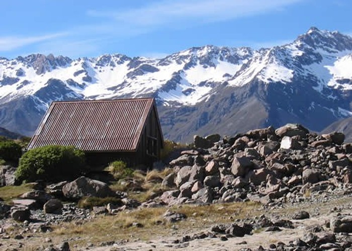
Ball Shelter
Te Wāhipounamu - South West New Zealand World Heritage Area
- 2 hr 30 min – 3 hr 30 min return via same track
- Easy/medium
Follow the old Ball Hut Road from the Blue Lakes car park along the moraine wall of the Tasman Glacier near Aoraki / Mount Cook. Although this track approaches Mount Cook, the peak is never visible.
|
Walking time
|
1 – 2 days
2 hr 30 min – 3 hr 30 min
|
|---|---|
|
Distance
|
8.0km |
|
Type
|
Return via same track
|
|
Grade
|
Easy/medium |
|
Bookings
|
No bookings — open access
No — open access
|
|
Starts
|
Blue Lakes car park, near Aoraki / Mount Cook Village |
|---|---|
|
Maps
|
NZTopo50-BX15
NZTopo50-BX16 |
|
Altitude
|
800m
–
1,020m
Altitude change 220m
|
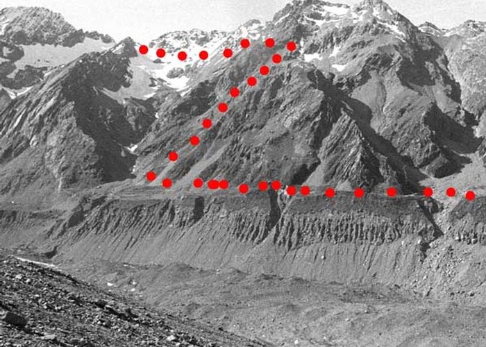
Beginning at a road end shelter, a 4WD road heads north, hemmed between the Mount Cook Range on the left and a tall moraine wall on the right. A second car park is passed in about 30 minutes, which is currently accessible to regular cars.
The Tasman Glacier and Lake are tantalisingly close but hidden. It is well worth clambering up the moraine at some point for the view.
After almost 1.5 hours, the track climbs onto the moraine wall and the views open up to the north and east. From here, the track soon becomes a foot track, passing the major slips that saw the closure of the road to vehicles in the 1970s. The track cuts across grassy flats and small sections of scree before rejoining the road.
The shelter is located near the bush on a large grassy clearing above a morraine wall.(ample camping here).
Beyond here, a trail leads on to Ball Glacier. Continuing along the flats, the trail soon drops down the moraine wall in a series of steps right down to the level of the Tasman Glacier. The views of the Ball Glacier itself are very unremarkable. Much more common is hiking up Ball Ridge towards Caroline Hut.