Nearby
Pyke River
Big Bay - Pyke - Hollyford Road-end Route
GPX file
•
Distance: 1.1km away
Big Bay - Pyke - Hollyford Road-end Route as tramped by us in May 2012 and recorded with Garmin GPS60csx
More ▶︎
Pyke Airstrip
Photograph
•
Distance: 2.2km away
The last good camping to be had here if you push on past Pyke Crossing.
More ▶︎
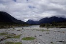
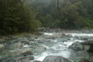
Pyke Crossing
Photograph
•
Distance: 2.9km away
A large braided river crossing, it was 3 or 4 seperate water channels seperated by gravel islands when this photo ...
More ▶︎

Mind the little bitches! Don`t forget some anti-sandfly-shit!
Photograph
•
Distance: 4.2km away
On this pic u can see just a little of them. After a few days at "camp sandfly" the bitches ...
More ▶︎
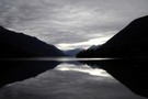
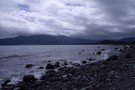
Lake Wilmot
Photograph
•
Distance: 5.0km away
Taken from where the Pyke flows into the lake, looking South. A very long, tiresome bushbash around the lake awaits.
More ▶︎
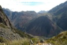
Red Pyke River confluence with the Pyke
Photograph
•
Distance: 7.3km away
The Red Pyke River meets the Pyke in the Pyke Gorge
More ▶︎
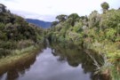
The Awarua River
Photograph
•
Distance: 7.8km away
Taken from the bridge about 10 minutes from the Big Bay hut.
More ▶︎
Pyke - Big Bay Route
Track
•
3 – 4 days. Hard. One way.
•
Distance: 8.0km away
A more challenging extension to the Hollyford Track following old roads, rivers, lake edges, and beaches.
More ▶︎
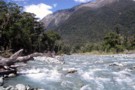
The Barrier River
Photograph
•
Distance: 8.3km away
This is the Northern branch. Very swiftly flowing, luckily it was only knee deep. Would be quite impassible when in ...
More ▶︎
Big Bay Hut
Hut
•
Standard Hut (DOC). Capacity: 9.
•
Distance: 8.3km away
Big Bay Hut (9 bunk, stove, limited firewood, tank water) is a house just above the beach in the remote ...
More ▶︎
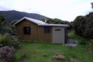
Big Bay hut
Photograph
•
Distance: 8.3km away
Very hard to find if you are coming from Martins Bay. The whole area between the sand dunes at Big ...
More ▶︎
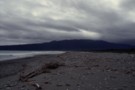
Three Mile Beach at Big Bay
Photograph
•
Distance: 8.8km away
Windswept, stoney and very uncomfortable to walk on. On the bright side theres plenty of driftwood if you feel like ...
More ▶︎
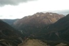
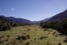
Red Mountain
Photograph
•
Distance: 8.9km away
Red Mountain from the descent from Stag Pass; the Simonin Flats are visible alongside the upper Pyke River with Kea ...
More ▶︎