Little Kyeburn Track
- 1 hr 30 min – 3 hr loop track
- Easy/medium
A 6km tramping track to the historic Buster Diggings and Buster Shelter Hut in the Oteake Conservation Area / Kakanui Ranges. This also forms part of the loop track over the 1400m Mt Kyeburn.
|
Walking time
|
1 hr 30 min – 3 hr |
|---|---|
|
Distance
|
6.3km |
|
Type
|
Loop track
|
|
Grade
|
Easy/medium
Will be snow-covered in winter. Skiing a better option at this time of year, Grades explained
|
|
Bookings
|
No bookings — open access
No — open access
|
|
Starts
|
Little Kyeburn Road (DOC sign at roadend) |
|---|---|
|
Ends
|
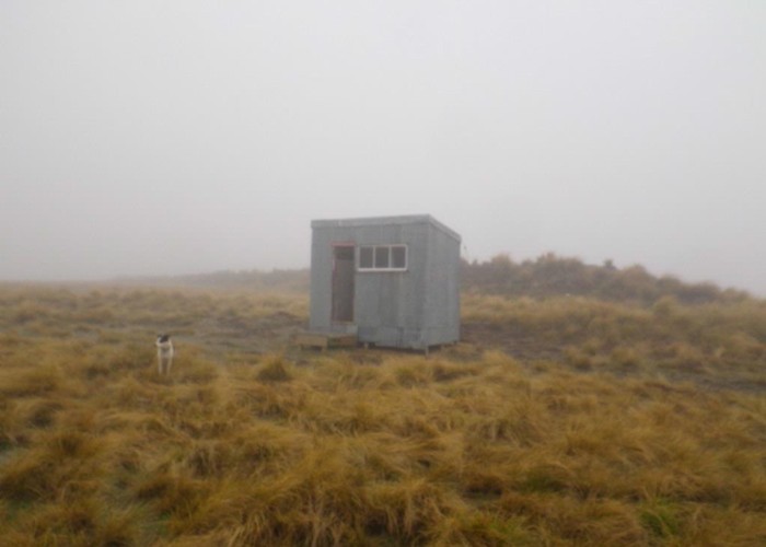
Mt Buster Shelter Hut |
|
Maps
|
NZTopo50-CB16
|
|
Altitude
|
657m
–
1,220m
Altitude change 563m
|
DoC have been kind enough to cut a new track up the Little Kyeburn Gorge to Buster Diggings and the Buster Shelter Hut. So I figure I should be kind enough to write about it.
The Oteake Conservation area is probably not a prime destination for trampers - a series of rounded tussock-topped hills with occasional rock & scree summits, cut by a number of gorged creeks such as the Little Kyeburn. The area is principally used by hunters, cross-country skiers and 4wd enthusiasts. Most tracks (though not this one) are also accessible to mountain bikes and horses.
The track is accessed from the Little Kyeburn Road, which turns off the Pig Root at Kyeburn, and crosses the Danseys Pass road from Naseby. The road is 2wd accessible, but crosses 2 fords so low clearence may be an issue for some.
The start of the track is hard to spot: go though the last gate on the 2wd road (where the Otoake Conservation Area sign is located), and there are two old tin huts. This is the carpark.
From the huts, follow the fenceline upriver across the paddock. After 100m a clear 4wd track begins at a gate. Follow this for 1.5km until it crosses the Little Kyeburn where a DoC sign points left to the Little Kyeburn Track. You can also drive this far if you have 4wd or it's dry.
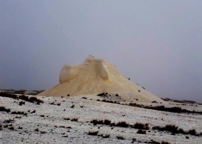
The tramping track follows a fenceline and then enters the Little Kyeburn Gorge. It heads up the valley floor for a couple of km through matagauri and below bluffs and scree, before zigzagging between bluffs to the tussock tops above, From there it's a further 2km to the Buster Shelter Hut. The buster diggings gold mining area starts behind the hut and is worth a visit.
The track is marked all the way with orange markers on warratahs.
Return options
There are three options to return to the carpark:
1) Back the way you came
2) Via the Mt Buster 4wd track: 1-2hrs
Cross the style behind the hut and follow the old 4wd track west through the buster diggings. At the locked gate turn left and follow the 4WD Mt Buster Rd 6km back to the carpark.
3) Via Mt Kyeburn: 2-4hrs
Cross the style behind the hut and follow the old 4wd track east to just below the summit of Mt Kyeburn. A short scramble is required to reach the summit. From the summit head due west, ignoring the 1st track which leads back to farmland, and continue down the ridge immediately south of the Little Kyeburn. An old 4wd track is soon picked up which ziz-zags back to the start of the Little Kyeburn Track.
ID 6198
About this track
270 views in the past year (23 per month).