Parks Peak Hut
Ruahine Forest Park
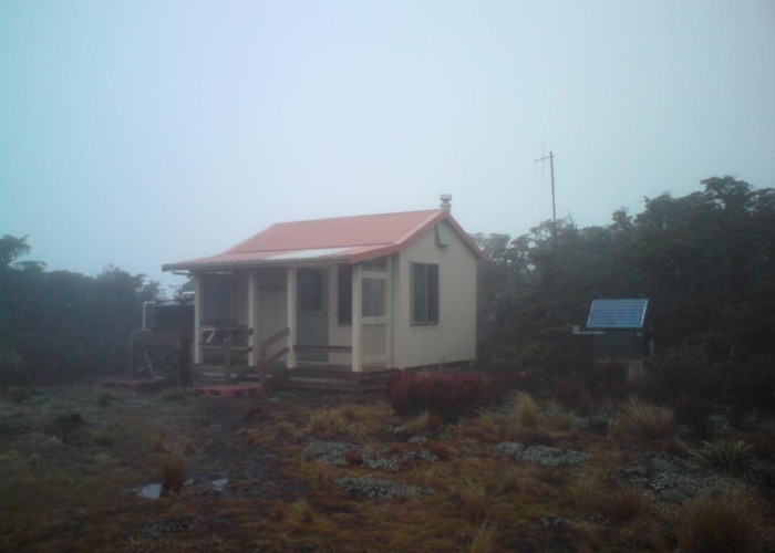
Parks Peak Hut (6 bunk, stove, tank water) is a new DoC hut on a cleared flat on the ridgeline east of the Makaroro. On a good day it should give amazing views out over the Ohara Valley, Guarvas Ranges and Hawkes Bay. The hut has a novel layout of beds, with two small platforms sleeping two each, and one set of single bunks. There's a good woodburner, and stunted growth around should provide some firewood if not the best.
The Parks Peak ridge is 800m above the Mangleton Roadend at Sentry Box, and a similar climb from the Makaroro Roadend at the now-no-more Craig's Hut, so a good workout is ensured. There's not much to explore around the hut itself: the track to the Pohatuhaha Peak being the only nearby trip. Other than that the hut is probably either a destination in itself, or used as a stopover on the way to the Main Ridge at Kylie's Biv or Aranaga Hut, or traveling on to No Mans.
The hut boasts it's own weather station and visitors are asked to read the rain gauge.
|
Owner
|
Owner: DOC |
|---|---|
|
Category
|
Standard Hut |
|
Sleeps
|
Sleeps 6
6
|
|
Facilities
|
Toilet, Enclosed wood/coal burner |
|
Water supply
|
Tap or tank water |
|
Getting there
|
Sentry Box Hut (Mangleton Road): 4.5km, 1.5-3 hrs, track, steep 800m climb Makaroro Road End: 10km, good track, 800m climb Main Range (Kylie Biv): Hut -> Upper Makaroro Hut (2km, 700m descent, 1-2hrs) -> Main Range/Kylie Biv via Totora Spur (3km, 1.5-3 hrs, 900m climb). Routes on to Sparrowhawk, Colenso, Ruahine Corner, Rockslide Huts Aranga Hut (derelict): (6.5km, 2-3hrs, ridgeline track) No Mans Roadend: (15km, 4-6hrs, ridgeline track / poled route) |
|---|---|
|
Unlocked
|
This hut is unlocked and open to access. |
|
Bookings
|
No bookings — open access
No — open access
|
|
Altitude
|
1,340m |
|---|---|
|
Mobile phone coverage
|
No coverage |
|
Maps
|
NZTopo50-BK37
|