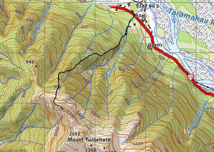
Mt Turiwhate track map

This map shows the gps'd route from SH73 up on to the tussock & rock main ridge leading to Mt Turiwhate.
The short deviation shown near the bottom of the track links with access to the route from private property. Walkers should start at the highway bridge unless they have permission to use the upstream private property access. [Access from the bridge also crosses private property but the land ownwers are ok with this so long as people stick to the marked route!]
