Steepface Hill
Hakatere Conservation Park
- 6 hr return by the same track
- Medium
- Car park to point 1488: 3 hours
- Point 1488 to summit: 30 minutes
- Summit to car park: 2.5 hours
A vigorous climb to a summit on the Mount Hutt Range. Spectacular views across the Rakaia River, Lake Coleridge, and beyond.
|
Walking time
|
1 day
6 hr
|
|---|---|
|
Distance
|
8.0km |
|
Type
|
Return by the same track
|
|
Grade
|
Medium
Unmarked route over steep tussock slopes and scree. Alpine conditions with snow and avalanche hazard in winter. Grades explained
|
|
Bookings
|
No bookings — open access
No — open access
|
|
Starts
|
Terrible Gully car park, Double Hill Run Road, Mount Hutt. |
|---|---|
|
Maps
|
NZTopo50-BW20
|
|
Altitude
|
364m
–
1,876m
Altitude change 1,512m
|
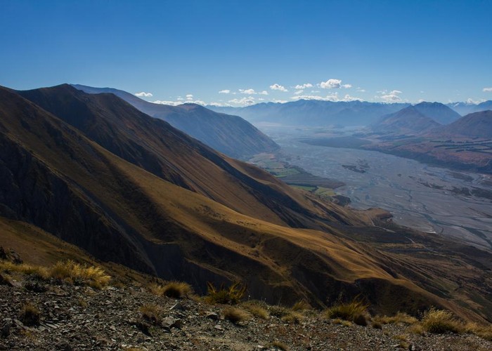
Steepface Hill (1876m) marks the northern end of the Mount Hutt Range, a steep peak that has had its nose chiselled off by the passing Rakaia Glacier some 20000 years ago. The resulting golden tussock slopes are indeed steep, and coming back down them is not easy.
The lower slopes of the hill are private land. Access is via an easement along a 4WD track at Terrible Gully. Alternative access is from Rat Hill near Radcliffe Stream, or along the ridges from Mount Hutt.
From Rakaia Gorge, take SH77 west and turn right onto Blackford Road immediately after the bridge. Follow Blackford Road, which becomes Double Hill Run Road and reverts to shingle. The road crosses a wide shingle fan of Hutt Stream, with its ford, and meanders under dusty kowhai trees. The Terrible Gully car park is on the left at the next bend.
From the car park, a 4WD track winds up the valley through a scrub of matagouri, kowhai, daisy, coprosma, and the like. Cliffs on the left are impressive lateral moraines scattered with a variety of jagged boulders. The easement leaves the 4WD track on a bend, with poles marking the way through scrub. After 20 minutes, a fence marks the park boundary. From here on, there are no markings.
The best route up Steepface Hill is up the golden tussock slope on the left. Push on up the valley for a few minutes to the vicinity of a small moraine hummock and push through the scrub to the tussock slope. Ease up toward the nearby spur, aiming roughly for the rocky tor.
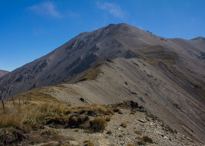
A good climb leads through golden tussocks and then gravel to point 1488. From here, the ridge is barely climbing, smooth and easy travel over sub-alpine plants alongside a wrecked old fenceline.
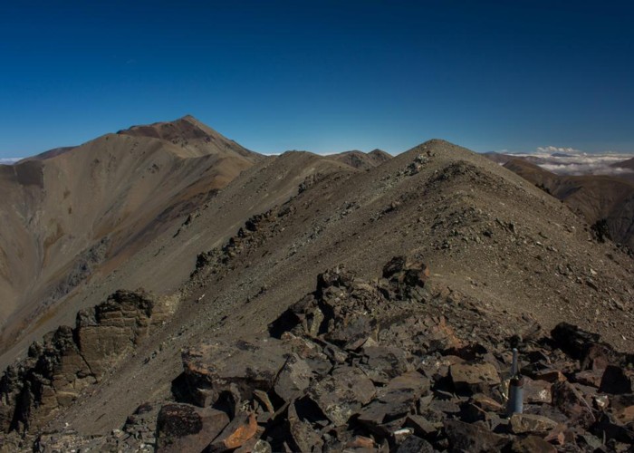
About 600m west of point 1488, the ridge hits some rocks and a steeper climb over scree to the summit commences. Going is a little slow with rocks moving under your feet but not too bad. The summit overlooks a pretty green basin, with a glimpse of the the summit of Aoraki out to the west.
The return is by the same route. Beyond point 1488, the hillside becomes painfully steep. At the tor, drop off the spur to the left. There is some scrappy shingle in a little gully that helps the descent a bit. Eventually, you come to the fenceline marking the park boundary. Follow this down, dropping off to the left before it becomes too steep.
Approximate walking times: