Robinson Saddle
Victoria Forest Park
- 3 days one way
- Easy/medium
- Palmer Road to Mid Robinson Hut: 3 hours
- Mid Robinson Hut to Top Robinson Hut: 3.5 hours
- Top Robinson Hut to Robinson Saddle: 3 hours
- Robinson Saddle to Lake Christabel Hut: 3 hours
- Lake Christabel Hut to Palmer Road: 6-7 hours
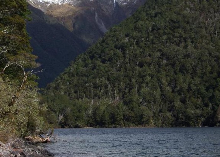
Forest and tops walk in Victoria Forest Park, visiting Lake Christabel.
1 member favourited
1 member checked in
|
Walking time
|
3 days
18 hr 30 min – 19 hr 30 min
|
|---|---|
|
Type
|
One way
|
|
Grade
|
Easy/medium |
|
Bookings
|
No bookings — open access
No — open access
|
|
Starts
|
Car park at bush edge, near end of Palmer Road, Maruia. |
|---|---|
|
Ends
|
Car park at Palmer Flat, Palmer Road, Maruia. |
|
Maps
|
NZTopo50-BU22
NZTopo50-BT22 |
|
Altitude
|
420m
–
1,300m
Altitude change 880m
|
Note that this track starts and ends at two points on Palmer Road 9km apart. It would be a good idea to drop a mountain bike at one end of the track before setting off.
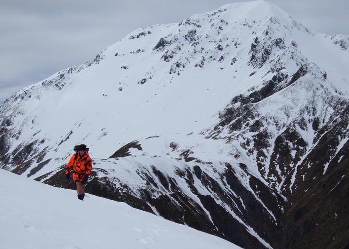
From the car park at the end of Palmer Road, a track skirts the farm flats to reach the Robinson River. It continues up to Mid and Top Robinson Huts, crossing Robinson Saddle on a poled route and dropping down valley to the Lake Christabel Hut. From here, the track skirts the lake out to Palmer Road.
Walking times:
ID 8579
About this track
83 views in the past year (7 per month).