Te Wāhipounamu - South West New Zealand World Heritage Area
This UNESCO World Heritage Area occupies the southwestern corner of New Zealand. It includes four national parks, and covers 10% of the New Zealand's land area.
To the south, Fiordland's steep U-shaped valleys and coastal fjords are evidence of past glaciation. These are some of the most remote landscapes in the country. A variety of short walks are available, along with the famous Milford and Routeburn tracks.
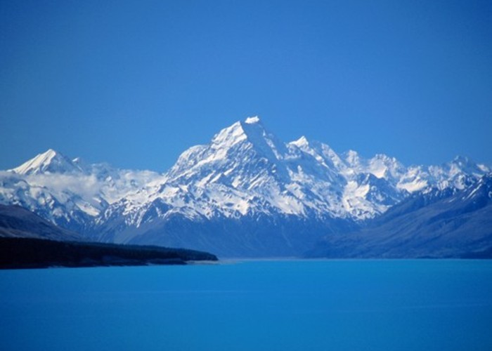
Further north, Aoraki / Mount Cook is New Zealand's highest peak at 3754m. A number of short walks are nearby, along with the more challenging Ball Pass and [[278|Copland Track].
The coastal rainforests of Westland include easy walks to the feet of Fox and Franz Josef Glaciers as well as the classic overnight walk to Welcome Flat Hot Pools.
|
Area
|
26,000 square kilometres |
|---|---|
|
Established
|
1990 |
|
Maps
|
NZTopo50-BX15
NZTopo50-CE07 NZTopo50-BZ12 NZTopo50-BY15 |