Temple Valleys Circuit
Ruataniwha Conservation Park
- 2 – 3 days loop track
- Medium
Tramping the North and South Temple Valleys connecting the two over Gunsight Pass.
1 member favourited
3 members checked in
|
Walking time
|
2 – 3 days
16 hr – 20 hr
|
|---|---|
|
Type
|
Loop track
|
|
Grade
|
Medium
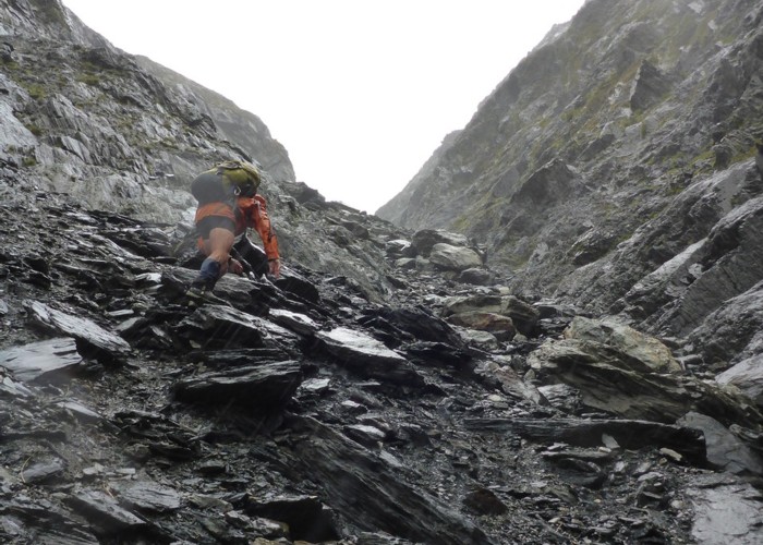
The journey over Gunsight Pass (North to South valleys) requires a climb of 1000m (up to 1900m altitude) - part of it is a narrow shingle filled rut - then a massive descent down a scree slope. Dangerous when wet - probably impassable during winter months Grades explained
|
|
Bookings
|
No bookings — open access
No — open access
|
|
Starts
|
At the end of a small road off Lake Ohau Rd, upstream from the joining of the Temple Stream to the Hopkins River. |
|---|---|
|
Maps
|
-
|
|
Altitude
|
600m
–
1,900m
Altitude change 1,300m
|