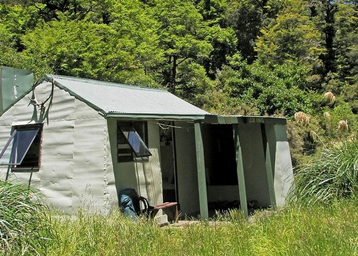
Leon Kinvig Hut
Ruahine Forest Park
Leon Kinvig Hut sleeps 8 on 2 platforms. There's a good open fire, plenty of wood around, and water from the river. Like the two downstream huts, Leon Kinvig sits on a river terrace looking over the Pohongina.
The valley here features almost continuous grassy slips on one side or the other. Downriver it become tight and gorged 1.5km below the hut. A marked track sidles the gorge on the true left.
Upriver it turns from podocarp to beech. The valley is broad and easy going as far as Top Gorge, 2km below Top Gorge Hut. The worst 200m section is passed on the true right.
Marked tracks lead up both valleysides. Heading east leads to the ridgeline track to Longview or over to Makaretu Hut in the next catchment east. Climbing west leads to the Ngamoko Range at Toka highpoint, and either Shorts of Knights track to Limestone Road roadend. A rough track runs north-south along Ngamoko Range from Piripiri Hut to the Pohongina Saddle at the valley head
|
Owner
|
Owner: DOC |
|---|---|
|
Category
|
Standard Hut |
|
Sleeps
|
Sleeps 8
8
|
|
Facilities
|
Toilet, Open fireplace |
|
Water supply
|
Tap or tank water |
|
Getting there
|
Limestone Road: track via Toka Highpoint - 9km via Knights Track, or 12km via Shorts Track Ngamoko Rd: 10km via Apiti Track Pohongina Field Centre: Here -> Ngamoko Hut 7km, 3-6hrs -> Mid Pohongina Hut 3km, 1.5-3hrs -> roadend 8km, 2.5-5hrs. Riverbed route with track option below Mid Pohongina Top Gorge Hut: 6km, 2.5-5 hrs. Riverbed route |
|---|---|
|
Unlocked
|
This hut is unlocked and open to access. |
|
Bookings
|
No bookings — open access
No — open access
|
|
Altitude
|
880m |
|---|---|
|
Mobile phone coverage
|
No coverage |
|
Maps
|
NZTopo50-BL36
|
|
Link
|
www.doc.govt.nz/p...http://www.doc.govt.nz/parks-and-recreation/places-to-stay/backcountry-huts-by-region/manawatu-whanganui/manawatu/leon-kinvig-hut/ |