Waikiti hut
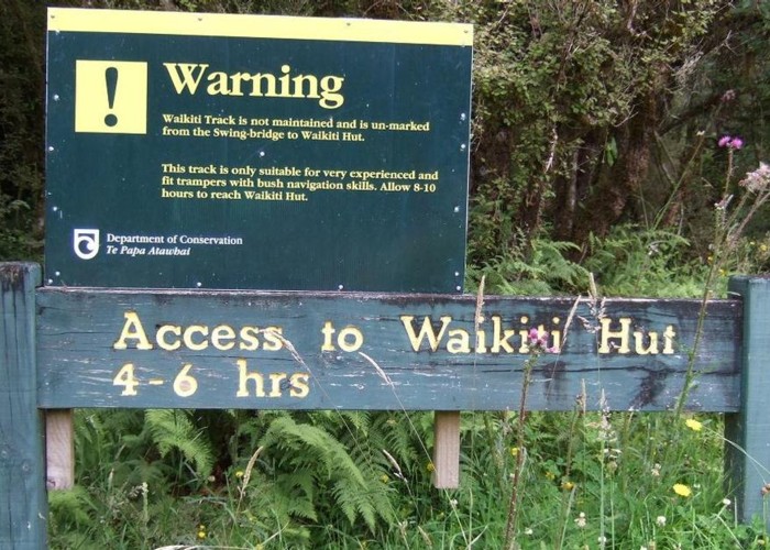
This hut is situated in the headwaters of the Waikiti river on a flat that is partly grass but largely tall scrub. Until about a year ago it was a challenging walk to reach the hut because of heavily overgrown tracks & windfalls/snow damage. This has changed with DOC having cut the up valley track about a year ago.
|
Owner
|
Owner: DOC |
|---|---|
|
Category
|
Basic Hut/Bivvy |
|
Sleeps
|
Sleeps 6
6
|
|
Facilities
|
Open fireplace |
|
Water supply
|
No water |
|
Getting there
|
1/ The easiest way now is up the Waikiti valley from the road bridge. The track starts on the TR. Post the track cutting it takes approx 4hrs. 2/ Through an unnamed saddle from the Trent River. Easily spotted on a map ESE of the hut. Untracked but good going. 3/ Via Crane Creek, Rochfort Basin & Logjam Creek. This route is described in Sven Brabyn's guidebook. The tracks are a bit overgrown but followable and the Rochfort basin hut has gone. Allow a full day to get to the hut this way. |
|---|---|
|
Unlocked
|
This hut is unlocked and open to access. |
|
Bookings
|
No bookings — open access
No — open access
|
|
Altitude
|
445m |
|---|---|
|
Mobile phone coverage
|
No coverage |
|
Maps
|
NZTopo50-BU21
|
ID 5737
About this hut
40 views in the past year (3 per month).