Otehake NZFS track up to Big Tops and down to Koropuku Hut

  • 8 hr – 3 hr one way
  • Medium

Information may be incorrect: you are not viewing the latest version of this page. This version ID 7297 created 28 January 201028 January 2010 by HonoraHonora.

Attractive old track from Otehake swingbridge to open tops. Recent extensions cut from gully to bypass waterfalls.
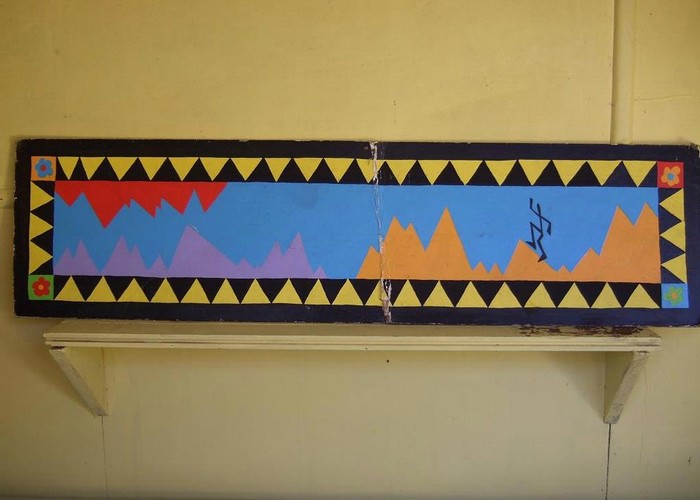
Mural gracing Koropuku hut • By glennj. Licence: C.
Otehake NZFS track up to Big Tops and down to Koropuku Hut: Key information
Walking time
1 day
8 hr – 3 hr
Distance
5.0km
Type
One way
One way
Grade
Medium
Able to be done in times of high river flow if prepared to use Deception Flood route and Otehake swingbridge. Grades explained
Bookings
No bookings — open access
No — open access
Otehake NZFS track up to Big Tops and down to Koropuku Hut: Find it
Starts
20m downstream of Otehake Swingbridge on true right
()
Ends
Koropuku Hut
Maps
NZTopo50-BV21
Altitude
345m – 1,260m
Altitude change 915m

Cross Otehake River from L. Kaurapataka side to orange triangle on opposite bank. Behind this, there is a small clearing leading to a leaning tree with markers indicating the start of this track. Traverse 100m forested flats being attentive to find sparse markers in the gloom currently invaginating and dropping off! A large tree is marked and indicates the start of a steep ascent diagonally from left to right to a rocky spur adorned with kidney fern. Here the track climbs a few meters then traverses briefly from right to left, then resumes its climb to less steep terrain and forest with more undergrowth. The track is reasonable to follow with attention. 2 scenic knolls are encountered, around here is the only water, a small tadpoled pond in a boggy area just off to the left of the track. After maybe an hour, the track eventually reaches a saddle and descends 50m into this. Here it is mossy but has no pooling of water.

 The track resumes climbing with occasional sidling. At one point it briefly sidles steep ground mitigated by recent slipping and windfall. 3 small outcrops of bluff are met, the middle section being 20 minute rock and the final bluff 5 minute rock indicating the time to reach the open scrub respectively. The surrounding forest is reasonably open and attractive with successive zones of rata and podocarps. From the saddle to the open scrubbed area would take another hour at most.
 
Where the track becomes open, there is a large cairn and a stone arrow showing the way to go along a small horizontal spur. There is a great view of L.Kaurapataka and Mt Pfeifer. Alas, the small tarn here mysteriously drained a few years ago. Follow the sparsely marked track on this reasonably flat section with occasional cairns to travel uphill initially on a rocky scrubby section, across scrub on to pink stable talus, and the last section through scrub to open short tussock.
 
Travel along the fault scarp parallel to tarns. This scarp is bisected by scree flowing from point 1656. This section will take no longer than an hour to do.
 
From the saddle descend a delightful herbaceous fellfield to herbs interspersed with tussock passing a small outcrop on the left. Cairns have been built to assist you in selecting the right line of descent. A narrow stable talus field with orange lichen is crossed then a narrow fine scree is reached. Descend this scree and then you have the option of further travel either down a scree on the right or a very pretty parallel gully with feathery tutu (toot). The gully narrows and trickles with a small stream, becomes rocky with lichen-bearing green boulders, then dark schist bedrock is encountered. Here the first beech trees begin. At this narrow point a track (marked with a white standard) leads from the true left sidling to the head of a parallel narrow gully which bypasses the waterfall section.
 
The start of this new gully is steep for the first 4 meters. An ancient pink dotted handkerchief is tied onto tree daisy here. The descent is straightforward to a section of small but open beech regen down an obvious track but the gully again narrows past the waterfall and darkens. Markers then lead you back into the original gully. This is choked with treefall which is currently navigable from clearing efforts by me and Frank but always subject to further obstructions.
 
A cairn on the true left is eventually sighted indicating the point where the gully is left to travel down through open mossy forest. Keep an eye out for the final red permolat marker on a big tree which tells you to sidle upvalley to the hut. The gully descent section takes about an hour to do.
  
From here there is no track,  to allow you the sense of discovery through various attractive zones on the true right of Koropuku stream. You will gain the orchard, a open clearing amid Ribbonwood after 20 minutes. Markers assist in reaching a narrow trail initially through thistle (alas) and mountain holly and fuchsia that brings you suddenly to the rear side of the hut.  
Map
ID 4977

About this track

Added 28 January 2010 by HonoraHonora. 7 revisions, most recently 28 January 2010 by HonoraHonora.
50 views in the past year (4 per month).