Brewster track to Mt.Armstrong
- 1 – 2 days return via same track
- Hard
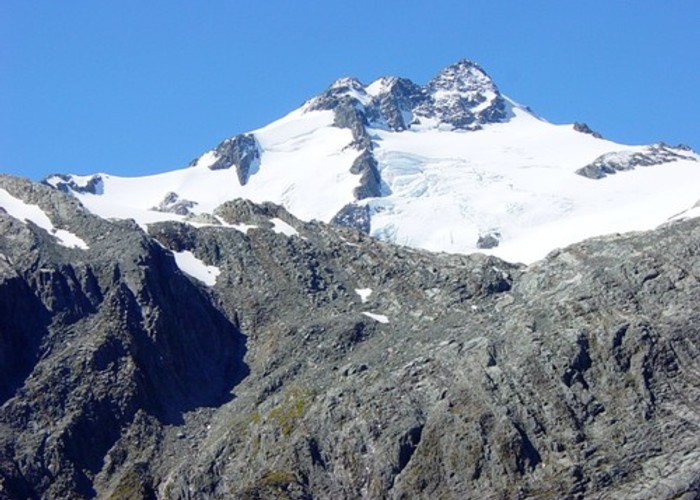
An ascent from the state hwy(SH6),just west of Haast Pass,of over 1700m to a summit on the main divide of the Southern Alps. A climb through beech forest from 450m to the bushline at 1160m and on to Brewster hut at 1450m which was recently upgraded by DOC. A scramble to Mt.Armstrong just above the hut for fantastic views to the east and west of the Alps and toward Mt.Brewster and its glacier which is readily accessible to experienced trampers.
2 members favourited
7 members checked in
|
Walking time
|
1 – 2 days
8 hr – 12 hr
|
|---|---|
|
Distance
|
9.0km |
|
Type
|
Return via same track
|
|
Grade
|
Hard
Steep ascent and descent, Narrow ridge above the bushline possibly corniced in winter or spring Grades explained
|
|
Bookings
|
No bookings — open access
No — open access
|
|
Starts
|
Fantail Falls carpark on SH6, just west of Haast Pass. |
|---|---|
|
Maps
|
NZTopo50-BZ13
|
|
Altitude
|
450m
–
2,174m
Altitude change 1,724m
|