Boyle Village - Mt Faust - Boyle Hut
- 7 hr – 8 hr one way
- Medium
A great trip over the top of Mt Faust and down a spur to Boyle Hut on the St James Walkway. Makes a great weekend trip.
|
Walking time
|
1 day
7 hr – 8 hr
|
|---|---|
|
Distance
|
9.0km |
|
Type
|
One way
|
|
Grade
|
Medium |
|
Bookings
|
No bookings — open access
No — open access
|
|
Starts
|
Boyle Village |
|---|---|
|
Ends
|
Boyle Hut |
|
Maps
|
NZTopo50-BT23
NZTopo50-BU23 |
|
Altitude
|
600m
–
1,721m
Altitude change 1,121m
|
Park at the Boyle Village end of the St James Walkway. This is where you'll finish if you return along the St James Walkway. Cross the river on the main road, climb a stile and follow a track into the outdoor adventure area. A sign indicates the start to the Mt Faust Loop Track.
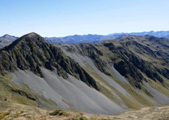
This track begins climbing almost immediately and maintains a steady gradient for the 1 and 1/2 to 2 hours it takes to reach the bushline. At the bushline 2/3 of your climbing is behind you so you can relax and enjoy the stunning views - of the Lewis and Boyle Rivers down below you and of the Doubtful and Nina valleys.
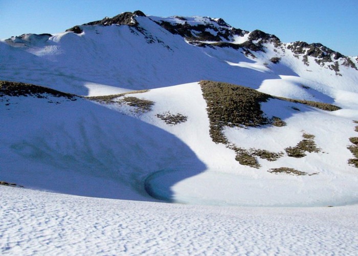
Marker posts lead you up a ridge to where you can gaze down at the tarns. This would make a great camping spot in summer. The ridge winds around in an arc as you approach Mt Faust. From here you can continue along the Lucretia Range or descend the spur to the north-east. The spur is easy-going and leads directly to Boyle Flats Hut after only a couple of hours from the Mt Faust summit. The section in the bush is more straight forward than it appears and from about halfway down there are orange markers to follow.
Stay the night at the hut and return via the St James Walkway for a great weekend loop trip.