Freehold Creek
Ahuriri Conservation Park
- 1 day return by the same track
- Medium
- Car park to bushline: 2 hours
- Bushline to tarns: 1 hour
- Tarns to Dumb-bell Lake: 2 hours
Climb the mountains behind Lake Ohau into a basin of tarns and waterfalls.
|
Walking time
|
1 day
5 hr – 9 hr
|
|---|---|
|
Distance
|
15.0km |
|
Type
|
Return by the same track
|
|
Grade
|
Medium |
|
Bookings
|
No bookings — open access
No — open access
|
|
Starts
|
Car park, Parsons Creek, Lake Ohau Road |
|---|---|
|
Maps
|
NZTopo50-BZ14
|
|
Altitude
|
520m
–
1,479m
Altitude change 959m
|
From the Parsons Creek car park, the track leads through dry beech forest to a view point and picnic table. Continuing uphill, the track reaches a junction. A trail to Lake Ohau Lodge leads right, while Freehold Creek is left. The track edges along the top of the terrace at the bottom of the hill, crossing Sawyers Creek. This area was logged extensively in the 1880s.
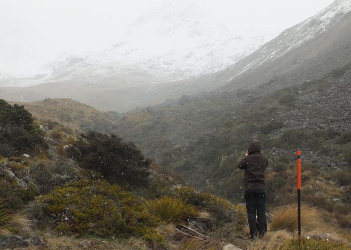
At Freehold Creek, the track bends upstream and over a bridge. The smooth track climbs through light forest alongside a tumbling white creek. Passing a couple of scree slides, the track becomes rocky underfoot and strikes the bushline. From here, the route is marked by poles.
The track bends to the right of the middle spur of three, following a creek, crossing to the true left, and climbing to a high basin with a tarn (1479m). A second tarn is just five minutes uphill. From here, a gently spur leads to the top of the range, and a route directly north will lead you to Dumb-bell Lake 2km away.
Walking times: