Waihua - Saddle Biv - Apiti Hut Trip
Te Urewera
- 3 – 4 days one way
- Medium
A really interesting trip in the Ureweras. The Waihua - Saddle section of this is untracked, the river providing good access but you have to make sure you go up the right branches.
The rest is all well marked but is overgrown and/or steep in places
|
Walking time
|
3 – 4 days |
|---|---|
|
Distance
|
36.0km |
|
Type
|
One way
|
|
Grade
|
Medium
Overgrown tracks and one section is off track Grades explained
|
|
Bookings
|
No bookings — open access
No — open access
|
|
Starts
|
Waiohau |
|---|---|
|
Ends
|
Ruatoki Valley Rd |
|
Maps
|
NZTopo50-BF39
NZTopo50-BF40 |
|
Altitude
|
56m
–
710m
Altitude change 654m
|
To Waihua Hut
This trip begins at Waiohau, go down the logging road just north of the bridge over the Waihua River. At the time of writing they were starting logging in this area so access may not be as easy and the landscape may have changed. Check with DOC Murupara (07-3661080) for the latest information. There is another route to Waihua Hut on the ridges north of this but I haven’t been on it so I am not sure where it starts from.
It was possible to drive up this road as far as a skid site, from there walk up zig zaging up the hill along the good forest road. At the top of a rise there is a fork in the road. It is important to take the right turn here, it is the one that is less obvious. This road is overgrown so you are pushing through scrub in some bits. It traverses a gully and you come out on the next ridge at an old broken Urewera National Park sign, which once indicated the time to Waihua Hut.
Head up the hill once again along the ridge and you leave the pines after a couple of hundred meters. Once in the native bush the track is more obvious and is well marked. It climbs steeply to the ridge top, undulates along and then drops down into a stream just short of Waihua Hut. A piece of pink ribbon marks where the track starts on the other side of this stream and it sidles up on the true left to pass a small slot gorge. It then drops steeply back to the stream and you follow the stream to the Waihua River.
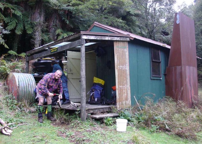
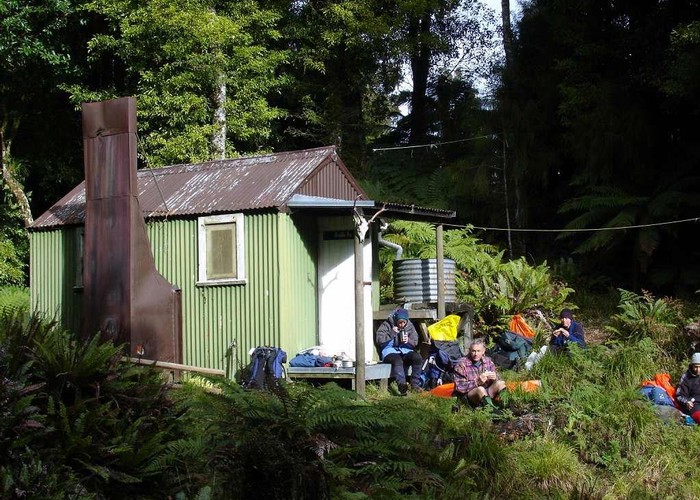
Immediately upon coming out at the river you will see a hut sign just 50m or so up stream on the opposite back. From there it is a short climb up to the hut. It is probably also worth a look at the gorge downstream from the hut. One of the great challenges is to navigate this gorge and one look at it and you will see why.
Waihua Hut – Saddle Biv
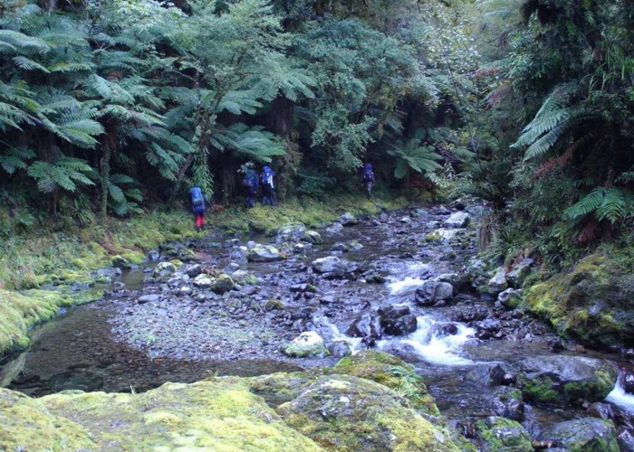
Drop back into the Waihua Stream and head up river. This section is not marked and is in the river all the way, so get used to it. You will come across pairs of the endangered native Blue Duck (Whio) here and you will see that DOC are doing stoat control. Note the numbers and locations of the birds that you see and advise DOC in Opotiki of what you see. They will appreciate it.
After about 40 mins you will come to the first of 5 significant forks in the stream. There is a pool here and I have seen a family of 5 Whio on this pool once. It is important that you take the correct turn. The stream coming from the south is the Te Onepu Stream and this is the route to Casino Hut. We go east up the Waihua.
The stream is narrow up here and after another hour we come to the second fork. This is the Opakau Stream coming from the north. Our route takes the stream coming from the south. After a few meters we come to a flat area that would make a great campsite. Hunters have used this and left behind their usual rubbish, but it is still a nice place. The valley is more open here and there is another hunter’s camp further up beside a small clearing. Hunters landing by helicopter have obviously used this.
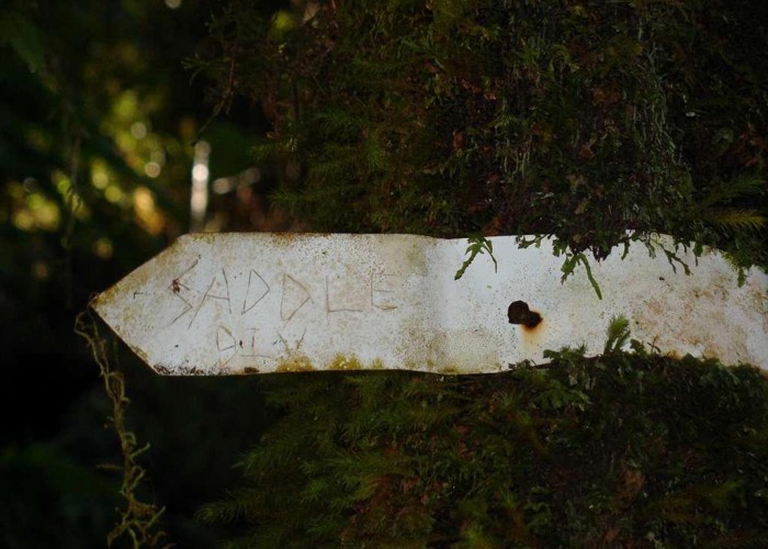
At fork 3 and 4 take the left-hand branch (looking upstream). You are assisted here by some ancient permolats with “saddle” scratched on them.
After fork 4 the valley narrows and becomes more difficult. Windfalls and slips block the way. Be careful when sidling away from the stream. The valley sides are steep and not too stable with only pungas to hang on to. Best to keep in the streambed as much as possible.
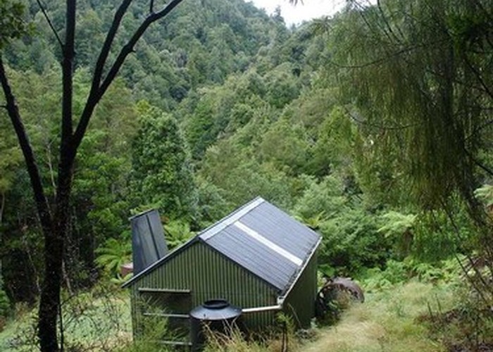
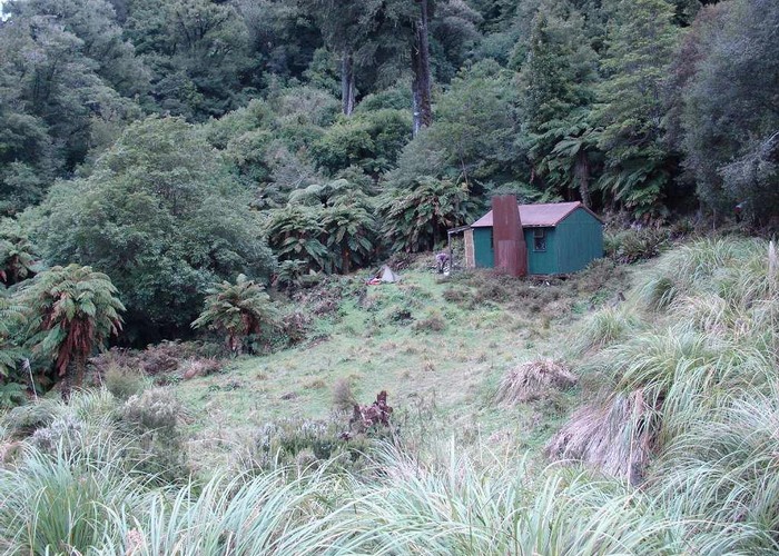
At last we come to fork 5. It is in a gorgy section. A permolat indicates the way, to the east. It starts by traversing a little waterfall and then once again follows the streambed. After 500m you suddenly pop out onto the helicopter pad above Saddle Biv and descend a short distance to the hut.
Our time for this section was 4.5 hours
If going in the reverse direction the route finding is much easier. Start from the helicopter pad above the hut, head down the obvious valley to the west and go downstream until you see the sign to Waihua Hut.
Saddle Biv to Apiti Hut
The DOC brochure says this section is 1-2 hours. We thought this misleading. It took us 2.5 hours going in the downhill direction.
The track is well marked and heads downhill from the hut and is soon in the Mangawai Stream. Go up stream and after a couple of hundred meters it begins to climb away from the stream on the opposite bank. The track climbs 200m to the top of the ridges, undulates along the tops and then descends steeply to Apiti Hut, Apiti hut is 200m lower than Saddle Biv so it seems a long way down.
The track drops into the Opaewai Stream, then climbs a short distance on the other side to Apiti hut.
Apiti Hut to Ruatoki Rd
The track immediately climbs from the hut and continues until 400m higher at the summit of Totoroieke 700m ASL. From here it is a long descent to the Pukawa Stream. You get glimpses of the wide valley of the Whakatane ahead and farmland up by Ruatoki. The track follows a ridge. It is well marked but overgrown. At regular intervals you need to stop and check where the next marker is. The Pukawa Stream is a long way down, 100m ASL and the final 200m is very steep, in the bush clinging to roots and relying on good grip from your boots. Take care.
Finally you are in the streambed and it is only 800m of easy walking to the edge of the Whakatane River. You come out on the edge of the river between two bluffs. You may prefer to climb over the bluffs in one direction or the other to get to an easier crossing, however we did manage a waist deep crossing from the mouth of the stream.
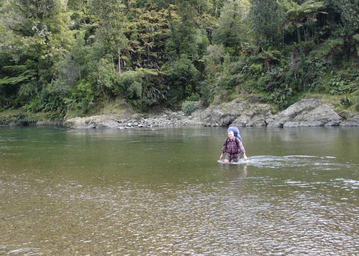
The Whakatane River is a big river. It flows over gravel flats at this point so is fairly safe under normal conditions. However I imagine it would soon become uncrossable in any sort of flood. Practice good river safety techniques here.
The walking track follows the true right of the river all the way. This is private land and there is stock around so have respect.
It is about 7kms downstream to where normal vehicle access is possible and another 1 km to the paved road.