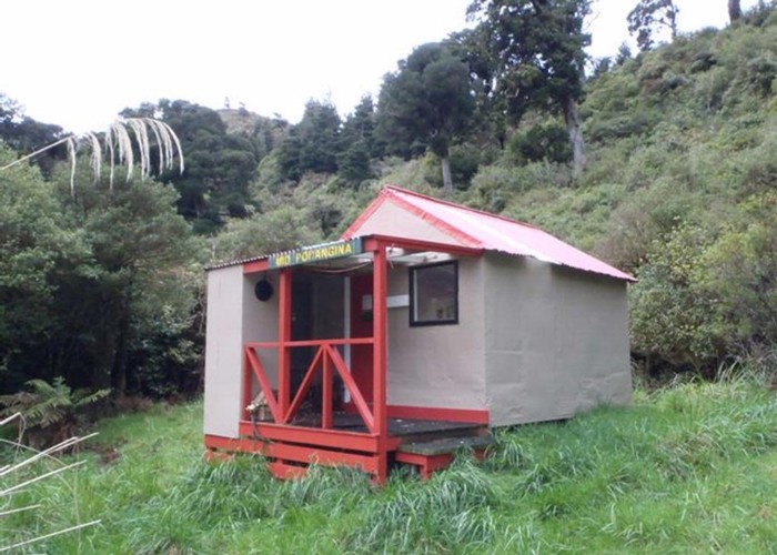
Mid Pohangina Hut
Ruahine Forest Park
Mid Pohangina Hut sits on a pleasant grassy flat just above the Pohangina River north of its confluence with Cattle Creek. It's a comfortable, welcoming hut with a warm fire. Popular with hunters it'll be busy in the roar but not bad outside that period.
A well maintained sidle track leads downriver to the carpark just north of DOC's Pohangina Base. There's a bit of up and down, but it's on a reasonable platform and not too bad going. About 2/3 of the way down a track drops to the river and crosses to the old Centre Creek Biv site. The biv has gone, but the track's still maintained and climbs VERY steeply from there to the Takapari Road - a 4WD track which leads to Travers Biv.
The sidle track ends at the hut and travel upriver to Ngamoku and Leon Kirvig is a riverbed route mith many crossings and deep pools to wade. Good fun on a warm day.
An unmarked route leads up Cattle Creek to Cattle Creek Hut. Access to the Ngamoko range is also possible.
|
Owner
|
Owner: DOC |
|---|---|
|
Category
|
Standard Hut |
|
Sleeps
|
Sleeps 4
4
|
|
Facilities
|
Toilet, Enclosed wood/coal burner |
|
Water supply
|
Tap or tank water |
|
Getting there
|
Pohongina Base Carpark (2763365,6124897): -> road (8km, 2-4 hrs, sidle track) Takapari Road (2764100, 6122100): -> old Centre Creek Biv site (3.5km, 1-2 hrs) -> road (2km, 1-2hrs, STEEP track) Leon Kirvig Hut: -> Ngamoko Hut (4km, 2-3 hrs, riverbed route) -> Leon Kirvig (5km, riverbed route) Cattle Creek Hut: 4km, river bed route |
|---|---|
|
Unlocked
|
This hut is unlocked and open to access. |
|
Bookings
|
No bookings — open access
No — open access
|
|
Altitude
|
550m |
|---|---|
|
Mobile phone coverage
|
No coverage |
|
Maps
|
NZTopo50-BL36
|